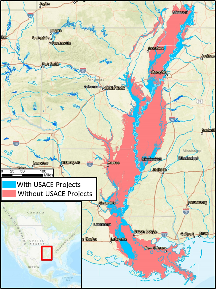
Computing AFDR with CWMS offers significant advantages over legacy methods. By leveraging standardized data and modeling tools, CWMS enables a consistent and transparent methodology that can be applied across all USACE districts. This promotes greater confidence in results and simplifies inter-district collaboration and comparison.
One of the key strengths of this approach is the ability to examine each hydrologic and hydraulic (H&H) model component independently. Every input—flows, stages, and reservoir operations—is carefully calibrated and parameterized to produce the most accurate flood inundation information available. These inundation results are then used in consequence modeling, allowing structure-level evaluation and verification to ensure the results are both sound and defensible.
Benefits of a Modernized Approach
This geospatial approach enhances the ability to:
- Apportion damages across multiple projects within a watershed or basin
- Aggregate results by project, state, or geographic region
- Perform detailed flood inundation analyses with high spatial resolution
Additionally, structure and agricultural inventories in flood-prone areas can be more easily updated and maintained, keeping consequence assessments current with development and land-use changes.
Perhaps most importantly, this modern method generates clear, visual mapping products that demonstrate the tangible benefits of USACE flood risk management projects. These maps help communicate where and how flood damages have been reduced—both within a district and across the nation. For example, the figure below illustrates the difference in flood extents between "with-project" and "without-project" scenarios for the 2011 flood event on the Lower Mississippi River, clearly showing the impact of USACE infrastructure.
