HEC-RAS Geometry
Begin by reviewing the HEC-RAS model currently used in CWMS for real-time forecasting. The model geometry was designed to generate inundation maps for real-time operations and may be structured differently depending on the types of hydraulic features in the system. How you set up HEC-RAS alternatives for AFDR depends on the basin's features and how they are represented in the existing geometry.
Typical CWMS HEC-RAS model geometries include combinations of the following features:
- Headwater reservoirs
- Tandem reservoirs, with reaches either broken or continuous
- Small levees (with minimal impact on river stage)
- Large levees (with significant impact on river stage)
Headwater Reservoirs and Small Levees
Watersheds containing only headwater reservoirs and/or small levees usually require minimal or no modifications for AFDR calculations. If the watershed has only these features, you can generally use the existing geometry as is.
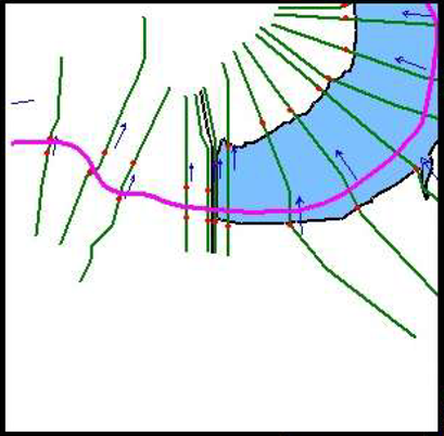
Headwater reservoirs are reservoirs located upstream with no others in series downstream. Cross sections usually begin downstream of these reservoirs, as shown in the figure below.

Tandem Reservoirs with Discontinuous Reaches
For watersheds with tandem reservoirs where the geometry is divided into multiple reaches (often split downstream of dams), you can model unregulated conditions by modifying upstream and downstream boundary conditions at these breaks.
This setup requires less effort compared to continuous reaches, but it does not simulate the hydraulics within the reservoir itself. Instead, hydrologic routing results from HEC-ResSim or HEC-HMS provide outflow boundary conditions. This approach may be acceptable in steep basins but can lead to inaccuracies in flatter basins where backwater effects are important.
If levees are small or absent, no new geometry is needed for AFDR. However, if large levees exist, a separate geometry without levees must be created. Choosing appropriate pool boundary conditions at dams is critical; ideally, a pre-project rating curve is used. Avoid using observed pool elevations from regulated events to prevent unrealistic high stages upstream.

Tandem Reservoirs with Continuous Reaches
When the HEC-RAS geometry has continuous reaches through downstream reservoirs, you must remove dam structures to simulate unregulated conditions. This requires a new geometry and unsteady flow file but no additional boundary conditions.
This approach provides the most accurate unregulated flow routing downstream of reservoirs. However, reservoirs with sedimentation or decades of operation may have abrupt cross section changes across the dam, causing model instability. Adjusting cross sections to pre-project conditions or modeling small inline structures to simulate weir flow can improve stability.
Note that flood damage estimates near reservoirs may show reduced damages in unregulated scenarios, reflecting real changes in flooding due to reservoir operations. Careful economic analysis is recommended for these cases.

Large Levees
The first step when modeling levees is to determine if they significantly affect in-channel water surface elevations (WSEs). If not, levees can often be represented by applying linear WSEs behind them or using reduction factors in HEC-FIA.
Small levees with minor hydraulic impacts are typically handled well by the HEC-FIA Holdouts method, which requires only regulated and unregulated HEC-RAS inundations.
Large levees that affect mainstem river stages require a separate HEC-RAS geometry and plans for the without-levee condition, as HEC-FIA’s simplified assumptions are insufficient.

Evaluating Levee Modeling Approaches
If the protected area is modeled with a 2D flow area due to complex hydraulics or size, simulating the without-levee scenario in HEC-RAS is preferable. If the levee is small and the protected area would fill like a bathtub if the levee were removed, using HEC-FIA to estimate without-levee damages is usually adequate.
Most CWMS HEC-RAS models already include 1D storage or 2D flow areas representing leveed areas. These can be exported as shapefiles for use in HEC-FIA. Always verify the model’s coordinate projection before exporting.


Older models often define levees within cross sections, which requires creating leveed-area shapefiles for HEC-FIA use. The National Levee Database (NLD) is a good source for these areas. Be cautious with overtopping scenarios, as they may cause unrealistic inundations and model instability. Updating levee representations to lateral structures or 2D areas is recommended when possible.

Creating Without-Levee HEC-RAS Geometries
Two common methods exist for modeling the without-levee condition in HEC-RAS:
- Pre-construction Natural Ground Elevations: Use as-built drawings or extract toe elevations via GIS or HEC-RAS Mapper. For 2D levee areas, also modify the terrain to remove levees using HEC-RAS Mapper’s terrain editor. This method best represents the natural ground but may require more time and effort.
- Lateral Structure Openings: If time or model stability is a concern, modify lateral structures by adding large openings to simulate levee removal.
- For 1D storage areas, place a large opening midway through the leveed reach to allow unimpeded flow and avoid “short-circuiting” of flow through the storage area.
- For 2D flow areas, placement of openings is less critical, but proper outflow paths must be established. Ideally, the entire lateral structure should be set to natural ground elevations to avoid flow impediments.
- In both cases, the invert elevation of openings should match natural ground, not just the lowest elevation within the storage area.
For more information, refer to the this tutorial.
Modifying Legacy Levee Points in Cross Sections
For models with levees defined as points within cross sections, remove these points and adjust the cross section elevations to represent natural ground as if the levee never existed. This adjustment prepares the model for without-levee scenario simulations. Refer to the figure shown below for an example.