How to NOT Copy the RAS/FIA Terrain into Every Forecast
Software Version
CWMS 3.4.0 was used to create this tutorial.
Minimizing the amount of data copied into the forecast directory can greatly speed up the process of creating new forecasts. The terrain files for HEC-RAS and HEC-FIA tend to be the largest files stored within a watershed, and a proper watershed setup can ensure that the terrain files remain in the base directory while still allowing the models in the forecast directory to access them when needed.
HEC-RAS Terrain Setup
To properly store HEC-RAS terrain files within your watershed, follow these steps:
- In the ras directory of your watershed, create a new directory to store the terrain files. For this example, the folder is named Data\03_Terrain.
- Copy the HEC-RAS terrain files to this directory. These will include .hdf, .vrt, and .tif files.

- If the terrain was previously stored elsewhere in the watershed, delete those files to ensure they will not get copied to the forecast unintentionally.
To link the terrain from the new directory in HEC-RAS:
- Open the base HEC-RAS model for the watershed and then open RAS Mapper.
- Remove the existing terrain by right-clicking and selecting remove
- Add the new terrain from the directory by right-clicking on Terrains and selecting Add Existing RAS Terrain. Navigate to the new location of the terrain file (as established in the previous steps).

- Right click the Geometries node and select Manage Associations to associate the new terrain to all geometries.
- If stored maps are used, ensure they still compute. Otherwise, remove and add them back so they are associated with the correct terrain.
See the HEC-RAS in CWMS workshop for more information on how to use HEC-RAS when running CWMS forecasts.
HEC-FIA Terrain Setup
To link the HEC-RAS terrain files (as denoted in the steps above) in HEC-FIA:
- Open the base HEC-FIA model and remove the existing terrain.
- If the terrain was previously stored in the HEC-FIA model (for example, in the fia/watershed/terrain grids/ folder), delete the files from this location. Remove the old terrain from the HEC-FIA menu by right clicking on the terrain and selecting Remove from Study.
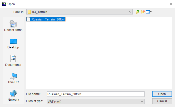
- Add the new HEC-RAS terrain, using the .vrt file from the directory established in Step 2 of the HEC-RAS Terrain Setup.

- In the file explorer, make sure the file type is set to .vrt before selecting the terrain.

- In the file explorer, make sure the file type is set to .vrt before selecting the terrain.
- If the terrain does not immediately display in the map window, click the Display open Map Windows tiled in the Map Panel button from the menu bar to refresh the map windows.

- Ensure that the Watershed Configuration in HEC-FIA is pointed to the newly added terrain.

See the HEC-FIA in CWMS workshop for more information on how to use HEC-FIA when running CWMS forecasts.