HEC-RTS Main Window
From the HEC-RTS main window, each module - Setup, Acquisition, Visualization, and Modeling - has menus, tools, and a map window specific to each module. Following are the basic elements of the HEC-RTS main window:
| Title Bar | Displays the name of the active watershed. |
| Menu Bar | Contains general and module-specific menus. |
| Main Toolbar | Contains shortcut icons for menu commands. |
| Module Tabs | Each tab represents an HEC-RTS module. Clicking a module tab opens that module in the HEC-RTS main window. |
| Watershed Pane | The area where the module specific commands and items are located. |
| Map Window | A map window displays the watershed representation, which is geographically-referenced (geo-referenced). |
| Map Window Toolbar | Contains tools to navigate within the map window, and setup time series icons. |
| Message Pane | Displays a scrolling list of messages. System output log information appears in this window from the time you start HEC-RTS until you exit. Messages related to incoming data are colored coded based on the quality of the data. Messages may also report a problem with a system component; problems with field equipment; a caution, warning, or flood event; or other critical situations. |
| Status Bar | Displays map coordinates when the select tool is hovering over a location in the map window. |
Menu Bar
The File, View, Maps, Scripts, Tools, Window, and Help menus (HEC-RTS Main Window) contain commands you can access from all four modules. Some of these menus also contain module-specific commands that appear only within individual modules. The following are descriptions of the commands and options that are common to all four modules.
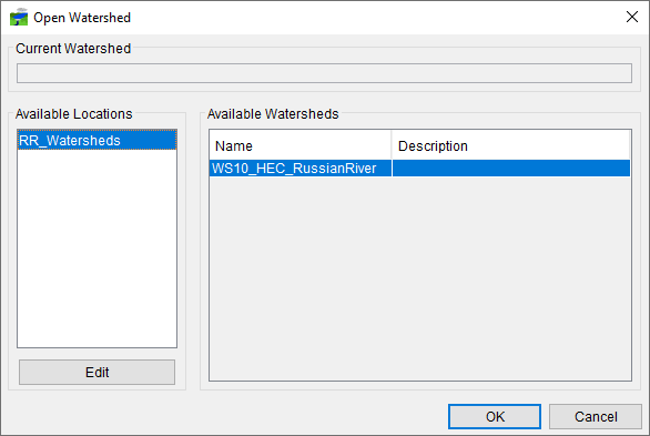
| File | From this menu, you can create, open, or close a watershed, save data associated with the watershed, and exit HEC-RTS. In addition, your most recently used watersheds are located after the ability to open a watershed in the File menu (Open Watershed Dialog). Available commands are: New Watershed, Open Watershed, Recent Watersheds, Save Watershed, Close Watershed, and Exit. |
| View | This menu is used to add or remove screen items (toolbars, module tabs, message pane, status bar); display watershed units; display time zone; zoom map window to the defined maximum extents; and save, restore and manage layouts. Available commands are: Zoom to All, Displayed Units, Displayed Time Zone, Toolbars, Messages, Status, Module Tabs, Save Layout, Restore Layout, and Layout Manager. |
| Maps | This menu is used to adjust the how the map panel of the HEC-RTS main window is displayed including map layers, map background, and whether coordinates are displayed. In addition, you can save the image in the map window as a graphics file, and you can print the image in the map window. Available commands are: Map Layers, Default Map Properties, Add Internet Map, Display Map Coordinates, Save Map Image, and Print Map. |
| Scripts | This menu allows you to execute existing scripts, create, test new scripts and run scripts. Available commands are: Editor, Schedule Script Job, Script Job Status, and Run. |
| Tools | This menu allows you to access data (HEC-DSSVue), set options for the HEC-RTS software, specify plug-in editor locations to use, view the console.log file, view the log file for the software applications being used (HMS, ResSim, RAS, FIA) and the log file for DSS processes, and view memory usage. Available commands are: HEC-DSSVue, Applications, Options, Model Version Editor, Console Output, Logs, and Memory Monitor. |
| Window | This menu allows you to select how you want to view and select multiple windows, which modules you want to view. Available commands are: Duplicate Window, Detach Window, New Map Window, Map Window Settings, Sync Map Windows, Tile, Cascade, Next Window, and Previous Window. |
| Help | Displays current version information about HEC-RTS and accesses the HEC-RTS User's Manual. Available commands are User's Manual and About. |
Main Toolbar
The main toolbar of the HEC-RTS interface provides quick access to the most frequently used option from the HEC-RTS menu bar and consists of the following six toolbars:
Standard Toolbar ![]()
From this toolbar you can create a new watershed; open a watershed; close a watershed; save a watershed; and, print what is displayed in the Map Window.
Map Toolbar ![]()
From this toolbar you can open a new map window; set the zoom level for all open map windows to the selected map window's zoom level; in the Map Panel, tile all open map windows; and, in the Map Panel, stack all open map windows.
Modules Toolbar ![]()
From this toolbar you can select the individual Module Tabs – Acquisition, Visualization, Modeling, and, Setup.
Modeling Toolbar ![]()
From this toolbar you can open MFP (need to have an MFP alternative selected); open HEC-HMS; open HEC-ResSim; open HEC-FIA; open the Supplemental Program dialog; open the Scripting Program dialog; and, open HEC-RAS.
Tools Toolbar ![]()
From this toolbar you can open HEC-DSSVue.
Animation Toolbar ![]()
This toolbar is only available in the Visualization module, and when you have created a grid set. The Animate button will open the Animate dialog and the grid set will display in the map window.