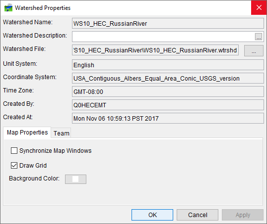
Once you have your watershed created, you can review the basic properties of the watershed. From the Setup module, from the Watershed menu, click Watershed Properties. The Watershed Properties dialog (Figure 1) will open. Information about the watershed is provided and includes the watershed name; watershed description; the watershed filename (WS10_HEC_RussianRiver.wtrshd); selected unit system; coordinate system for the watershed; watershed time zone; user who created the watershed; and, the date and time when the watershed was created.
To the right of the Watershed File box (Figure 1), click  , a Windows File Explorer will open, displaying the directory and file structure for the watershed. The Watershed Properties dialog (Figure 1) also contains two tabs - Map Properties and Team. The Map Properties tab is selected by default, this allows you to synchronize or not synchronize map windows; to either display a grid or not on map window; and to change the background color of map windows. The default background color of map windows is white, to change the color, to the right of Background Color (Figure 1), click
  , a Color Chooser will open which will allow you to change the background color of map windows.

The Team tab (Figure 2) is setup for the HEC-RTS Team Modeling concepts for collaboration between modelers working with the same watershed and forecast. From this tab, if you want the watershed to be available to other modelers, you will select Team Watershed, and define the network location of the master watershed. Further information and details about the team modeling concept in HEC-RTS is provided in Team Modeling.
