Import a Stream Alignment
To import a stream alignment, you must have added an Arc shapefile (Map Layer Formats) map layer (Adding Map Layers) that represents the stream network of your watershed. This shapefile must have an attribute that is the name of each stream, and each stream must form a contiguous line with one upstream point and one downstream point.
To import a stream alignment:
- From the Setup module, from the Watershed menu, point to Stream Alignment, click Import.
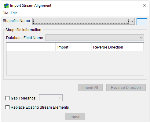
- The Import Stream Alignment dialog (Figure 1) will open.

- In the Shapefile Name drop-down list, the name of the ArcGIS® shapefile that HEC-RTS has chosen is displayed. HEC-RTSS automatically selects the first shapefile that contains polylines. If this is not the correct shapefile, on the File menu, click Choose Shapefile.
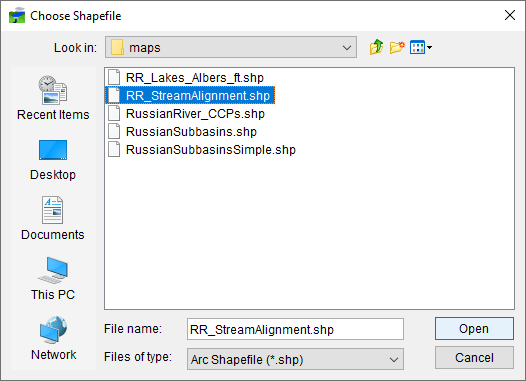
- A browser Choose Shapefile dialog will open (Figure 2). Use the dialog to select the shapefile to be imported (typically located in the maps folder of the watershed). Click Open.

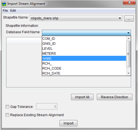
- Once the correct shapefile has been chosen, the program automatically searches for a database field name of Stream_ID. If there is no Stream_ID in the shapefile you chose, you must select the database field name that contains the names of each stream from the Database Field Name drop-down list. In the example shown in Figure 3, for the shapefile nbpoto_rivers.shp, the database field name is NAME.

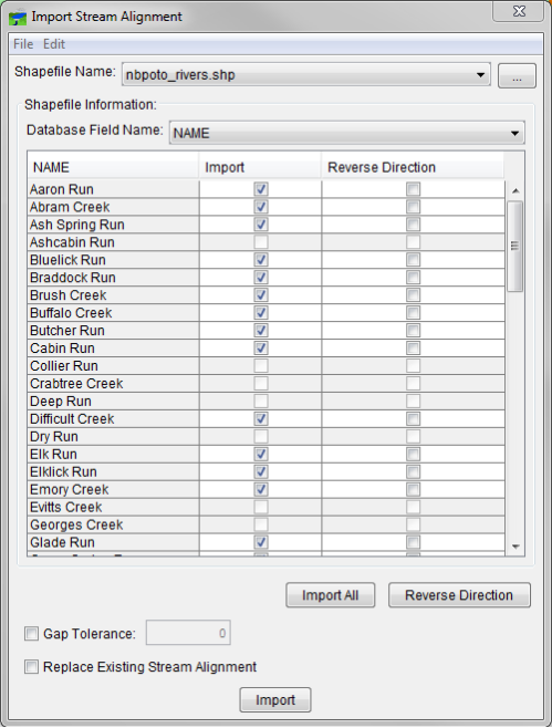
- When you have selected the correct database field name, the table will list the stream names (Figure 4). HEC-RTS requires a stream to be a contiguous line with one upstream point and one downstream point. If a stream is a contiguous line, the checkbox in the Import column of the table will be set. If the line that represents a stream is non-contiguous, the checkbox will not be set, and a Warning message (Figure 5) will appear indicating that the lines are not continuous and that the streams cannot be imported. Click OK to close the message and to continue defining the import options.


- You can use the Import All and Reverse Direction buttons to select each of the checkboxes in the Import and Reverse Direction columns, respectively.
- Gap tolerance is used to connect stream elements that have a gap between the end point and the junction with another stream. By default, the gap tolerance is set to zero, so HEC-RTS can connect streams to other streams. To allow gap tolerance, check the Gap Tolerance checkbox. Enter a value larger than zero in the Gap Tolerance field. HEC-RTS will connect streams that have a gap between them that is equal to or less than this value.
- The Replace Existing Stream Alignment check box allows you to replace the existing stream alignment with the one you are importing.
- Once everything is set, click Import. The stream alignment will be automatically drawn in the map window.
- Click OK on the confirmation dialog.