Download PDF
Download page Updates to the National Structure Inventory.
Updates to the National Structure Inventory
By Nicholas J. Lutz
A major update to the National Structure Inventory (NSI) is on the horizon. Starting in 2011, the U.S. Army Corps of Engineers (USACE) began developing the first NSI in order to ensure ready nationwide coverage of buildings and their characteristics for economic and consequences modeling. That inventory was developed by USACE to drive dam safety modeling, levee safety modeling, and real time consequences through the Corps Water Management System (CWMS) National Implementation. In coordination with the Federal Emergency Management Agency (FEMA), USACE has continued to update the NSI’s original estimates of the location of vulnerable structures and population assignments throughout the past decade. These improvements have correspondingly improved the quality of the consequence analysis results. The current version of the NSI, released in 2019, represented a marked improvement in the geospatial location and classification of structures due to leveraging Microsoft Bing footprints and commercially available parcel data.
The 2022 version of the NSI aims to further improve structure characteristics that influence economic consequence assessments, particularly to ensure more reliable inputs for cost-benefit analyses and to facilitate real-time estimates of flood damages. New analysis of parcel data and surveys of structures will improve structure level data on attributes such as foundation type and structure value. This allows the NSI to minimize its reliance on generic assumptions based on census data and other regional level data sources. The use of a new parcel data vendor also avoids previous license restrictions, allowing the NSI to be shared with our state and local partners as well as interested members of the general public.
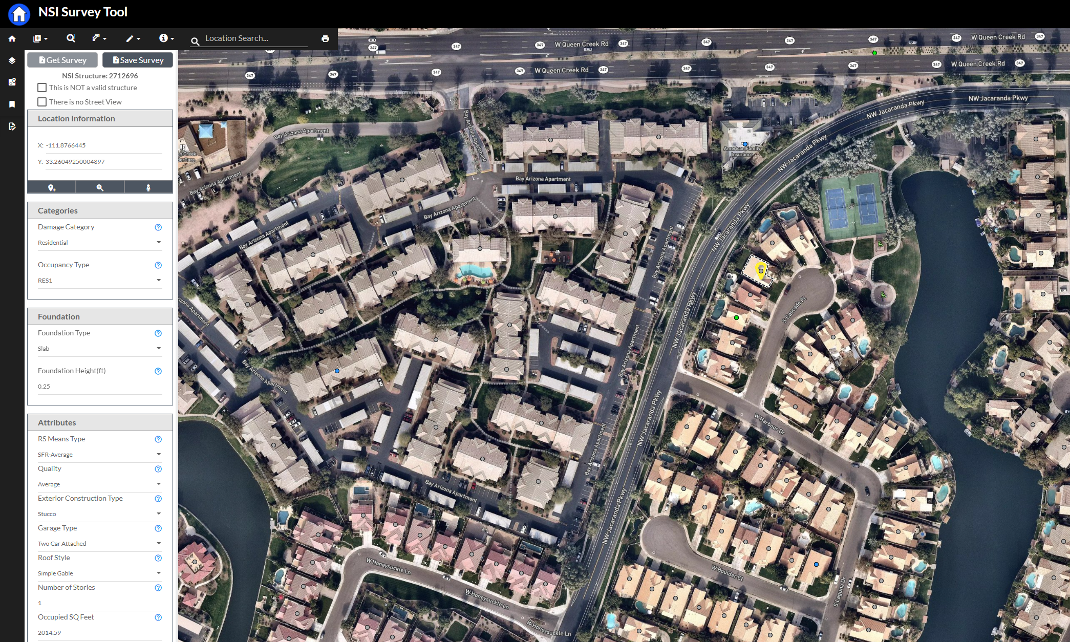
In 2021, the NSI development team designed and launched a new survey tool. The NSI Survey Tool (Figure 1) was created to support an effort to validate and adjust standard NSI assumption; that validation effort involved a survey team randomly selecting portions of NSI structures from across the nation to evaluate and update structure attributes. The survey tool will soon be available to all study teams within USACE, which will allow them to create structure surveys within their own study areas to validate or adjust the local NSI values. The survey tool interface is shown in below.

Improved Attribution
The attributes associated with valuation and foundation height are being improved through the surveys collected via the NSI Survey Tool and analysis of the parcel data.
Structure Value
Structure values directly inform the exposed economic value of the inventory in a study area. Greater exposed value reflects more significant economic consequence potential, and can impact the potential benefit of mitigating flood damages. USACE economists estimate the depreciated replacement value of structures within their study area and the NSI aids this effort by making estimates of the square footage and price per square foot of a particular structure type. The 2022 version of the NSI improves square footage estimates by drawing from parcel data, building footprint data, and numerous other datasets when necessary. Updates to depreciated replacement values per square foot have also been made. However, it will still be incumbent on study economists to ensure the validity of the data for their study area.
Foundation Height
The height of a structure's foundation changes the first floor elevation and the point at which flood damages are expected to significantly increase. It also changes the depths to which any occupants of the structure are exposed, which is important for life safety considerations. Previous versions of the NSI relied on a methodology developed by FEMA for the HAZUS program to inform foundation type and height assumptions; specifically, regional building permit data collected by the Census Bureau was paired with estimates of foundation heights, given a particular foundation type. This likely led to reasonable foundation type distributions on average for a broad region, but allowed for significant structure-level, or even neighborhood and study level, error. As study teams are increasingly concerned with nonstructural measures, inaccuracy of these assumptions can have greater ramifications, as nonstructural analyses rely heavily on first-floor elevations. The updated NSI mitigates existing limitations by drawing on parcel data that often reports the foundation type of the structure and whether there is a basement present. Using recently collected nationwide survey data, improved foundation height estimates can be made for a known or assumed foundation type.
Improved Geolocation
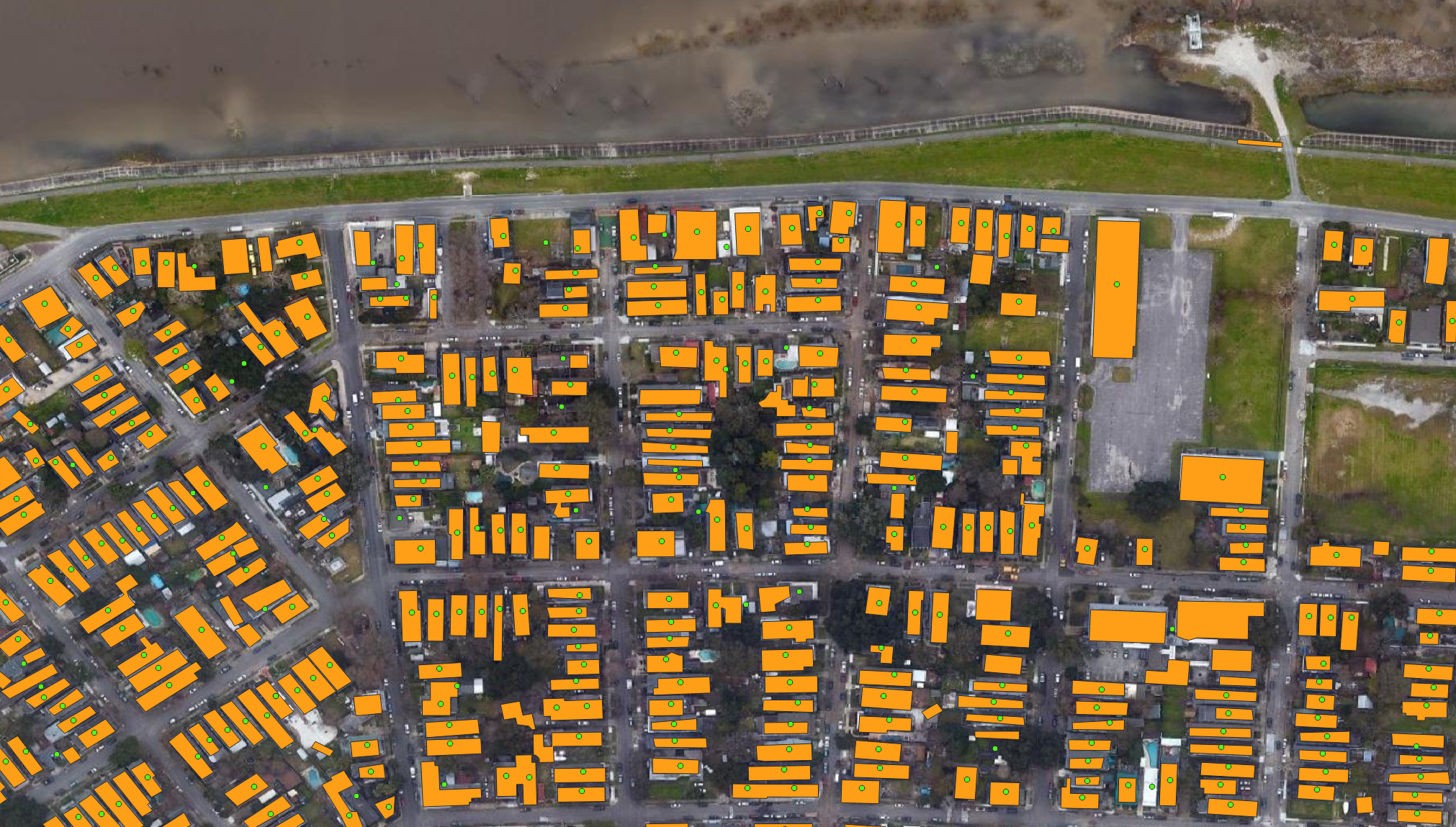
FEMA has made significant progress in leveraging image classification to develop a national building footprint dataset called USA Structures; this footprint data, along with NSI points, are shown Figure 2. USA Structures combines aerial imagery based footprints created by Oak Ridge National Laboratory (ORNL) in Oak Ridge, TN, with data from the 133 US Cities program sponsored by the National Geospatial-Intelligence Agency (NGA) to define building footprints based on LIDAR and other publicly available footprint datasets. By drawing from the best available footprint information within each county, the NSI can provide improved coverage and quality of building footprints across the nation.

Applications
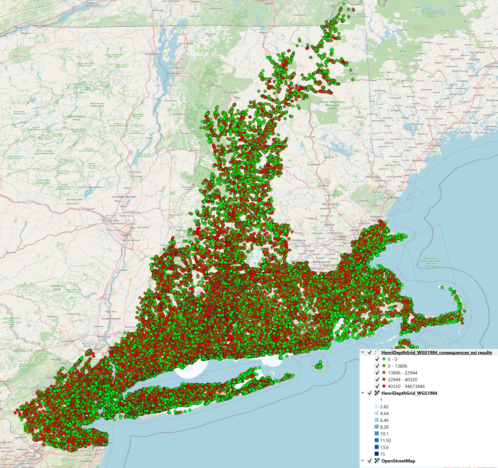
The use of the NSI continues to expand. For example, it is used across the Dam and Levee Safety Program to generate consequence assessments when paired with tools such as the Levee Screening Tool or software such as LifeSim. In addition, FEMA has utilized the NSI in conjunction with go-consequences for real-time estimates of the impacts of hurricanes, as shown in Figure 3. The NSI data has also been used within feasibility applications of HEC's Flood Damage Reduction Analysis (HEC-FDA) software to support plan formulation and project justification. Future releases of the NSI will continue this service for USACE study teams, but will also be available to outside stakeholders such as local emergency management agencies and state water resource agencies. The goal is to expand the use of the NSI in evaluating the consequences of natural hazards.

Research and Development
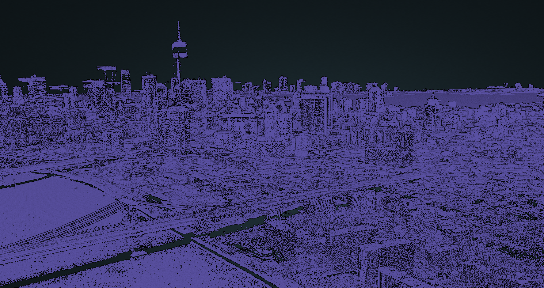
The NSI development team will continue to update its products as part of a multi-year R&D work unit. Special attention is being paid to scaling up use of remote sensing technology in defining structure attributes. LIDAR returns were used by the 133 US Cities program to determine a structure building outline, square footage, and height. This program is being leveraged to continue to improve the development of building footprints and attributions for the NSI. The US. Geological Survey's (USGS) three-dimensional (3D) Elevation Program (3DEP) program has created a centralized dataset of LIDAR data that can extend the reach of the original 133 US Cities program, as well as improve the consistency of the quality of input data. The data for the 3DEP program has been made available on Amazon Web Service in the Entwine data format; see the example of Entwine LIDAR point returns from the USGS 3DEP program displayed in Figure 4. This will improve estimates of structure locations, structure value, and number of stories. The NSI team is also using available datasets and machine learning tools to improve our estimates of other missing attributes.

Further Reading and Data Access
The NSI documentation is growing and improving. Future versions of the NSI will be made available through tools identified in the NSI documentation.