 Initial_Georeference.zip
 Final_Georeference.zip
This tutorial is designed to help new users of HEC-HMS learn how to georeference existing elements in an HEC-HMS Basin Model using spatial information in subbasin and reach shapefiles.
In this tutorial, you will georeference existing elements in an HEC-HMS Basin Model with subbasin and reach shapefiles.
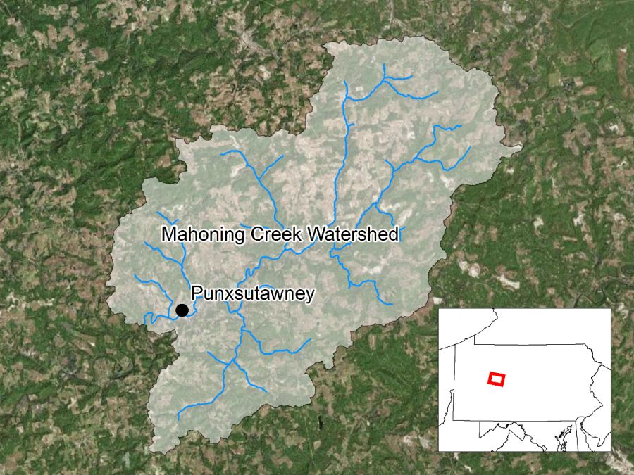
The Punxsutawney Watershed (400 km2) is part of the Allegheny River Basin located in western Pennsylvania, USA. Primary conveyance streams include: Stump Creek, East Branch Mahoning Creek, and Mahoning Creek. The confluence of Stump Creek and East Branch Mahoning Creek is located east of the enclave of Big Run. Mahoning Creek is downstream of the confluence. A map of the watershed is shown in Figure 1.
Basin geometry was originally defined by delineating subbasins and river reaches using GIS tools. An older version of HEC-HMS was used, which means the basin model elements were not georeferenced and the subbasin and reach elements were not displayed as GIS elements. Starting with HEC-HMS version 4.3, there are tools to georeference existing subbasin and reach elements using the geo-spatial information in shapefiles.
You can import subbasin and reach elements from shapefiles, or georeference existing HEC-HMS subbasin and reach elements. HEC-HMS uses the name attribute within the subbasin and reach shapefiles when importing information from shapefiles. The name in the shapefile's attribute table must exactly match the subbasin or reach name in the basin model for the element to be georeferenced. The following steps shows how to georeference existing subbasin and reach elements.
- Double click the HEC-HMS icon
 to start the program. The main program window will appear.
 - To open an existing project, click File and select Open….
- The Open an Existing Project window will open; click Browse to open the Select Project File window.
- Navigate to the project directory and select the "" file.
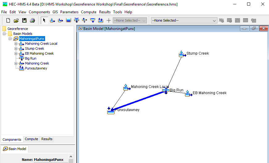
- Click the Select button and the existing project will open. You will notice the basin model is not georeferenced because the elements are displayed as icons.
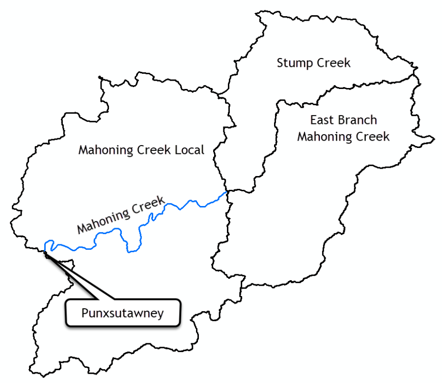
- The subbasin delineation is shown in Figure 3. Subbasin and reach shapefiles have been created that contains an attribute with names that match the element names in the HEC-HMS basin model.
- Go to the GIS menu and choose the Georeference Existing Elements menu option.
- Choose the Subbasins element type and click the Next button.
- Navigate to the … \Georeference\maps directory and select the Subbasins.shp file. Click Select. Click Next.
- Choose the "Name" attribute field to set the subbasin element names.
- Click the Finish button.
- On the Basin Model Coordinate System dialogue box, Click Select….
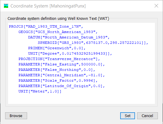
- Click Browse, Select the Subbasins.prj file. Click Select Click Set. The coordinate system information should populate as shown in Figure 4.
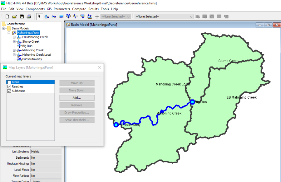
- Follow the previous steps and import the reach feature in the Reach.shp file. Figure 5 shows the three subbasin elements and the one reach element that were imported from the two shapefiles.
- Right click on the MahoningatPunx basin model name in the Watershed Explorer and choose the Resort Elements Hydrologically menu option. The elements in the Watershed Explorer should be ordered from upstream to downstream, as shown in Figure 5.
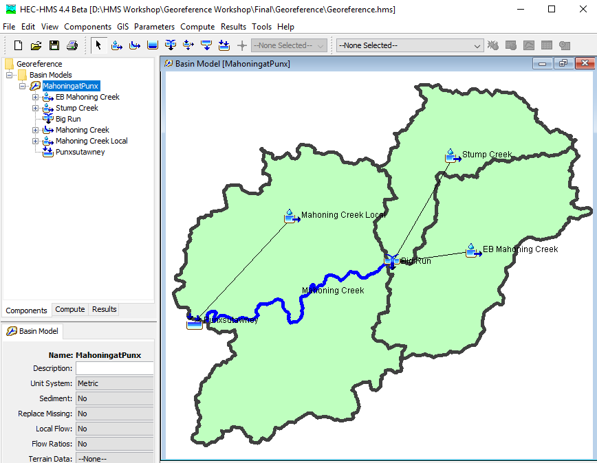
- Go to the View menu and choose the Map Layers… menu option. Uncheck the Icons. The elements in the Basin Model are shown without icons so that the users only interact with polygons and lines, as shown in Figure 6.
