PDF
Download PDF
Download page Watershed Burn Severity Calculation Procedure.
Watershed Burn Severity Calculation Procedure
Last Modified: 2023-03-10 09:45:02.382
This tutorial demonstrates a process to estimate the burn severity for HEC-HMS subbasins.
Software Version
ArcPro was used to create this example.
Introduction
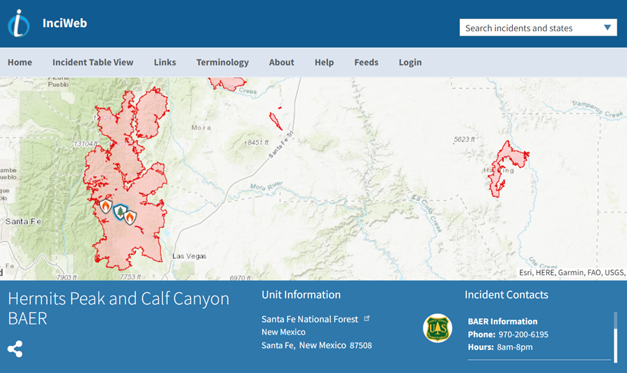
In this tutorial you will learn how to use the Burned Area Emergency Response (BAER) maps to determine the burn severity of each subbasin in the Gallinas Creek Watershed.
Acquiring Burned Area Emergency Response (BAER) Maps
- Attached is a shapefile for the Hermits Peak/Calf Canyon Fire burn severity maps.
- To obtain BAER maps for other fires, go to the National Forest Service’s website below or contact them directly for the shapefile format (.shp).
- Note: The InciWeb website also contains news, photos, and maps of the affected area. Click the link below for more information about the Hermits Peak and Calf Canyon Fire.
Computing Burn Severity Percentages in ArcGIS Pro
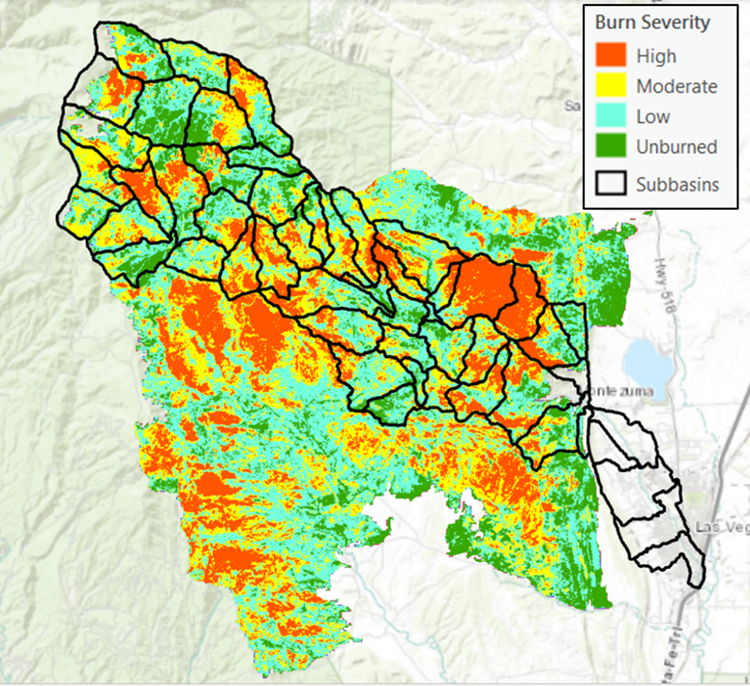
- Download the burn severity map shapefile (HermitsPeak_CalfCanyon_BAER_Map.shp) and HEC-HMS delineated subbasins shapefile (Gallinas_Creek_Subbasins.shp) and import them into ArcGIS Pro.
- Note: ArcGIS Pro 2.9.3 was used for this tutorial.
- Note: ArcGIS Pro 2.9.3 was used for this tutorial.
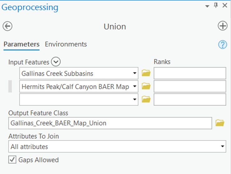
- Use the Union tool in ArcGIS Pro to combine the BAER shapefile and the Gallinas Creek subbasins shapefile together.
- Once all the required inputs are populated, run the Union tool by clicking Run in the bottom right corner of the geoprocessing window.
- Once all the required inputs are populated, run the Union tool by clicking Run in the bottom right corner of the geoprocessing window.
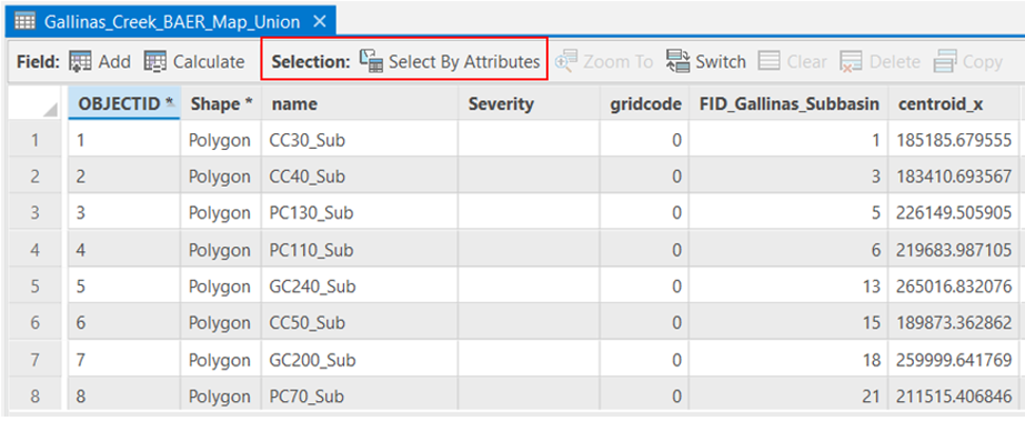
- When the union shapefile was created, the polygons that weren’t covered by the BAER shapefile were not given a value for the “Severity” field. This field needs to be updated so the blank values equal “Unburned.”
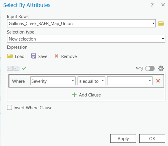
- Open the newly created shapefile’s attribute table and click Select By Attributes.
- Fill out the Select By Attributes window so that “Severity” is equal to “ ” (blank), which will select the polygons without a value for “Severity.” Then click OK.
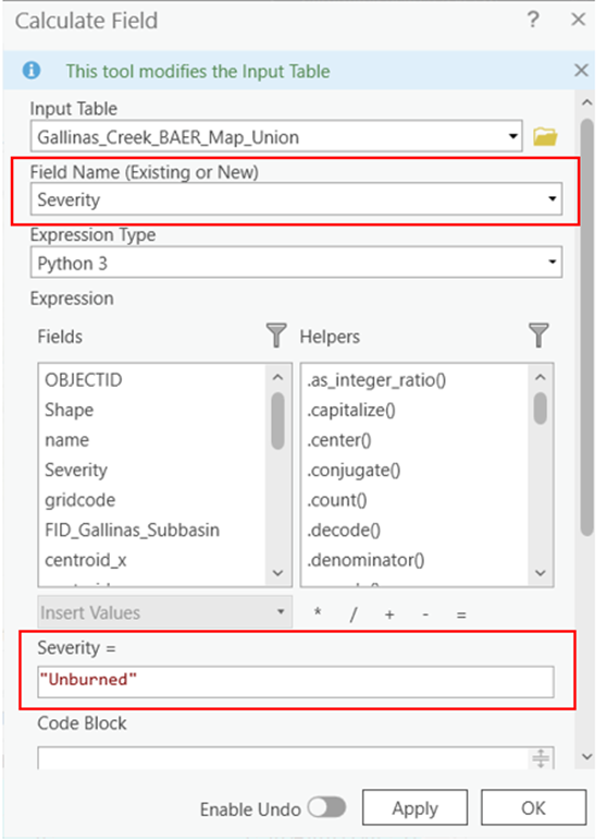
- Once the polygons are selected, right click on the “Severity” field and select Calculate Field.
- Fill out the Calculate Field window by setting “Severity” equal to “Unburned.” Click OK.
- Open the newly created shapefile’s attribute table and click Select By Attributes.
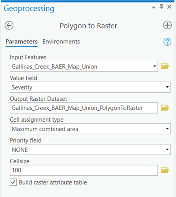
- Use the Polygon to Raster tool in ArcGIS Pro to convert the newly created shapefile into a raster.
- Set the Value field to the field that contains the burn severity classification (in this case “Severity”)
- Set the Cellsize to the size of the cells in the BAER shapefile (in this case approximately 100 ft).
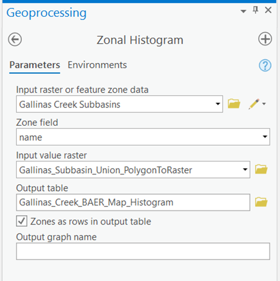
- Use the Zonal Histogram tool in ArcGIS Pro to calculate the number of cells that each subbasin contains.
- Make sure the Zones as rows in output table option is checked.
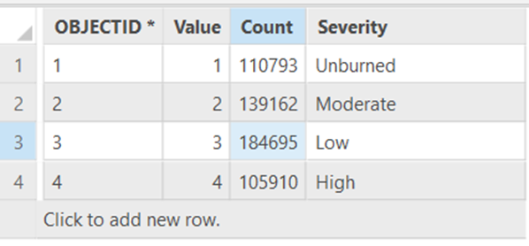
- The resulting table should look similar to the one below. In this case “CLASS_1” equals unburned, “CLASS_2” equals moderate, “CLASS_3” equals low, and “CLASS_4” equals high.
- Note: The classes are labeled according to the way the objects are ordered in the attribute table, which is why “Moderate” is “CLASS_2” while “Low” is “CLASS_3”.
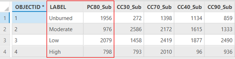
- Note: You can check which class corresponds to which burn severity by rerunning the Zonal Histogram tool with the Zones as rows in output table option unchecked.
- You can then compare the values for PC80_Sub from the earlier table with the values in the table below.
- You can then compare the values for PC80_Sub from the earlier table with the values in the table below.
- Note: The classes are labeled according to the way the objects are ordered in the attribute table, which is why “Moderate” is “CLASS_2” while “Low” is “CLASS_3”.
- Make sure the Zones as rows in output table option is checked.
- Create new fields in the histogram table to calculate the burn severity percentage for each subbasin.
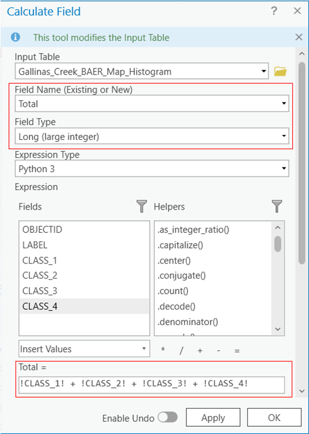
- Right click on one of the fields in the histogram attribute table and select Calculate Field.
- Type “Total” for the Field Name input. This will automatically create a new field in the attribute table.
- Set the Field Type to “Long” and the “Total” equal to the sum of the values in the 4 classes. Click OK.
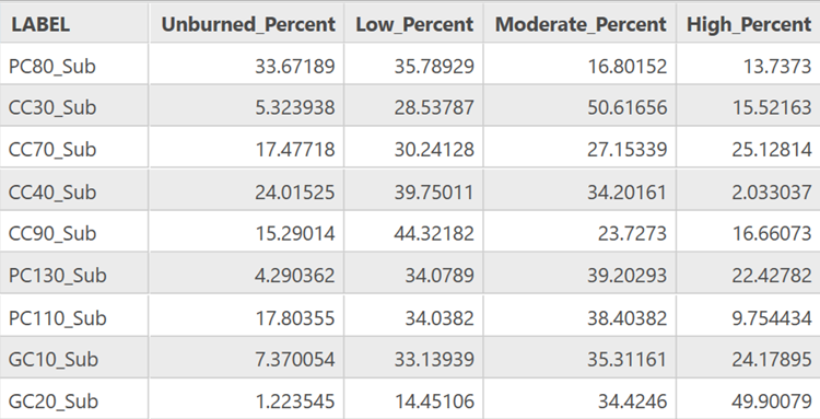
- Create and calculate fields for the percentage of unburned, low, moderate, and severe area.
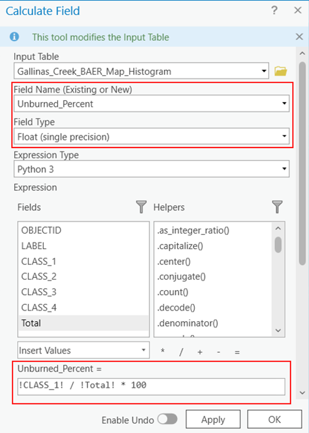
- Open the Calculate Field window again and type “Unburned_Percent” for the Field Name.
- Set the Field Type to “Float” because more precision is needed.
- Set the “Unburned_Percent” equal to “!CLASS_1! / !Total! * 100” and click Apply.
- Repeat for low, moderate, and severe burn severities.
- The final table should look similar to the one below.
- Right click on one of the fields in the histogram attribute table and select Calculate Field.