Bug Fixes
Program hang after pre-processing drainage with multiple processors
A bug was introduced in v.4.6 that caused the GIS | Preprocess Drainage step to hang. The issue is thought to be isolated to cases where multiple processors were used during computation; It was not observed in small domain test cases. The issue has been fixed in the v.4.6.1 release so that the thread executing TauDEM aread8 command is closed when the process finishes. Under normal program operation, the indefinite progress window closes and flow direction and flow accumulation rasters are created in the <project root>/gis/<basin name> directory.
"Could not delineate elements because the break points did not intersect the stream network" error with ESRI WKT projection
A "Could not delineate elements because the break points did not intersect the stream network" error was erroneously given when an ESRI WKT projection was used with the input terrain data. Several entry points in the code were updated to morph the input ESRI WKT to an OGC WKT allowing the delineation step to proceed. The bug was found using an ESRI WKT for the Kentucky State Plane North projection. It is likely bug would occur with other ESRI WKT projections.
Terrain File path updated after import
An issue was found when referencing Terrain Data when the path to the original base terrain data file broke. Logic was updated in the Terrain Data management to reference the terrain data file that is created upon import to HEC-HMS. These files are located in the <project root>/terrain directory.
Missing data on sediment load results from USGS Long-Term debris yield method
An issue was found when the last burn date is set to be after the simulation end date in the HMS project. In this case the USGS Long-Term method was trying to use negative number of years since last burn and the computed sediment yield was NaN. Also, if the direct runoff event starts on the burn date, the USGS Long-Term Debris Flow method was using zero days since the burn and the calculated sediment yield was zero. The issue has been fixed in v.4.6.1 release so that (1) if the last burn date is after the simulation end date, an error message will be popped up, (2) if the last burn date is after an erosion event date, the debris yield will be set to zero and (3) if direct runoff starts on the same day as the burn date, the number of days since the burn date is set to 1.
Statistics Report Generator - Terminates for Datasets with Elements That Did Not Have Results
An issue was found when attempting to generate a statistics report if a source was used in the basin model. Sources do not have results causing the report generation to fail. New handling logic was added for this case allowing report generation to proceed.
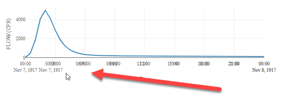
Standard Report Generator - Overlapping X-Axis (Time) in Several Plots
An issue was found where plots had two axes resulting in overlapping time strings. An example is shown below.
The second axis has been removed so that time strings do not overlap.
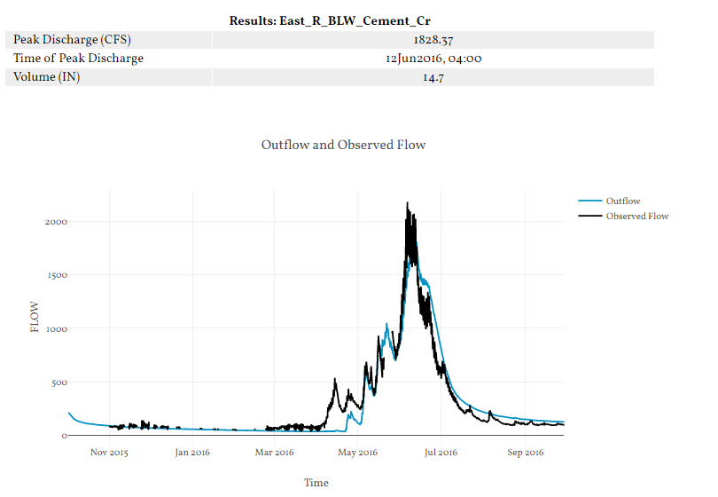
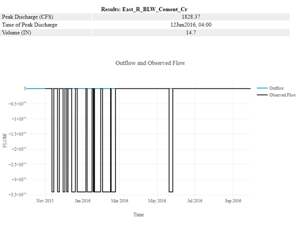
Standard Report Generator - Incorrectly Display Time Series Plots with Missing Data for Certain Dates
An issue was found in plots that had missing data for several dates. The missing data were filled with a non-NaN negative value. This caused the plots to look as shown in the image below:
To resolve this issue, the missing data were refilled with NaN values, so that the plotting library would ignore those data. This solution mirrors the plots produced in HMS. Below is an example of a plot after changes have been made.