Download PDF
Download page Selecting a Discretization Method.
Selecting a Discretization Method
The discretization method defines how a subbasin is discretized. Traditionally, the Mod Clark grid cell file has been used to define the spatially-discrete elements of a subbasin. One limitation of the Mod Clark grid cell file is that it does not use absolute spatial references. Grid cell locations are referenced from an arbitrary lower left corner. Structured and Unstructured discretizations provide spatial-awareness to spatially-discrete subbasin elements. Advantages of the spatially-aware approach include the ability to view discrete elements, the ability to sample values from other geospatial data, and the ability to visualize results for discrete elements.
There are four types of Discretization: Structured, Unstructured, File-Specified, and None. The 2D Diffusion Wave and Mod Clark transform methods are inherently gridded, and require a gridded discretization; therefore, the discretization method can not be None when one of these methods are selected. Whenever a gridded Canopy, Surface, or Loss method is used, a gridded discretization must be provided.
None Discretization
The None Discretization represents the entire subbasin as one discrete element within the larger modeling context. This configuration is commonly referred to as a "lumped-parameter." The reality is that all discretization approaches do some amount of spatial-averaging. The amount of spatial-averaging depends on the extent of discrete elements.
The following image shows the None Discretization selected. If the None Discretization is selected, there is no Discretization tab in the subbasin element's component editor.
Structured Discretization
The Structured Discretization creates a Cartesian grid within the bounds of the subbasin. The Structured Discretization gives options for Standard Hydrologic Grid (SHG) or Universal Transverse Mercator (UTM) projection and 50, 100, 200, 500, 1000, 2000, 5000, or 10000 meter grid cell sizes.
The following image shows a Structured Discretization that uses the SHG projection and a 2000 meter cell size.
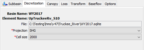
Spatial elements for a Structured Discretization are stored in a SpatiaLite database. The database is identified by the File specification in the component editor. The database file is managed by HEC-HMS and the file location shown in the component editor cannot be modified by the user. The spatial elements are stored in a layer named "discretization" in the SpatiaLite database.
The projection defines the projected coordinate system of the grid cells. There are options for SHG and UTM zones 1-60, north and south.
The grid cell size defines the grid cell size to be used in the discretization. There are options for 50, 100, 200, 500, 1000, 2000, 5000, or 10000 meter grid cell sizes.
After selecting a new Structured Discretization definition, the grid cells can be computed from the GIS | Compute | Grid Cells menu option.
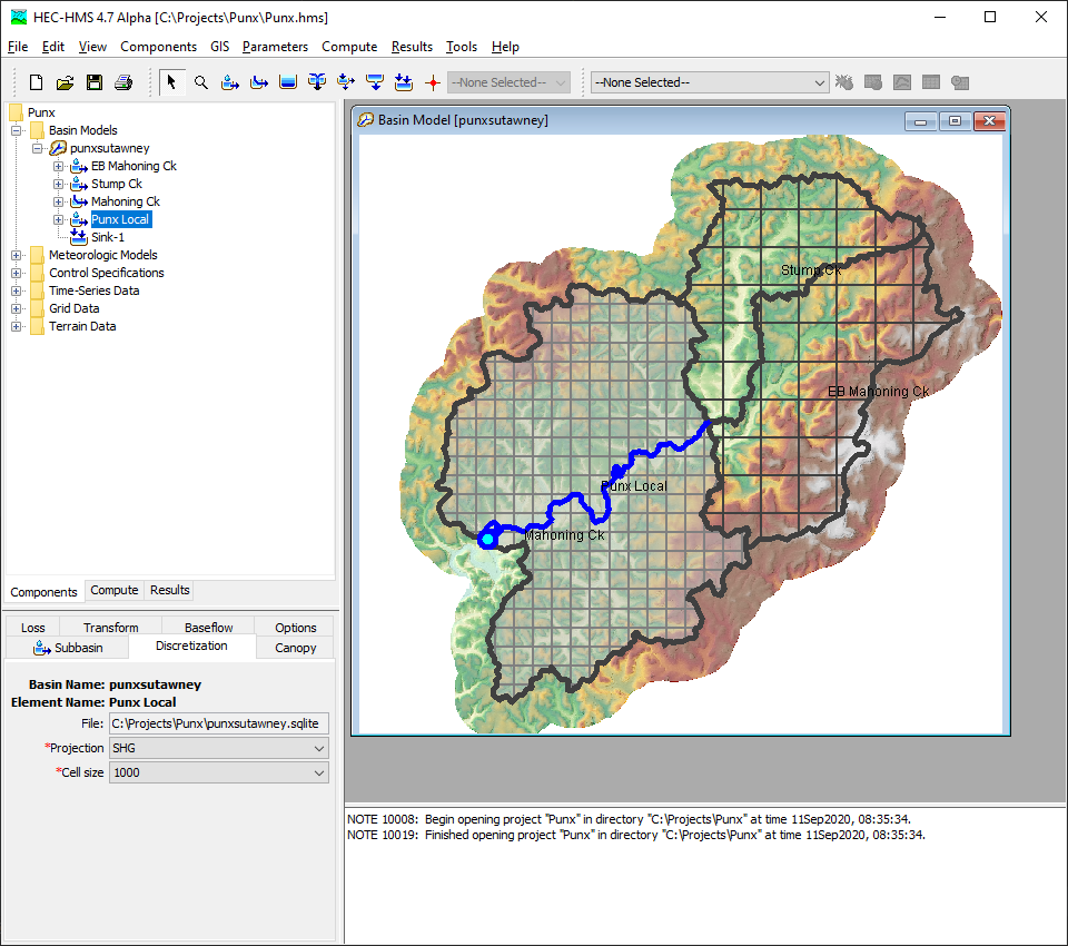
The Punxsutawney basin model shown below uses an SHG projection with a 1000 meter grid cell size for the lower subbasin and a 2000 meter grid cell size for the upper subbasins.
Unstructured Discretization
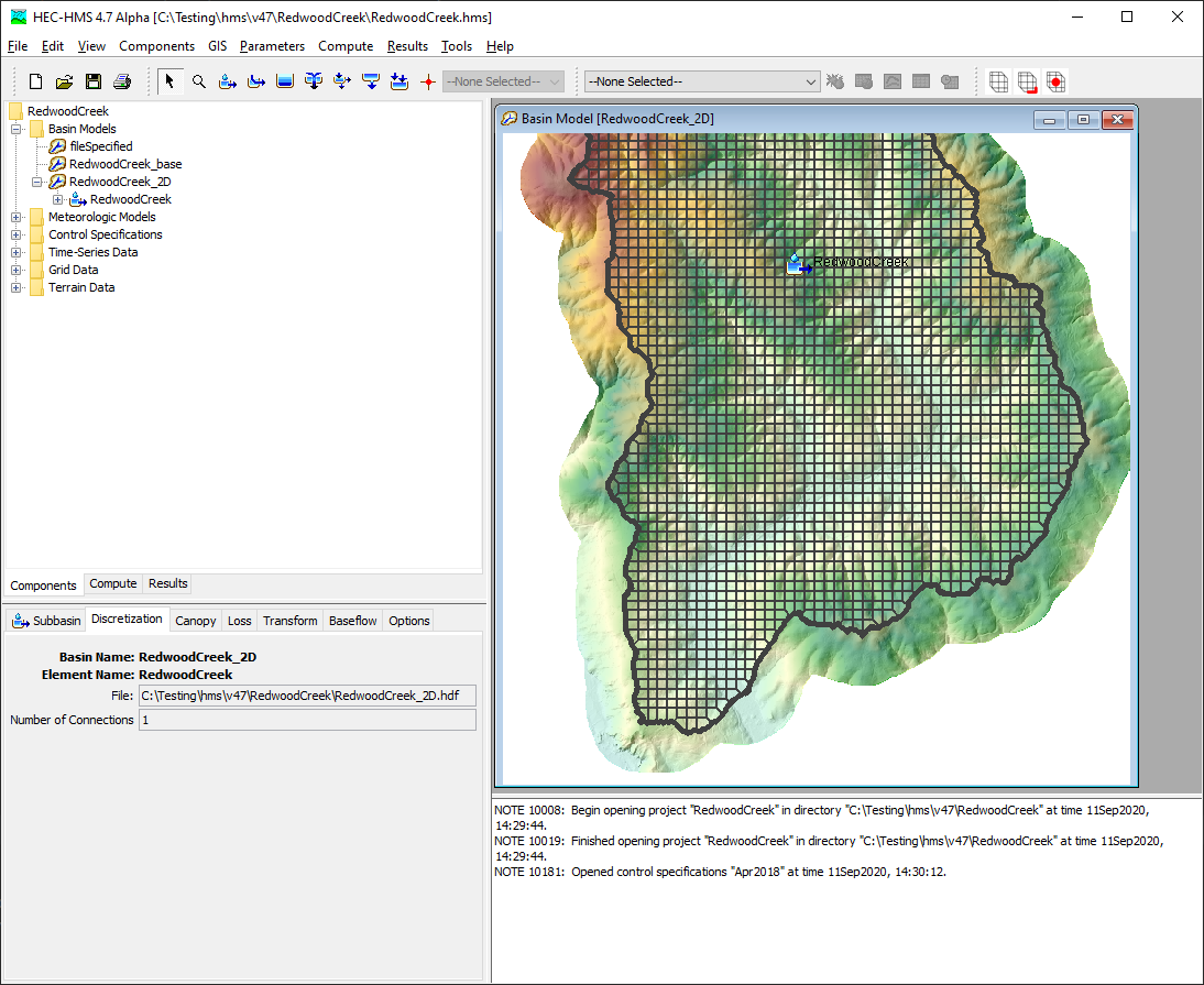
Unstructured Discretizations can have any coordinate reference system and the grid can be unstructured. Unstructured grids can be imported from an HEC-RAS Unsteady Plan HDF file (using HEC-RAS version 5.0.7 or newer). The plan file has an extension of ".p##.hdf", where "p##" corresponds to the specific plan of interest. Unstructured grids are most commonly used with the 2D Diffusion Wave transform method.
The following image shows an Unstructured Discretization.
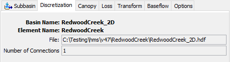
Spatial elements for a Unstructured Discretization are stored in a HDF5 file. The backing file format for an Unstructured Discretization is an HDF5 file with an identical schema to HEC-RAS, such that files are interoperable. Once imported, the HDF file is managed by HEC-HMS and the file location shown in the component editor can not be modified by the user.
The Number of Connections is the number of connections to or from the unstructured discretization. Connections are created during import and currently can not be modified by the user.
The image below illustrates an Unstructured Discretization.
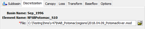
File-Specified Discretization
File-Specified Discretizations were introduced to support the traditional Mod Clark grid cell file, but also support valid Structured Discretization and Unstructured Discretization files. When a File-Specified Discretization is used, the path to a grid-defining file is provided by the user.
The following image shows a Mod Clark grid cell file specified in the File-Specified Discretization editor.
Mod Clark grid cell files can be created from the GIS | Compute | Grid Cell File... menu option. For more on the format, see Grid Cell File Format.
The following image shows a valid Unstructured Discretization HDF file specified in the File-Specified Discretization editor.
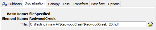
If a Structured or Unstructured Discretization has already been computed, the File-Specified option allows users to rapidly change the discretization definition without creating a new basin model.
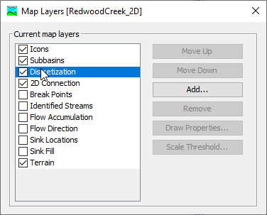
Viewing the Discretization Layer
The spatial features display for Structured and Unstructured discretizations can be toggled on or off in the Map Layers dialog, shown below.
Global Editing
Global editors can be used to quickly edit information for all subbasins and reaches instead of editing individual element Component Editors. Discretizations can be edited globally from the Parameters | Discretization menu.
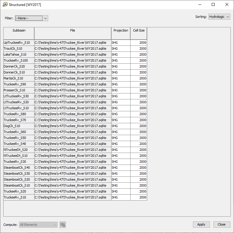
The following image shows the global editor for a basin model where all subbasins are set to use the SHG Structured Discretization.