The Temporal Pattern Importer utility is launched from the Tools | Data | Atlas 14 menu in HEC-HMS.
A project must be open to access the Temporal Pattern Importer.
Step 1: Select Files
Select a NOAA Atlas 14 Temporal Pattern file using the File Browse button (1). The file must be a valid NOAA Atlas 14 Temporal Pattern file in comma separated value (CSV) format.
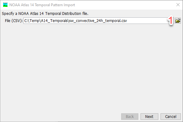
NOAA Atlas 14 Temporal Pattern CSV files can be downloaded from the NOAA Precipitation Frequency Data Server. For any given location, the temporal pattern file can be downloaded from the "Supplementary Information" tab. The temporal pattern files are distributed in CSV format.
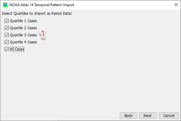
Step 2: Select Quartiles
Select quartiles to import (1). NOAA Atlas 14 categorizes temporal distributions for four precipitation cases defined by the duration quartile in which the greatest percentage of the total precipitation occurred. All Cases includes temporal patterns for all storms that were analyzed as part of the volume.
Step 3: Select Destination
Select destination. Paired data can be saved to the project HEC-DSS file or an external HEC-DSS file (1). The wizard will default to an external HEC-DSS file with an automatically generated file name based on the input data (2). If the project HEC-DSS file is chosen the project HEC-DSS file is set and the file text field and file browse button become disabled.
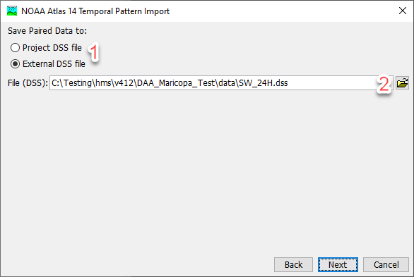
An "external" DSS file indicates a DSS file that is not managed by HEC-HMS. External is not an indicator of whether the HEC-DSS file lives within the HEC-HMS project directory or not. Best practice is to locate all project files in the HEC-HMS project directory.
Step 4: Processing
After Next has been selected in Step 4, a progress bar will display, indicating the progress of the import.
Step 5: Import Complete
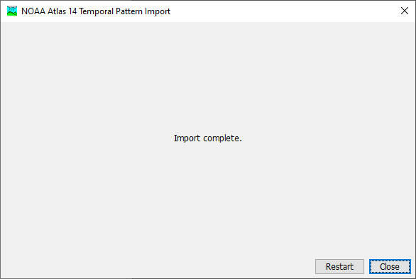
After the import is complete, the wizard will automatically progress to step 5, indicating that the import is complete. There are buttons to Restart or Close the wizard.
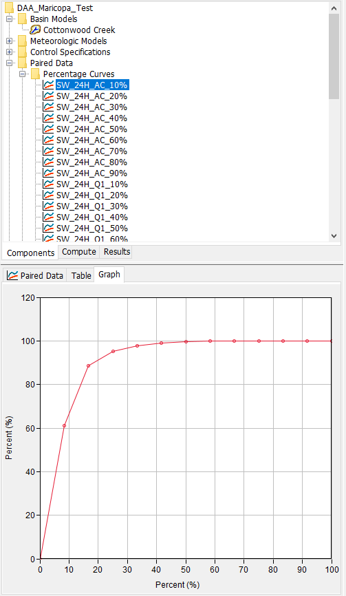
The Paired Data will be saved to the HEC-DSS file set in step 3. In HEC-HMS percentage records will be generated as Paired Data and can be viewed from the Watershed Explorer.