Download PDF
Download page Hybrid Snow Validation and Verification.
Hybrid Snow Validation and Verification
Introduction
This section documents the validation and verification (V&V) effort for the Hybrid Snow (a.k.a. Radiation-derived temperature index, RTI) method which was added within HEC-HMS v4.11. The HEC-HMS Java implementation was evaluated using data from the Swamp Angle Study Plot. Results produced by the HEC-HMS Hybrid snow method were compared against those produced by the original C++ implementation from the models' author (Follum et al, 2015; Follum et al, 2019).
Goals
The goals of the Hybrid Snow V&V effort were:
- Make model calculations consistent between the C++ (Follum et al, 2015) and Java (HEC-HMS) implementations,
- Refactor HEC-HMS code for improved readability and consistency with HEC-HMS coding standards,
- Ensure mass conservation, and
- Develop automated tests that will flag altered results when future modifications are made to the HEC-HMS Hybrid snow method.
Location
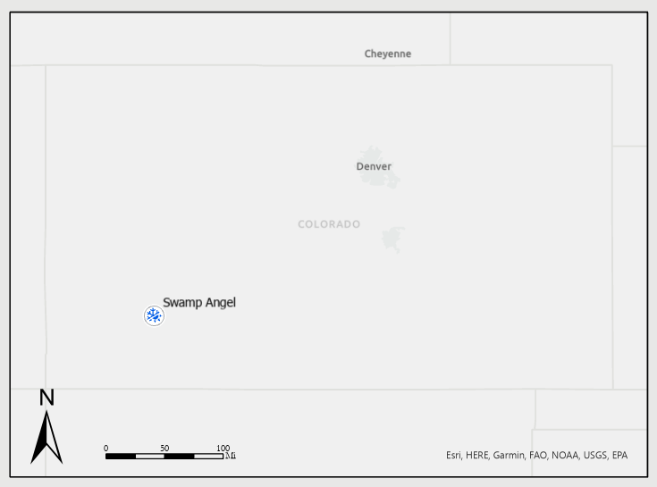
The Swamp Angel Study Plot (SASP) is located in the San Juan Mountains in southwestern Colorado in the Senator Beck Basin. SASP is located at an elevation of 11,060-feet and is located in meadow sheltered by the surrounding terrain and subalpine forest. The location of SASP allows for snowpack and precipitation measurements under minimal wind influence.
Approach
An HEC-HMS project was constructed for the SASP location. A basin and meteorologic model was created to represent the land surface and meteorologic processes, respectively, at this location. The following sections describe the model construction and parameterization techniques that were used.
Basin Model
For this V&V effort, the study plot was treated as a point location despite it being parametrized as a gridded model. A single subbasin element was developed where the SASP was represented in the center of a 3x3 grid of 10-meter cells. The resulting study plot subbasin had an area of 0.00035 square miles (0.22 acres). Only snow accumulation and melt processes were simulated. As such, no canopy, surface, infiltration, or baseflow methods were selected for the subbasin elements. A structured discretization using the SHG projection and a 10 meter cell size was used. Finally, the ModClark transform was used to ensure that precipitation-runoff outputs were computed on a grid cell basis. The following values were initially used within the Hybrid snow method:
| Parameter | Value |
|---|---|
| Rain Threshold Air Temperature (deg C) | 0 |
| Snow Threshold Air Temperature (deg C) | 0 |
| Base Temperature (deg C) | 0 |
| Melt Factor (mm/deg C-6 hr) | 0.33 |
| Max Negative Melt Factor (mm/deg C-6 hr) | 0.5 |
| ATI Coefficient | 0.8 |
| Wind Function (mm/mb-6hr) | 0.5 |
| Water Capacity (%) | 2 |
Meteorologic Model
A meteorologic model was created and used to supply the necessary boundary conditions using the following methods:
| Process | Method |
|---|---|
| Shortwave Radiation | Interpolated Shortwave |
| Longwave Radiation | Interpolated Longwave |
| Precipitation | Interpolated Precipitation |
| Temperature | Interpolated Temperature |
| Windspeed | Interpolated Windspeed |
| Atmospheric Pressure | Interpolated Pressure |
| Dew Point | Interpolated Humidity |
Input Data
Boundary conditions required to force the Hybrid Snow computations were obtained for water year (WY) 2006 from the repository of SASP data (Landry et al. 2014). Hourly time series of the required meteorological variables were downloaded in CSV format and imported to DSS for use within HEC-HMS. The point time series were converted to grids using the values shown below. No additional corrections were applied to the boundary condition data since the modeling domain was assumed to represent the point at which the input data was collected.
| Parameter | Value |
|---|---|
| Latitude (°) | 37.90694 |
| Longitude (°) | -107.71139 |
| Interpolation Method | Inverse Distance |
| Radius of Influence (km) | 100 |
Computational Settings
A control specification was created for WY2006 using a 1 hour computational time step.
Results
The results of the V&V effort were based upon a continuous simulation of WY2006 at an hourly time step. The WY2006 simulation contained multiple periods of snow accumulation and a large range of air temperatures. At each time step, the following model output parameters were compared:
- Liquid water at the soil surface (LWASS)
- Liquid water content
- Antecedent Temperature Index (ATI)
- Radiation temperature
- Snow water equivalent (SWE)
- Albedo
- Heat deficit
The following plots provide comparisons of these results between the Java (HEC-HMS) and C++ (Follum et al, 2015) results. As shown below, the results closely match between these two code bases. However, slight differences are present. These differences stem from improvements that were made to the Java (HEC-HMS) implementation. Most notably, the solar hour angle computations within HEC-HMS were improved to be more representative of the location (i.e., grid cell or subbasin) in question. Solar hour angles are used when estimating downwelling shortwave radiation. Due to the differences in shortwave radiation, differences are also present within the computed radiation temperature, albedo, liquid water content, etc. However, these differences were expected and the results from HEC-HMS were considered more accurate than those produced by the C++ code.


Additionally, the mass balance was computed for each time step as well as the entire WY using the following:
| \Delta \mathrm{SWE}=\mathrm{LWASS}-\mathrm{Precipitation} |
The total and maximum mass balance errors for the WY2006 simulation are shown below:
| Parameter | Value |
|---|---|
| Sum Mass Balance Error (mm) | -4.7058E-12 |
| Max Mass Balance Error (mm) | 9.8288E-13 |
Summary
The Hybrid snow method within HEC-HMS was successfully validated and verified using the Swamp Angel Study Plot (SASP). An HEC-HMS project was constructed and parameterized for this location. HEC-HMS outputs were compared against those produced using the original C++ implementation from the models' author (Follum et al, 2015). The results between the two code bases were found to be nearly identical with minor differences due to improvements in the solar hour angle calculations within HEC-HMS. Furthermore, mass was found to balance within a tolerance of +/- 1E-12 mm for any given 1 hour time step as well as the entire WY.
References
Anderson, Eric. 2006. "Snow Accumulation and Ablation Model – SNOW-17". National Weather Service. https://www.weather.gov/media/owp/oh/hrl/docs/22snow17.pdf.
Follum, Michael L., Charles W. Downer, Jeffrey D. Niemann, Spencer M. Roylance, and Carrie M. Vuyovich. 2015. “A Radiation-Derived Temperature-Index Snow Routine for the GSSHA Hydrologic Model.” Journal of Hydrology. Elsevier BV. https://doi.org/10.1016/j.jhydrol.2015.08.044.
Landry, Christopher C., Kimberly A. Buck, Mark S. Raleigh, and Martyn P. Clark. 2014. “Mountain System Monitoring at Senator Beck Basin, San Juan Mountains, Colorado: A New Integrative Data Source to Develop and Evaluate Models of Snow and Hydrologic Processes.” Water Resources Research. American Geophysical Union (AGU). https://doi.org/10.1002/2013WR013711.