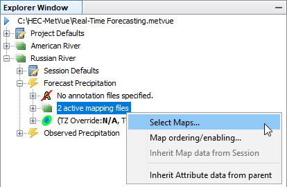
There is more than one way to associate shapefiles with the attribute that is used to draw it. The first is to directly associate the attribute with the shapefile when it is selected. This associative action can be done via the Project Explorer on the project defaults, the session defaults, or one of the Map Windows. Under any one of these nodes, right-click on the 'Maps' node and choose the 'Select Maps' option which opens a Dialog. The table below provides a description of the available features.
In the example shown, the map file usa has the attribute 'State Outlines' associated with it and will use that attribute for all shapes in the file. This will override any attribute type that is defined in the DBF file.
The shapefile specification states that only a single type of shape, either 'Point', 'Line' or 'Polygon' can be in the file. Other shapefiles specified, such as ALTU.Line, use the '<default for data type>' attribute. The program has a default attribute defined for any shape type without a defined attribute. For points, this is a square symbol with a black outline and white fill. For Line and Polygon shapes, a solid, thin, black line is the default. If the wrong type of attribute is associated with a shapefile, the program will use the default attribute for that shape type and produce warnings in the output window.
Item | Description |
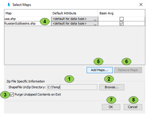
1 | Shows the default directory location to use for unzipping shapefile archives. By default it uses the temp directory location. |
2 | Used to set the location for the zip archives to be unzipped to. It brings up a standard directory browser. |
3 | If this box is checked, when the program exits it cleans up all the unzipped content it created. When the program is restarted, it will look for the specified shapefile in the unzip directory. If it cannot find it, it will unzip the original zip file again. If left unchecked, the program will create the unzipped content required in the unzip location specified. When it exits it will leave the files. On restart the files will be there, saving the unzip step. |
4 | A list showing the currently selected maps, the attribute to associate with them if the TYPE attribute is not present in the .dbf file, and the selection of Basin Average or Background Map. Note that if a zip file is selected, the program will show all the shapefiles in the zip file in this list and not the zip file itself. |
5 | Making this selection brings up a standard file selection dialog which by default will show all the shapefiles and zip files available. Multiple files can be selected at once using standard shift and ctrl keys. |
6 | Removes any maps that are highlighted on the table in 4. Standard shift and ctrl keys can be used to make multiple, discontinuous selections. |
7 | Save all changes |
8 | Discard all changes. Note that by this time any specified zip files have already been processed and will not be cleaned up until the program exits. |
The second method is to associate the individual shapes within a shapefile directly to an attribute using a column in the DBF file. This is done by specifying the attribute type using the column 'TYPE'. It does not matter what column position the TYPE field is in. When the DBF file does not contain a TYPE column or the TYPE column contains some other sort of metadata other than an attribute of the attribute schema being used, the program simply assigns the attribute that was associated with the shapefile.
Also, note that since the TYPE attribute of each shape object in the file can be different, a single shapefile can be used to contain multiple attribute types (e.g. Basin_Polygons and Subbasin_Polygons) as long as the file still only contains Point, Line or Polygon data exclusively. This exclusivity of the shapefile object type is part of the shapefile specification.
