Adding a point is most often done with an irregular TIN than it is with a grid but it can be done to a gridded dataset as well. Note however that adding a point to a grid means it is no longer a grid and will be processed as an irregular TIN. Any added point modifies the totals in the aggregate image. When saving discrete images for the dataset, the individual images will be modified using their temporal distribution weights and the modified aggregate value.
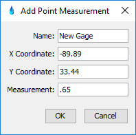
To add a point, simply position the mouse where the point is to be added and select the 'Add Point…'option. This will bring up the dialog. The X and Y coordinates of the point are in the display coordinates of the map projection selected and at the point that the mouse was pressed. Adjust the locations, measurement and name of the point as desired.