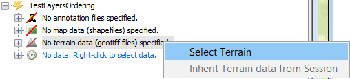
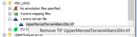
Terrain elevation data is loaded via a TIF file. Any file type with a .tif extension may be selected; this includes GeoTIFF files. Only one TIF file may be selected per map panel. Attempting to select a second TIF file will overwrite the currently-selected TIF. A selected TIF file can also be removed via a context-menu action.