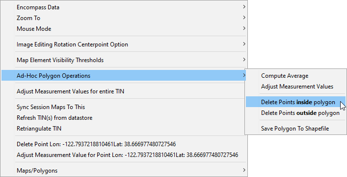
Make sure all the measurements that are to be deleted are visible on the screen. Set the mouse mode to 'Define Polygon' and create a polygon with the points to delete in the polygon (see Creating a Polygon With the Define Polygon Tool). Right click to bring up the Map Window context menu and select the appropriate option.
Note that once the polygon is formed there is also an option to delete points that fall outside of the polygon. This option would typically be used to 'trim' the extents of a storm prior to performing a depth-area-duration analysis by encompassing the portion of the storm to retain.