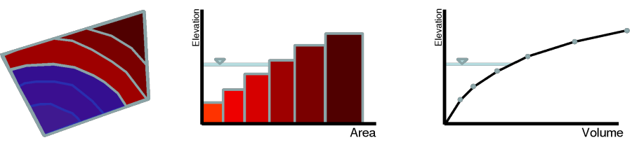
The bed change, sorting and layering are simulated in HEC-RAS using a subgrid approach. In this approach each computational cell has two sets of curves for the horizontal wetted area and water volume as a function of elevation. In addition, each face also has two sets of curves for the wetted horizontal length and vertical wetted area as a function of elevation. These curves are referred to as the subgrid curves. One of these sets of curves is relatively high-resolution and is utilized by the flow model in order to capture to effects of the subgrid bathymetry on the water storage and conveyance. The high-resolution (hydraulic) curves are obtained from a detailed terrain model, while the coarse (sediment) curves are derived from the flow curves. In theory it is possible to utilize the same high-resolution curves for both hydraulic and sediment, but this would make the computational time and memory requirements for the sediment transport calculations prohibitively expensive. This is the reason why a second set of relatively coarse curves are utilized by the sediment transport model to compute the subgrid bed change, sorting and bed layering.
Figure 3 24. Schematic illustrating the subgrid concept utilized in HEC-RAS.
The computational cell and faces have piece-wise constant elevations as a function of area and length. Therefore, the subgrid topography is schematized as having "subareas" or "sublengths" for cells and faces respectively with discrete elevations. These subareas and sublengths are referred to collectively as subregions. The location of the discrete elevations is not known. Only the amount of area at cells and length at faces which corresponds to each discrete elevation is known.