Download PDF
Download page Re-projecting Model Geometry.
Re-projecting Model Geometry
Georeferenced HEC-RAS models may need to be reprojected from one coordinate system to another. Typical use cases are a model that has been developed using a local coordinate system (e.g. State Plane) and needs to be converted to a National coordinate system (e.g. Albers projection). HEC-RAS provides tools to perform this coordinate system transformation with relative ease. These tools have been broadly used with 1D model data and have been adapted for 2D models but have not been used as extensively.
However, HEC-RAS does not support coordinate system transformation where a horizontal datum shift is required. Coordinate transformations in North America between spatial reference systems that use NAD83 and WGS84 or in Europe that use ETRS89 and WGS84 work because they share a very similar datum.
Step-by-step guide
Prior to converting your HEC-RAS model, you will need to collect spatial reference system information for the current coordinate system an the coordinate system your are projecting the data into.
Geometry Conversion
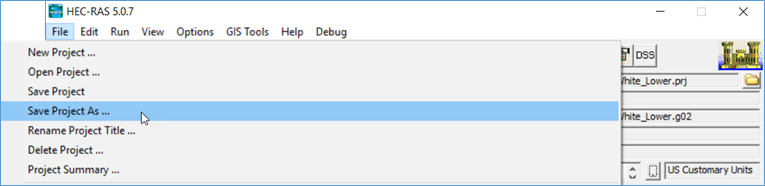
- Save Project As - save a copy of your project, in case something goes wrong.

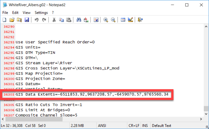
- Check your geometry data file. There is a bug with versions 5.05 to 5.07 where the GIS Data Extents tag in the geometry file may have been improperly set. If the GIS Data Extents tag is empty, set it to "GIS Data Extents=0,0,0,0". If the data were generated with HEC-GeoRAS, the tag will be correct (see the example below).
- Convert the Geometry
- Choose Options | Convert Horizontal Coordinate System from the main HEC-RAS window.
- Set the FROM coordinate system ("Current Project Spatial Reference System").
- Set the TO coordinate system ("Destination Project Spatial Reference System").
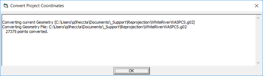
- Press OK to convert.
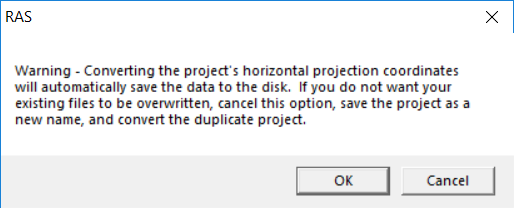
- A quick warning will come up - this is your last reminder to save your project as a copy of the original. Press OK.
- A message will come up informing you of the conversion. Press OK to dismiss.
- Verify Geometry
- The projection will automatically be set in RAS Mapper. Use background imagery to verify the data are in the correct location.
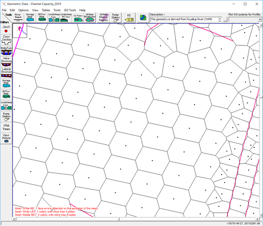
- Errors may have been created when the model was converted. This will be more likely to have happened with 2D Flow Areas. Errors in the geometry will be reported at the bottom of the Geometric Data Editor.
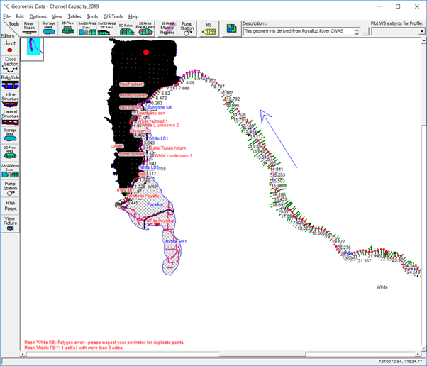
Here are some things to look for that may need closer attention:
- Duplicate perimeter points
- Mesh cells with too many faces
- Breaklines may need to be enforced as points may not longer be exactly as desired
- Previous hand edits of computation points will then be lost!
- Elevations extracted for cell faces may have “changed” with new terrain. This may result in elevations along Hydraulic Structures no longer being higher than minimum cell elevations. This may be true for Gates and Culverts as well.
Terrain Model Conversion
At this point you will have converted model geometry, but if you wish to visualize inundation results you will need a Terrain Layer in the same coordinate system. If you model is a 2D model, you will need the Terrain Layer for extracting hydraulic properties. The next step is to convert the terrain model.
- Open RAS Mapper.
- Set the coordinate system with the new projection file by selecting the Tools | Set Projection for Project option.
- Create a New RAS Terrain Layer
- Verify that the data were converted on import.
- Associate the RAS Terrain with the model geometry.
Manning's n Value Layer Conversion
If you have a geospatial Manning's n Value Layer, you will need to convert and associate that dataset as well.
Document the Model
Document in the project file and the geometry files noting the coordinate system it is now in and any other information you think is pertinent
Problems?
If you see this cells with a lot of faces like the image below, you may have converted the data incorrectly. For instance, you may have inadvertently converted the data by using incorrect coordinate systems (e.g. switched the FROM and TO coordinate systems).