HEC-RAS Mapper can create terrains from a wide variety of raster data formats. Some of these formats such as GeoTIFF can include a spatial reference system (SRS) stored internally within the file. When this internal projection data is not stored properly, or is in a format that HEC-RAS geospatial libraries don't recognize, you will NOT be able to reproject the raster and create an HEC-RAS terrain. This guide discusses how to work around an unrecognized internal raster projection (or when NO projection is specified) by skipping the SRS translation step and importing the terrain dataset directly into a RAS Terrain.
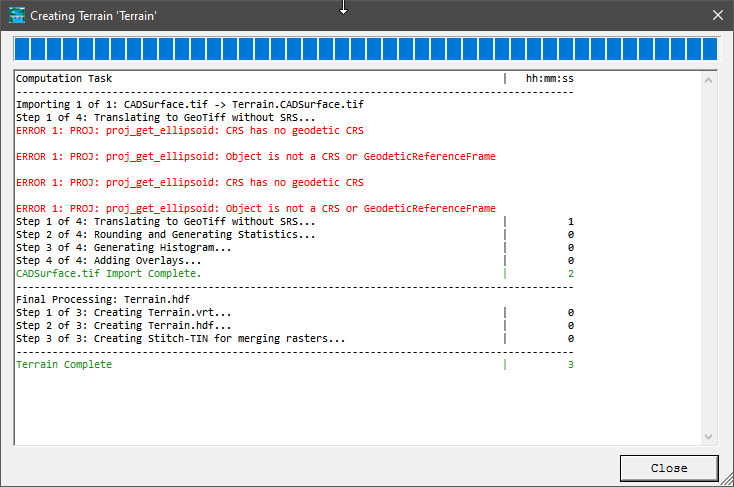
A raster surface was exported from a CAD application as a GeoTIFF with an internally stored SRS. When attempting to create a new terrain with this surface in HEC-RAS Mapper an error occurs indicating there was an issue translating the the SRS:

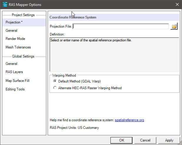
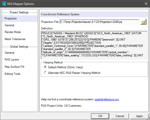
First, clear the SRS from the RAS Mapper Options and select Apply. This will ensure that HEC-RAS will not attempt to use the source raster internal SRS data to reproject it into the project SRS.
Next, create a new RAS terrain, and Respond "No" to the dialog requesting a to set Project SRS:
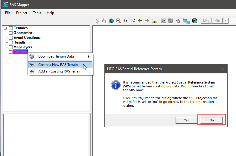
In the terrain importer select the source terrain data. Another message dialog will appear asking if you want to use the raster's SRS for the project. Select "No".
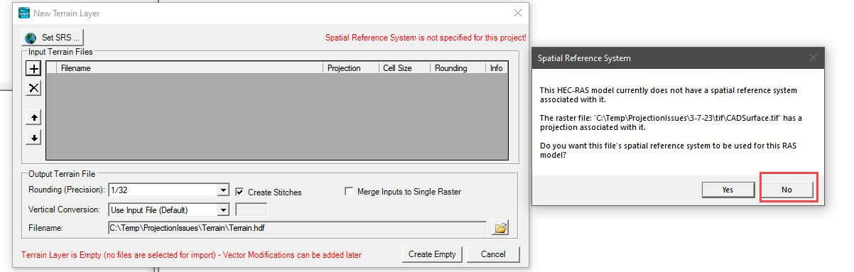
The terrain import process will complete, but errors are shown indicating that the SRS is missing and no reprojection was done: "Step 1 of 4: Translating to GeoTIFF without SRS..." Since the SRS was missing RAS Mapper imported the terrain data but skipped the reprojection step. That means the new HEC-RAS terrain will maintained the projection of the source raster data as is.
Next, set the Project SRS to the know projection of the terrain data.
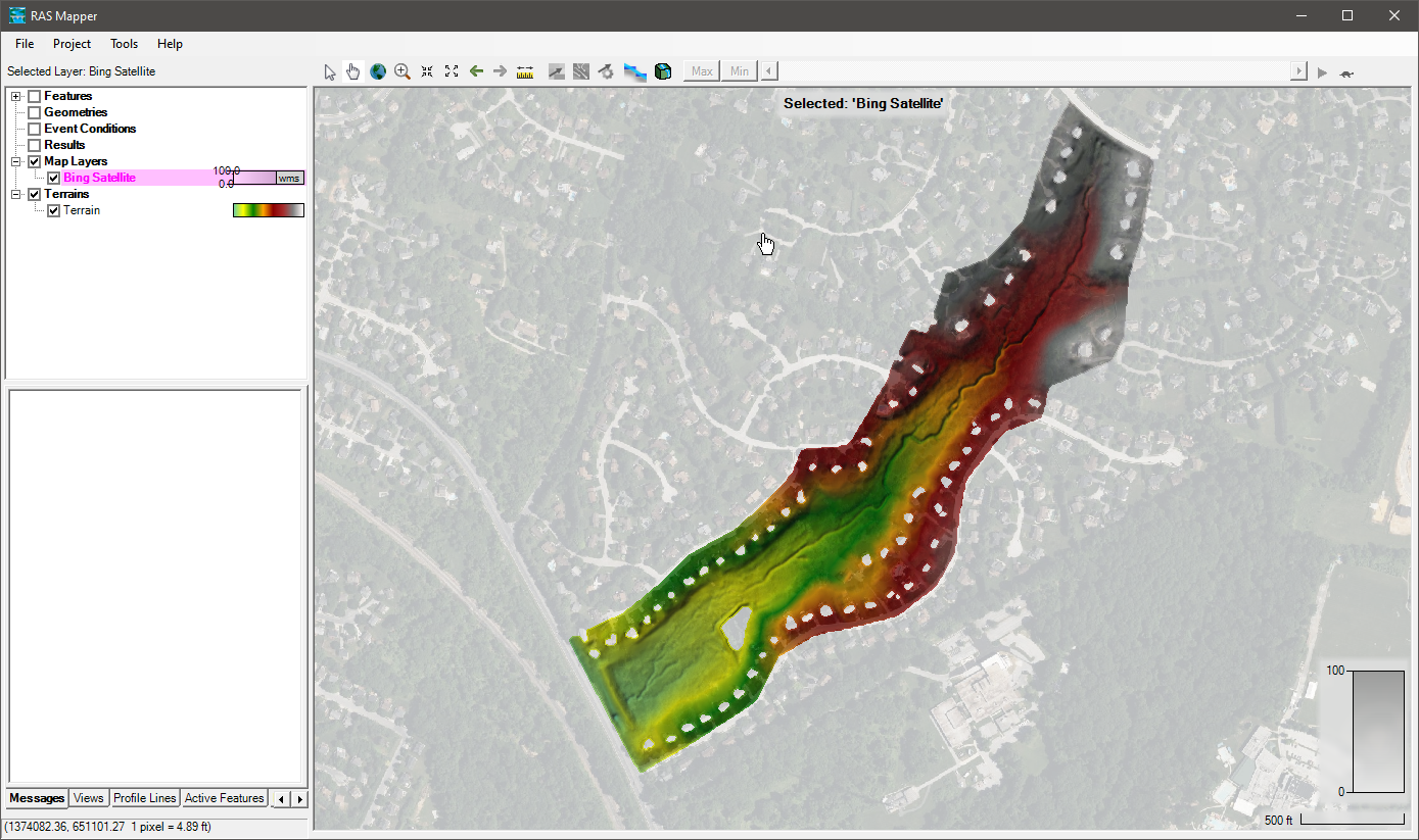
Finally, verify the terrain is projected correctly using background imagery .