Download PDF
Download page Downloading Terrain Data.
Downloading Terrain Data
Ground surface elevation data is crucial to developing a good HEC-RAS model. Often, identifying terrain dataset for use in the study can be a difficult task. HEC-RAS is attempting to streamline the process of the getting the modeling process started by providing tools to assist in the acquisition of terrain data.
The USGS has made data for the United States available for download through the National Map Viewer. In an effort to simplify the process of utilizing elevation data provided as part of the USGS 3DEP (3D Elevation Program), HEC-RAS Mapper provides the capability to "automatically" download terrain data. While the USGS terrain data may be representative of the ground surface in the overbank areas, it most likely will not accurately represent the ground surface in the river channels. This will be evident due to flat features where water existed during data collection.
To utilize the download tool, you must first have a Projection defined and zoom to the area of interest.
Open RAS Mapper
To access the USGS Terrain download tool, select the Project | Download Data | USGS Terrain menu item. The figure shown below will be displayed.
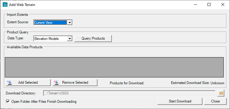
To get and use the data, you will follow four basic steps.
- Query the USGS Product Database
- Select the USGS Products of Interest
- Download the USGS Datasets
- Create a RAS Terrain.
Query Products
First, you will need to identify the Import Extent (the default option in the current view). The extent options include Current View, Geometry, Shapefile, and Manual Entry.
Next, press the Query Products button to ping the USGS server to see what data are available. At this time, you can ask for Elevation Model data or Topo Maps (in case you want those as background layers). When you query the USGS database, the interface will provide feedback that it is working, as shown below.

Once the list of available data has been received, the Available Data Products table will be populated as well as showing information about the dataset including Cell Size, Description, Date (Published), File Size, and Web Link to metadata. As shown in the figure below, there are likely to be several elevation data sources for your study area.
Note that the information about each data set will not necessarily be valid. The data download tool is passing on information scraped from the USGS database.
If you Query Projects using the Geometry for the source extent, the data download tool will automatically restrict the data products returned to just those that intersect the selected geometry. This can be a handy option if you already have an existing HEC-RAS model.
Select Products
To add a terrain dataset to the Products for Download list, select the product and click the Add Selected button or check the box. This will place a check mark in the "Data to Download" column.
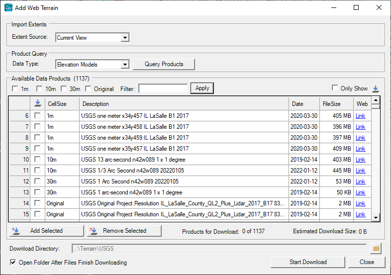
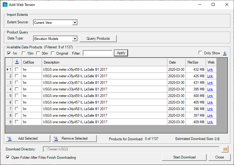
To assist you with identifying the data to download, the data download tool has a Filter mechanism. The filter capabilities have some built in filters based on grid resolution (1m, 10m, 30m, Original) or you can enter your own filter. For the example figure below, the data have been filtered for just the one meter data ("1m"). Note, this reduces the number files in the table to 9 (of 1137 Available Data Products).
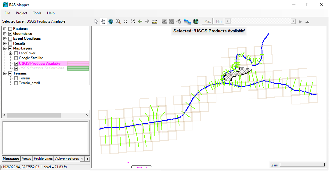
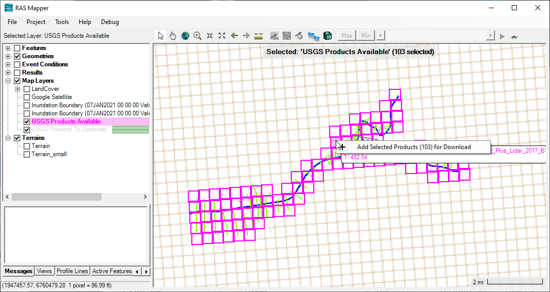
The data download tool also assists you in selecting data by providing an interactive layer. When the products are queried, 2 layers will be added to RAS Mapper: USGS Products Available and USGS Products to Download. The USGS Products to Download layer can be used to interactively select datasets. It will also show you what is selected in the Table on the download tool. Using the Selection Tool, in RAS Mapper, you can Add to the selection by using the Ctrl key or Remove from the selection using the Ctrl+Shift key. Once you have selected the terrain dataset, right-click (on the layer name or the features) and choose Add Selected Products for Download. Remove Selected Products for Download is likewise available.
Ctrl + Click -> Adds to the current selection
Ctrl + Shift + Click -> Removes from the current selection
Once a product is selected for download, it will be add to the USGS Products to Download layer and the features will be painted using that layer's symbology (green is default).
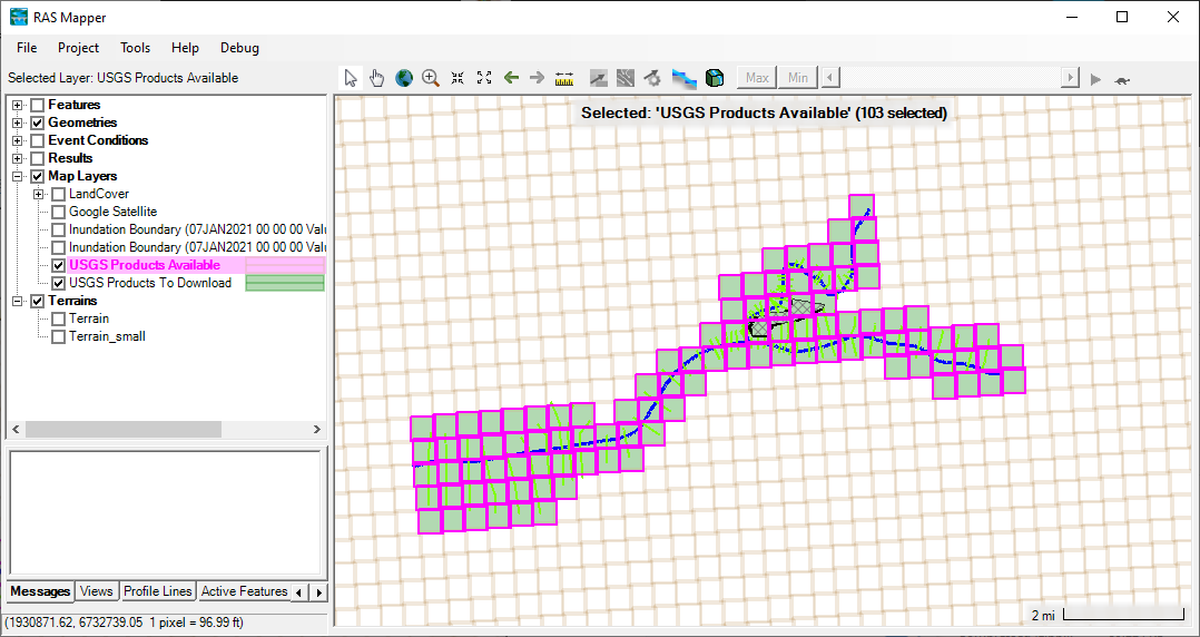
The selected products for download will be reflected in the product list with a check mark. You can verify each product with highlighting a row in the table and the selection in RAS Mapper will update (and vice versa).
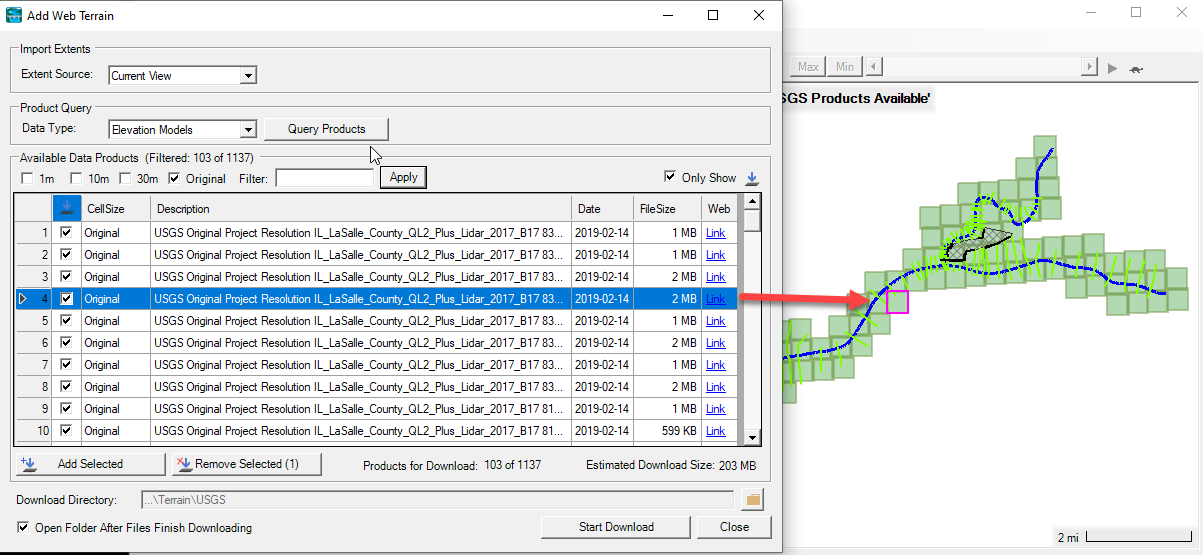
As products are added to the download list, the download tool will provide feedback. The Products for Download count and the Estimated Download Size will will be updated to inform you of the selection. (Note, the file size estimate comes from the file's metadata and is often incorrect.)
Download Products
By default, a USGS directory will be created in the Terrain folder. Clicking the Start Download button with begin the process of downloading the USGS data. The download process will happen asynchronously, so that you can continue using RAS Mapper. As the data download, a status window will appear. If you expand the window, you will get the status for each file.
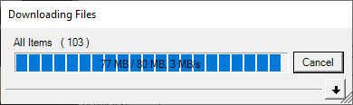
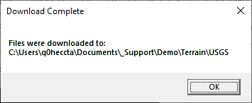
Once the data have been downloaded, a window will be displayed informing the of the process. A file explorer window will also be open, if the the Open Folder After Files Finish Downloading check box is selected.
When you close the terrain download tool, the interactive USGS layers will be removed from RAS Mapper.