Download page Setting the Spatial Reference Projection.
Setting the Spatial Reference Projection
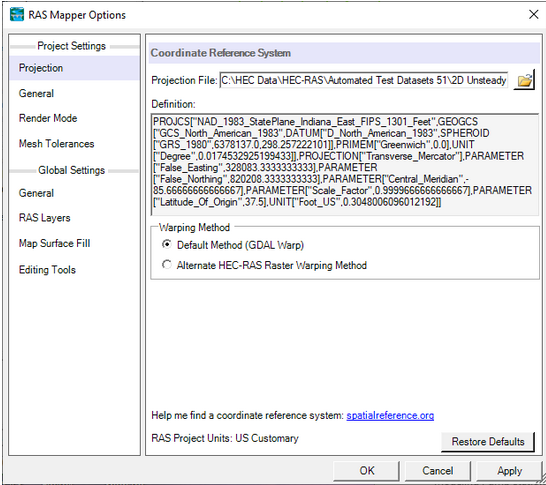
Once RAS Mapper is open, if the data is in a specific spatial coordinate projection, that projection should be set in RAS Mapper. Setting a spatial coordinate system is not required (i.e., maybe the user is just doing some testing of hypothetical data), but setting the coordinate system has many advantages in HEC-RAS and HEC-RAS Mapper. To set the spatial reference system for the project, from the RAS Mapper menu bar, select the Project |Set Projection menu item. When the Set Projection option is selected, the window shown below will appear.
To set the spatial reference system (coordinate system), browse and select an existing “.prj” file (ESRI projection file) that contains the correct coordinate system. If using ESRI's ArcGIS® Version 10.0 (or earlier), browse to the ArcGIS directory that contains a listing of all the available coordinate systems and select the appropriate one. Otherwise, locate an ArcGIS projection file (*.prj) within one of the GIS project directories (look for a shapefile that has a projection file defined). Unfortunately, the directory of coordinate systems was removed at ArcGIS version 10.1 and newer. So, users will have to create one with ArcGIS or search on the internet for an ArcGIS projection file. For the example provided in Figure 2-2, the Coordinate Reference System selected was “NAD_1983_StatePlane_Indiana_East.prj”.