Download PDF
Download page New Features.
New Features
HEC-RAS 6.3 Released
Major Features
- Initial Conditions Water Surface using Initial Conditions Points
Initial Conditions Points (IC Points) were introduced in HEC-RAS 6.0 allowing the user to generate a horizontal initial water surface for 2D areas. This capability is significantly improved in version 6.3, where a water surface profile is computed from the IC Points. The water surface elevation profile is computed between specified points assuming normal depth can be achieved using a unit-width flow. Areas in backwater (where no IC Point is provided upstream) area assigned a horizontal water surface. Water surface elevations downstream of the most downstream IC Point are set by projecting normal depth.
- GRiD Terrain Download
Similar to the the terrain data import capability using the USGS web services, the ability to download terrain from the Geospatial Repository and Data Management System (GRiD) is available for users with a GEOAxIS account. Information on GRiD can be found here: https://grid.nga.mil/grid/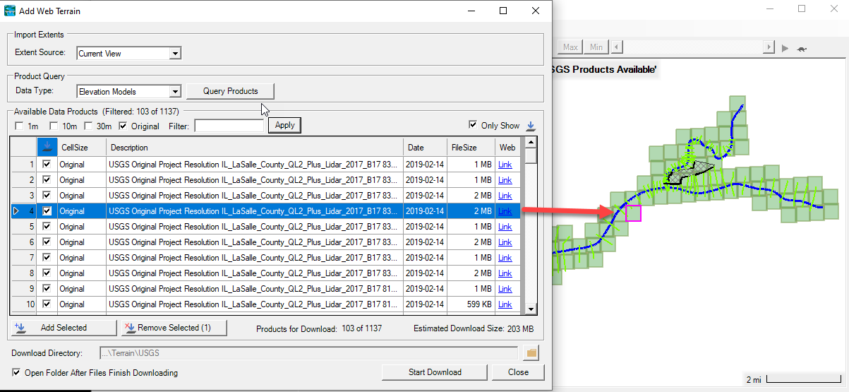
- Spatially Varied Downstream Boundary Conditions
In HEC-RAS Versions 6.2 and earlier, the water level (i.e. stage) boundary condition can only be specified as single time-series per boundary condition line. In other words, the water level is spatially constant along the boundary condition line. In HEC-RAS 6.3, the option was added to specify a spatially variable stage boundary condition, which is especially useful for nesting HEC-RAS within other models, such as ADCIRC. In In this new feature, the user can specify any number of stage time series along a boundary condition line. To compliment this feature, utilities have been developed to extract, interpolate between points, and import variable stage time series data into HEC-RAS. - New 2D Sediment Initialization Options
Previous versions of HEC-RAS could use output files from previous 1D sediment simulations to initialize new sediment simulations. Version 6.3 updates the interface and expands this capability to 2D sediment transport. This is useful for model initialization (e.g. skipping the multiple sediment warm ups or using a hydrograph to initialize the bed gradations). Instead of writing a specialized hotstart file, HEC-RAS can just read an output file from a previous simulation and overwrite the initial bed elevations (cross sections or cells), bed gradations, or both, in 1D or 2D.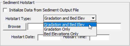
- New 2D Local Inertial Approximation Equations
HEC-RAS 6.3 provides a new 2D solver option, called the Shallow Water Equations (SWE) with the Local Inertial Approximation (SWE-LIA). The solver is based on the existing non-linear SWE solvers (i.e. SWE-ELM and SWE-EM) but ignores the nonlinear advective and mixing terms shown in the momentum equation below.

Compared to the previous SWE solvers, the LIA solver is faster and more stable. The advection term alone can be represent up to 30% of the computational time. In removing the advective and mixing terms, their stability requirements and limitations are also removed which allows for larger time steps. The SWE-LIA solver sits between the existing non-linear SWE solvers and the the Diffusive Wave Equation (DWE) solver in terms speed, accuracy, and applicability. Solvers based on the Local Inertial Approximation have been shown to produce results comparable to the full non-linear SWE equations for a range of flood modeling applications. The SWE-LIA solver is useful for example in simulating flooding from slow rising hydrographs or compound flooding where wind is important and cannot be simulated with the DWE but can be with SWE-LIA.
Minor Improvements
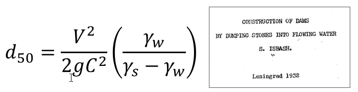
- Riprap Calculator Updates and Isbash Riprap Equation
Version 6.3 redesigned the Riprap calculator interface released in version 6.1 and added the Isbash equation
- Geometry layers in RAS Mapper will no longer show on the tree if they have no data (empty). They will appear when in edit mode.
- In RAS Mapper, Try Fix Mesh option will now remove duplicate/close cell centers, as well as duplicate/close points along the mesh perimeter.
- Improved Manning's n value extraction routine for multiple Manning's n option.
- Significantly improved the time to view project extent in RAS Mapper when structure outlets are present in the project.
- RAS Mapper will now attempt to search for land cover and terrain files in External Dependencies folder if that folder exists.
- Added units to the legend in RAS Mapper.
- Results that did not finish running or are corrupted will no longer automatically add to the tree in RAS Mapper.
- Bed change and sediment concentration result maps will now be created with the appropriate default symbology.
- Added ability to smooth polylines in RAS Mapper using 2 different techniques.
- Added ability to create profile line between 2 reaches, if there is a path between them.
- Can now set terrain modification method, and perimeter profile mode for all selected terrain modification polygons.
- Can now import or export custom color ramps for use in other projects.
- Added a multi-step progress bar to enforcing breaklines in RAS Mapper.
- Improved responsiveness of adding points, lines, polygons, in layers that required unique names.
- Added a way to remove duplicate points or lines in a layer.
- Compute 2D property tables progress bar now shows individual progress for each step.
- Can now view DSS Location Info in the DSS Viewer.
- Can now plot Time Series Profiles in the DSS Viewer.
- Can now cancel 2D area property table creation.
- Added an option in RAS Mapper to increase point density in profile plots.
- Added find (Ctrl+F) functionality to the river layer in RAS Mapper.
- Exporting a layer in RAS Mapper should export all columns in the attribute table.
- Riprap scour calculator no longer resets scale of the XS visualization when a new equation is selected.
- Can view 2D Area properties in RAS Mapper without being in edit mode.
- Improved user experience for meteorological raster data import form.
- 1D Structures will now convert to 2D structures if they no longer intersect a river centerline when finishing an edit session in RAS Mapper.
Training
2D Sediment Workshop Videos
HEC hosted a 2D sediment workshop for several district and USACE laboratory modelers using these new tools. Edited videos of most of these talks are included on the HEC-RAS Training page.