Blocked areas are used to identify areas where a cross section should not have conveyance based on a physical obstruction built in the floodplain but that is not represented in the terrain model. These areas are represented with polygon areas where large areas of in-fill may occur in the floodplain or other man-made structures (like an old bridge support structure). When creating an blocked obstruction polygon, the user will be asked to provide a elevation height (the default elevation will be defined by the highest elevation on the terrain model at intersection of the blocked polygon with cross sections). Blocked obstruction elevations will likely need to be modified in the XS Editor for each individual cross section.
For existing data Blocked Obstruction polygons can be created by right-click on the Blocked Obstructions layer and select the Create Blocked Obstruction Polygons from XS Blocked Obstructions.
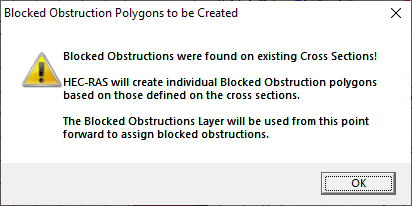
If blocked obstructions are defined on existing cross sections, the first time a user creates a polygon on the Blocked Obstructions layer, HEC-RAS will automatically create Blocked Obstructions area polygons. From that point forward, those polygons will be used to define the blocked obstructions.