Ineffective flow areas are used to identify areas of zero-velocity where a cross section should not have conveyance. These non-conveyance areas are represented with polygon areas and are important in areas behind bridges in backwater areas in the floodplain. When creating an ineffective area polygon, the user will be asked to provide a trigger elevation (the default elevation will be defined by the highest elevation on the terrain model at intersection of the ineffective polygon with cross sections). Ineffective flow area trigger elevations will need to be modified in the XS Editor for each individual cross section.
For existing data, Ineffective Flow Area polygons can be created by right-click on the Ineffective Flow Areas layer and select the Create Ineffective Flow Area Polygons from XS Ineffective Areas.
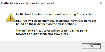
If ineffective flow areas are defined on existing cross sections, the first time a user creates a polygon on the Ineffective Flow Area layer, HEC-RAS will automatically create ineffective flow area polygons. From that point forward, those polygons will be used to define the ineffective flow areas.