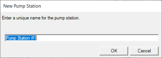
The Pump Stations layer is used to specify pump station locations. After clicking on a location on in RAS Mapper, you will be prompted for a Name.
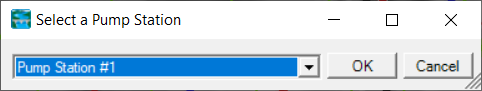
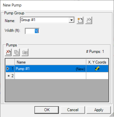
To create a pump, select the Pump layer and draw a line from the pump inlet location to the pump outlet. When you finish the line, RAS Mapper will attempt to find the nearest Pump Station to attach to. If a pump station is not within tolerance, the Select Pump Station dialog will provide user input to attach the correct pump station. The Pump Group Editor will then be shown, allowing the user to select the Pump Group and provide a Pump Name. The inlet and outlet locations of the pump will be determined by RAS Mapper. Additional Pump and Pump Station information must be completed in the Pump Station Editor.
Additional pump information, like the pump capacity curve and rules, will need to be completed from the Geometric Data Editor.