Download PDF
Download page Spatial Reference System.
Spatial Reference System
The first step in creating a project in HEC-RAS Mapper is establishing the coordinate system you are going to work in for the project's geospatial data. Setting the projection for your project will ensure that the Terrain and geometric data are all in a common coordinate system and allow you to use background data from another coordinate system to assist in model development and analysis.
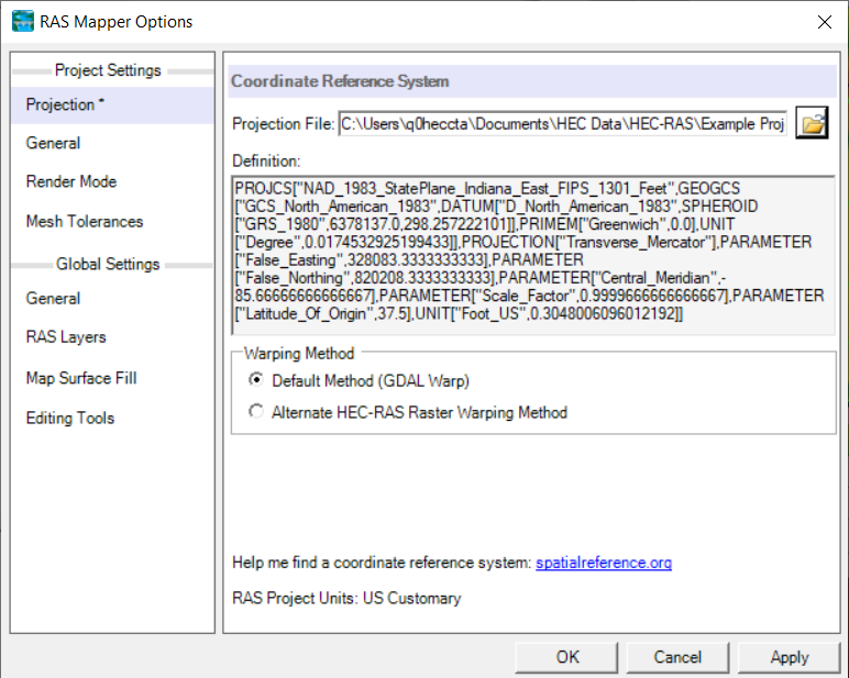
To set the projection in RAS Mapper, select the Project | Set Projection menu option. This option will show the Project Settings | Projection option allowing you to select the projection for your project. (At this time, the only projection used is an Esri projection file (*.prj).) Once a projection has been specified, RAS Mapper will project all data into the selected coordinate system.
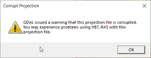
When the projection file is selected, GDAL will check the file. If the file is "invalid" (according to the GDAL check), an error message will be invoked. The native GDAL check is overly sensitive and may give a false warning. In other words, the re-projection of data will work just fine, just GDAL had an issue with the some part of the projection string. Below, find a screenshot of the the warning message.
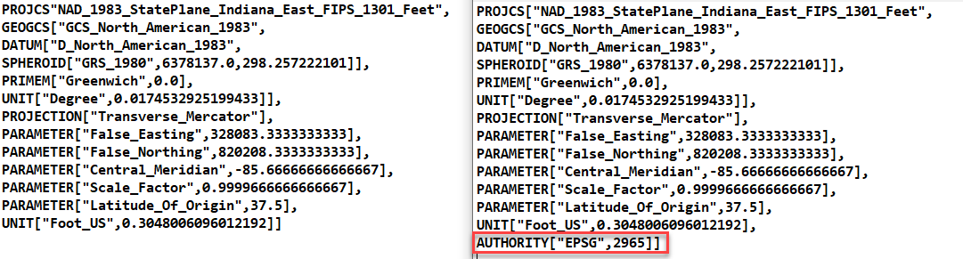
An example of a two projection files are provide below. Both projection files work fine in RAS Mapper, however, the projection file with the additional "Authority" information throws a GDAL warning.
RAS Mapper must have a projection file specified to utilize the automatic re-projection of data using Web Imagery or other added background data. Re-projection of data within RAS Mapper is accomplished using GDAL/OGR libraries developed under an Open Source license by the Open Source Geospatial Foundation (http://www.osgeo.org). GDAL supports numerous raster and vector formats (http://www.gdal.org). The Default RAS Warping Method uses GDAL; however, we have found GDAL Warp to not work properly in ALL circumstances. If you are having trouble aligning reprojected data, the Alternate HEC-RAS Raster Warping Method may provide the correct results.
Typically, a well-known projection will be created used for your study area and if you have any additional GIS data it will be projected to that coordinate system and a projection file will be available. The digital terrain model (DTM) for your study area is the basis for the hydraulic analysis and having one projected into an appropriate coordinate system for the study area is imperative. Projection files can also be generated using a GIS (in ArcGIS, for instance, a user just needs to export a vector dataset to a shapefile). You can also use online resources, such as the Spatial Reference web site (http://spatialreference.org) to search for a projection file and download the esri .prj file (viewable online using the ESRI WKT link). However the user acquires the projection, care must be taken to verify the coordinate system parameters – especially the unit system!
Web Imagery
Setting the coordinate system is necessary to utilize publicly available web imagery. The Web Imagery tool (Project | Add Web Imagery) allows the user to add background imagery (aerial imagery, for instance) available from standard web services. Data is temporarily downloaded from the selected web service and then projected to the coordinate system specified in RAS Mapper. Typically, hosted data is in the Web Mercator projection. Translating the data from Web Mercator to another projection may result in data artifacts. Distortion is most apparent when using a continental-scale projection (e.g. USA Albers) as opposed to a local projection (e.g. California State Plane Zone 3).
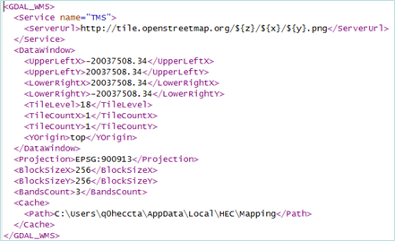
Users can add access to a web map service (or tile map service) by creating a an XML file, which meets GDAL specifications for web services, and placing it in the HEC-RAS mapping folder. This folder is located in the path of the user login (“C:\Users\'YourUserName'\AppData\Local\HEC\Mapping\5.1\XML"). An example XML file for access to Open Street Maps is shown in the figure below (http://www.gdal.org/frmt_wms.html).