Junctions are used to connect river reaches. Junctions will be automatically created for the user within RAS Mapper and the distance between bounding cross sections computed internally. The default method for computing the water surface elevations across the junction will be used unless modified by the user within the Junction Editor available from the Geometric Data Editor. There are two ways to form a junction: (1) a tributary reach will split an existing river reach and (2) the end points of three reaches will be moved and snap together. Either case, RAS Mapper will give the visual feedback to assist the user. Discussion of how to form a junction is provided below.
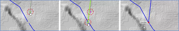
Splitting a river reach to form a junction is the most-likely scenario. To do so, create the second river such that the downstream endpoint lands on the first river at the location to split the river. Double-click to end the new river. The user will be asked to provide a name for the new river reach. The user will then be prompted to create the junction through a series of steps:
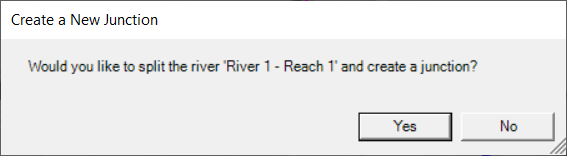
- Splitting the existing river
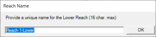
- Rename the downstream reach of the existing river
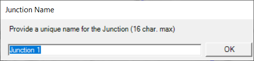
- Name the new junction.
An alternative way to create a junction is by moving the endpoints of three reaches close enough together that the points “snap” together and form a junction. If/when all three reach endpoints are within the snapping distance tolerance a junction will be formed. Note, the junction is formed when the editable reach is closed (double-click to close the open feature). An example of this process is illustrated in the figure below.