The Porosity and Flow Drag Layer layer is used to specify surface classifications which are assigned porosity and flow drag parameters. The approach is similar to how the Manning's roughness coefficient is specified in HEC-RAS. A surface classification layer is created which can be a mix of raster and vector data. Each classification is then assigned specific porosity and flow drag parameters which are then interpolated onto the computational mesh cells and faces.
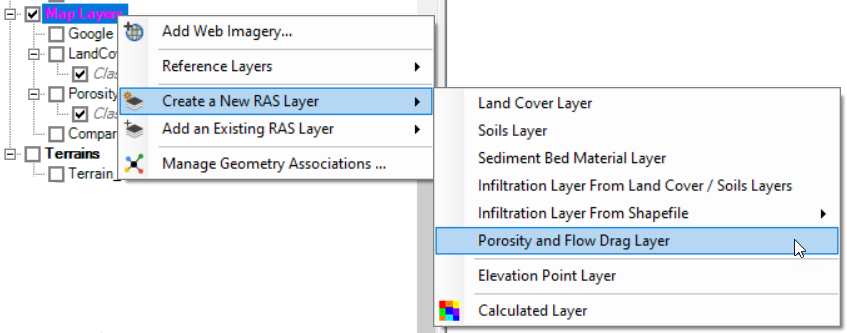
The Porosity and Flow Drag Layer is created in RAS Mapper by right-clicking on Map layers and selecting the Create a new RAS Layer | Porosity and Flow Drag Layer menu item.
A dialog will be available to add raster or vector data representing flow obstructions.
To add a polygon, start Editing. Create the polygon of interest and provide an classification Name.
Provide parameters that describe the flow obstructions. Learn more about each parameter here.
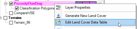
You can enter parameters for multiple classification regions by right-clicking and selecting the Edit Land Cover Data Table menu item on the the new layer.