Download PDF
Download page Settings and Options.
Settings and Options
RAS Mapper provides the user with control over several aspects of data extraction and visualization. Access to these Options are provided through the Tools | Options menu item. The Options window is organized into the general categories of "Project Settings" and "Global Settings". Project Settings are those where the user will want to provide changes on a per project basis, where "Global Settings" are more general preferences that are unlikely to be changed once set.
Each option will have Default Settings that can be reset using the Restore Defaults button.
Project Settings
Project Settings will be specific to the HEC-RAS model being developed based on the coordinate system you are working in, the resolution of the terrain model, and the your preferred choice of units.
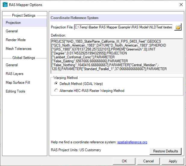
Projection
This allows the user to specify a projection by selecting an projection file. Once a projection has been specified, RAS Mapper will project all data into the selected coordinate system. This must be set to visualize background data such as Web Imagery. HEC-RAS uses GDAL (gDal.org) for reprojection data. Projections can be defined using a projection file - esri prj, wkt, proj4, and epsg strings are supported.
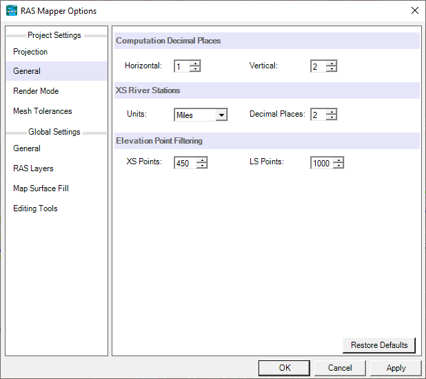
General
General project settings are the catch all for RAS Mapper options that are most likely to be modified for each HEC-RAS project.
Computation Decimal Places - This is the number of decimal places used for extracting information from the Terrain. Options for Horizontal and Vertical decimal places are provided.
XS River Stations - River stationing for 1D hydraulic objects (cross sections, inline structures, and lateral structures) are automatically computed using the Units specified to the number of Decimal Places selected. If the 1D objects require increased precision, RAS Mapper will automatically increment the number of decimal places.
Elevation Point Filtering - Point filtering is used to reduce the number of points on Cross Sections (XS Points) and Lateral Structures (LS Points) to the number of points specified by the user. HEC-RAS has a total limit of 500 points on a cross section. Hydraulic computations at lateral structures will take place between every two points; therefore, it is wise to limit the number of points to just those that provide adequate definition to the structure.
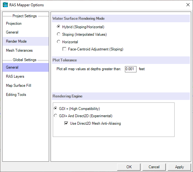
Render Mode
Render mode is used to control how computation results are plotted in RAS Mapper.
Water Surface Rendering Mode - This render mode is used to specify how 2D model water surface elevation results are interpolated, Sloping or Horizontal. The default option is the Hybrid option where RAS Mapper attempts to use either the Sloping or Horizontal method depending on the change in water surface between two computation points.
Plot Tolerance - This tolerance is used as a threshold values to remove areas that have an extremely shallow depth from plotting.
Rendering Engine - GDI+ and Direct2D rendering are supported by HEC-RAS Mapper. GDI+ tends to work with all graphics drivers; however, Direct2D will improve vector graphics.
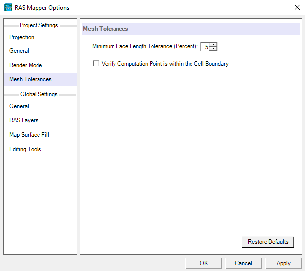
Mesh Tolerances
Minimum Face Length Tolerance (%) is used to evaluate the length of each cell face. If the cell face becomes very small compared to the overall distance from the cell center to the neighboring cell center it is removed with the two adjacent cell faces replacing the length.
Verify Computation Point is within the Cell Boundary is used to verify that the computation point is fully contained with the the cell.
Global Settings
Global Settings will be based on user preferences on how they prefer RAS Mapper to look and feel as they interact with data during data query, selection, and editing.
General
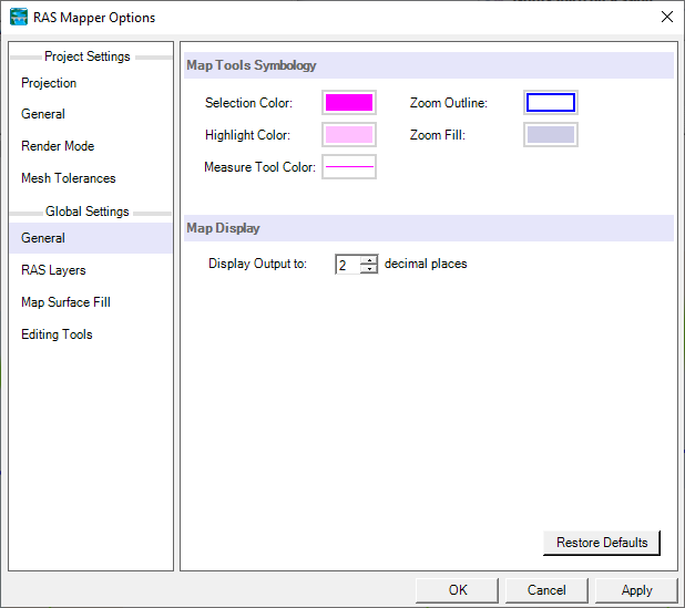
General settings are used to setup the symbology for the mapping Tools.
Map Tools Symbology allows the user to customize symbology when Selecting and Highlighting features, Zooming into an area, and using the Measure Tool. The Highlight Color is also used to highlight the Selected Layer in the Layer List.
Map Display controls the how text is written to the cursor's map tip when hovering over a layer.
RAS Layers
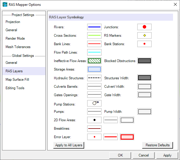
RAS Layer Symbology allows the user to customize the symbology for the RAS-specific layers to have a consistent look and feel across HEC-RAS projects.
Map Surface Fill
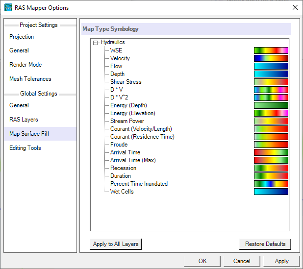
The Map Surface Fill options allow the user to customize the default symbology for the RAS result maps that are created.
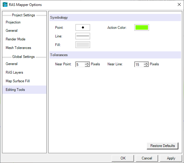
Editing Tools
The Editing Tools options allow the user to customize how interface looks and reacts to the user interaction with the Edit Layer.
Symbology - Allows the user to set the symbology for the layer that is currently open for editing. The Action Color shows the user what will happen provided a point is moved or inserted through the click of the mouse.
Tolerances - Interaction tolerances can be specified based on the precision with which the user is working. The Near Point tolerance specifies how close the mouse cursor needs to be to a point before it "snaps" to the point to allow for a move or delete action. The Near Line tolerance specifies how close the mouse cursor needs to be to a line before it allows the insertion of a new point.