Background
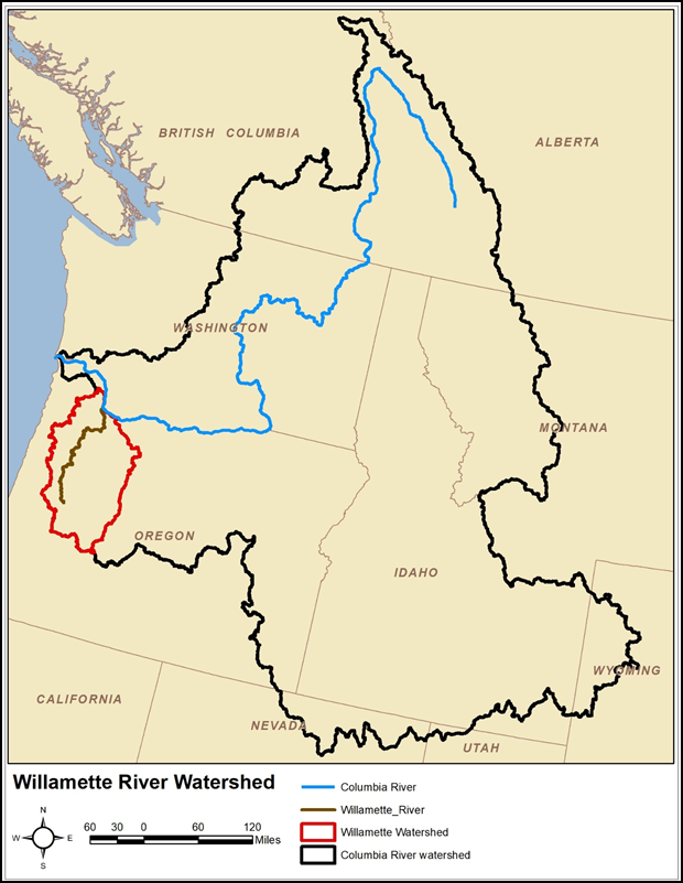
The U.S. Army Corps of Engineers (USACE) owns and operates a large system of dams, navigation locks, and levees within the Willamette River watershed. Operation of these systems provides national, regional, and local benefits that include flood damage reduction, drought impact reduction, hydropower, water supply, navigation, recreation, and environmental support, as authorized by Congress. The location of the Willamette River watershed is shown in Figure 1.

As part of an ongoing study, hydrologic modeling of floods induced by both precipitation, snowmelt, and rain-on-snow conditions will be performed within the Willamette River watershed. Estimates of boundary condition values are necessary to force the hydrologic model. These boundary conditions include precipitation and snow water equivalent (SWE). The hydrologic model will be used to simulate runoff given various combinations of precipitation and antecedent SWE (i.e. the amount of SWE that is assumed to exist on the ground surface at the start of the simulation). Furthermore, the 1- and 3-day durations have been identified as the two most important precipitation durations within the area of interest and will be used to construct hypothetical hyetographs. Therefore, estimates of the 10-, 2-, 1-, 0.5-, and 0.2-percent chance exceedance SWE and 1- and 3-day precipitation accumulations are required. Additionally, the amount of time SWE is expected to equal or exceed various magnitudes is required.
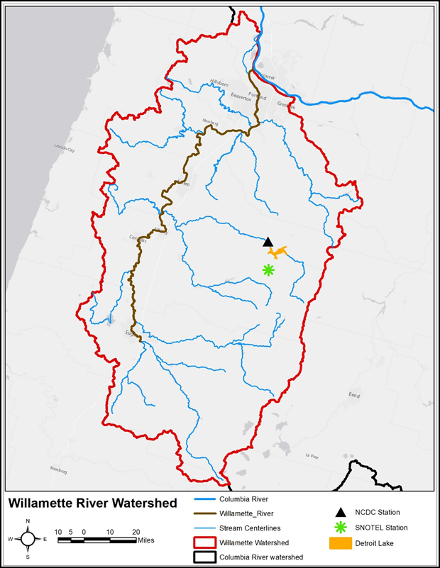
You have been tasked with performing a cursory statistical analysis to provide the required boundary condition quantile estimates for the watershed upstream of Detroit Dam. Detroit Dam is an approximately 460 foot tall concrete gravity dam located on the North Santiam River that provides flood control, hydropower, and recreation benefits (in addition to other authorized purposes). The location of this dam is shown in Figure 2.

Objectives
In this workshop, you will gain experience performing parametric modeling. Specifically, you will import precipitation, analyze the data, fit several models, and estimate the required quantile information. HEC-SSP version 2.3-beta was used to created this tutorial. HEC-SSP can be downloaded here.
The following major tasks will serve as an outline for the workshop:
Spend approximately 10 minutes per task to accomplish Tasks 1 - 4. We will compare the results (Task 5) together during the workshop review.
Continue to Task 1. Create a new HEC-SSP Study and Import Precipitation Data.
YouTube Videos
Videos have been created to accompany this tutorial and guide: Parametric Modeling Playlist