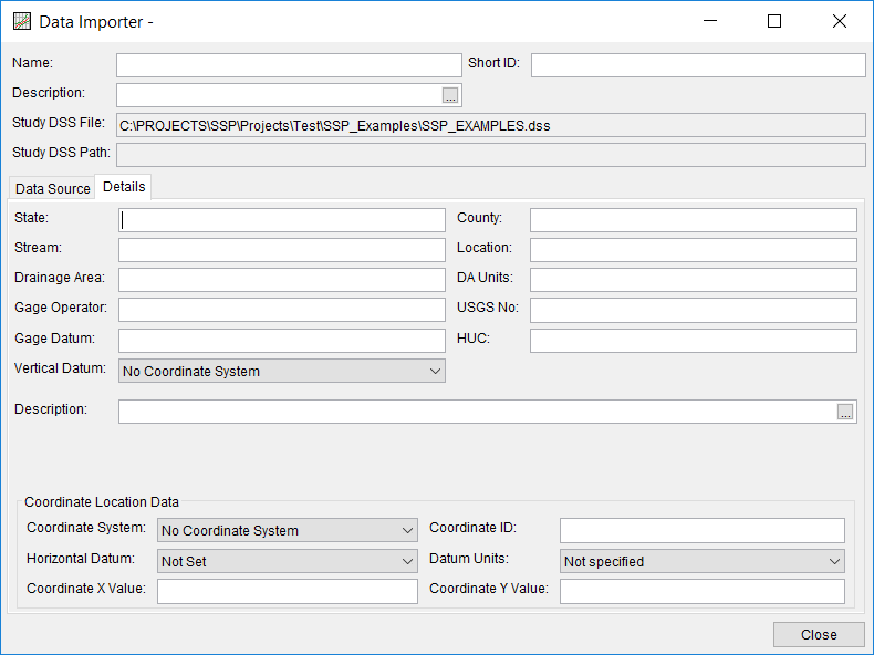
When downloading data from the USGS website, in addition to the raw data, the software will also attempt to download any metadata available for each gage location. When using one of the other four methods for importing data, the user can manually enter metadata by selecting the Details tab, as shown in Figure 1. The metadata consists of the State, County, Stream, Location, Drainage Area, DA Units, Gage Operator, USGS Gage No., Gage Datum, HUC (Hydrologic Unit Code), Vertical Datum, and a description field. Additionally, the coordinate location of the data is shown. The coordinate location consists of Coordinate System, Coordinate ID, Horizontal Datum, Datum Units, Coordinate X Value, and Coordinate Y Value. If coordinate system data are entered, data icons and text labels will show up on the background map at the specified locations.
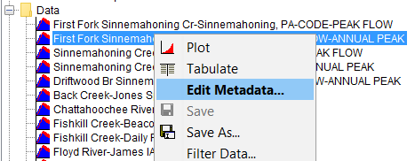
Metadata can be viewed and edited any time after the data has been imported into the study by opening the Metadata Editor. To open the Metadata Editor, place the mouse pointer on top of a data set in the Data folder and then click the right mouse button. Choose the Edit Metadata option from the shortcut menu, as shown in Figure 2. The Metadata Editor will look exactly like the Details tab on the Data Importer. The Metadata Editor can also be opened from the Data menu and from a shortcut menu that opens by right clicking on a data icon in a background map.

