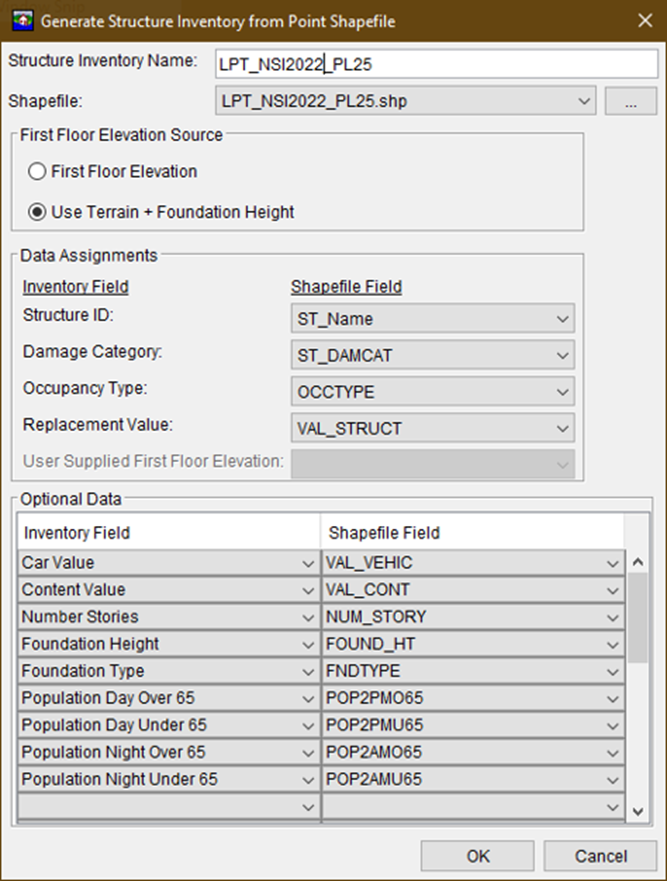
Most CWMS HEC-FIA models use structure inventories sourced from the National Structure Inventory (NSI). Older models may still rely on older versions of the NSI (e.g., Version 1) which are now outdated. Before computing AFDR, it's important to update any legacy structure inventories to the current NSI version for consistency and accuracy.
The NSI is a widely used database built from multiple geospatial sources to support flood risk and hazard assessments. That said, if a more detailed or locally maintained structure inventory is available for your watershed, you may choose to replace or supplement the NSI data with it. Be sure to consult with district economists to determine the most appropriate inventory for your analysis. Please review this tutorial for more information on how to replace the structure inventory in an HEC-FIA model.
Verifying Structure Placement
To ensure the inventory is valid, verify structure locations using HEC-FIA or a GIS application such as ArcGIS Pro. A best practice is to evaluate structure placement using two flood events:
- A high-flow (damaging) event: Ensures the inventory captures structures affected by severe flooding.
- A low-flow (non-damaging) event: Helps detect structures that are incorrectly placed—e.g., within the river channel or too close to the banks.
Structures inundated during a low-flow event are often misplaced and should be relocated outside of the non-damaging inundation area to reflect realistic flood risk.
Preparing the Inventory for Use in HEC-FIA
Although starting along riverbanks is useful for initial calibration, structure placement must be validated across the entire floodplain to ensure full spatial coverage.
Once your structure inventory is reviewed and adjusted:
- Export it as a point shapefile.
- Import it into your HEC-FIA study.
The HEC-FIA User's Manual provides step-by-step instructions for importing a shapefile created from the NSI or a local inventory.
The illustrates how to generate a structure inventory from an NSI-based shapefile.
