Download PDF
Download page Forecasting Using HEC-MetVue.
Forecasting Using HEC-MetVue
When a forecast that contains a HEC-MetVue Model Alternative is opened or created, that alternative will be displayed in the forecast tree under the Modeling tab. This HEC-MetVue Model Alternative has its own project file, which is located in the ./forecast/MetVue/ directory. Any changes to the HEC-MetVue settings will be performed on this project file, and can later be copied to the watershed project file with the Save To Base action. Each Map Panel in the alternative has its own node under the Model Alternative node. When a Forecast is first opened, the data for each Map Panel will be extracted and loaded into the Map Panel. The data is also reloaded after subsequent data extractions.
Through the process of loading the data into each Map Panel, HEC-MetVue reads data based on the specifications in the Input Settings tab of the Alternative Editor, and converts them to a Triangulated Irregular Network (TIN). As a TIN, HEC-MetVue can display and edit the data spatially, on a per Map Panel basis. Initiating the display is performed by selecting a Map Panel node.
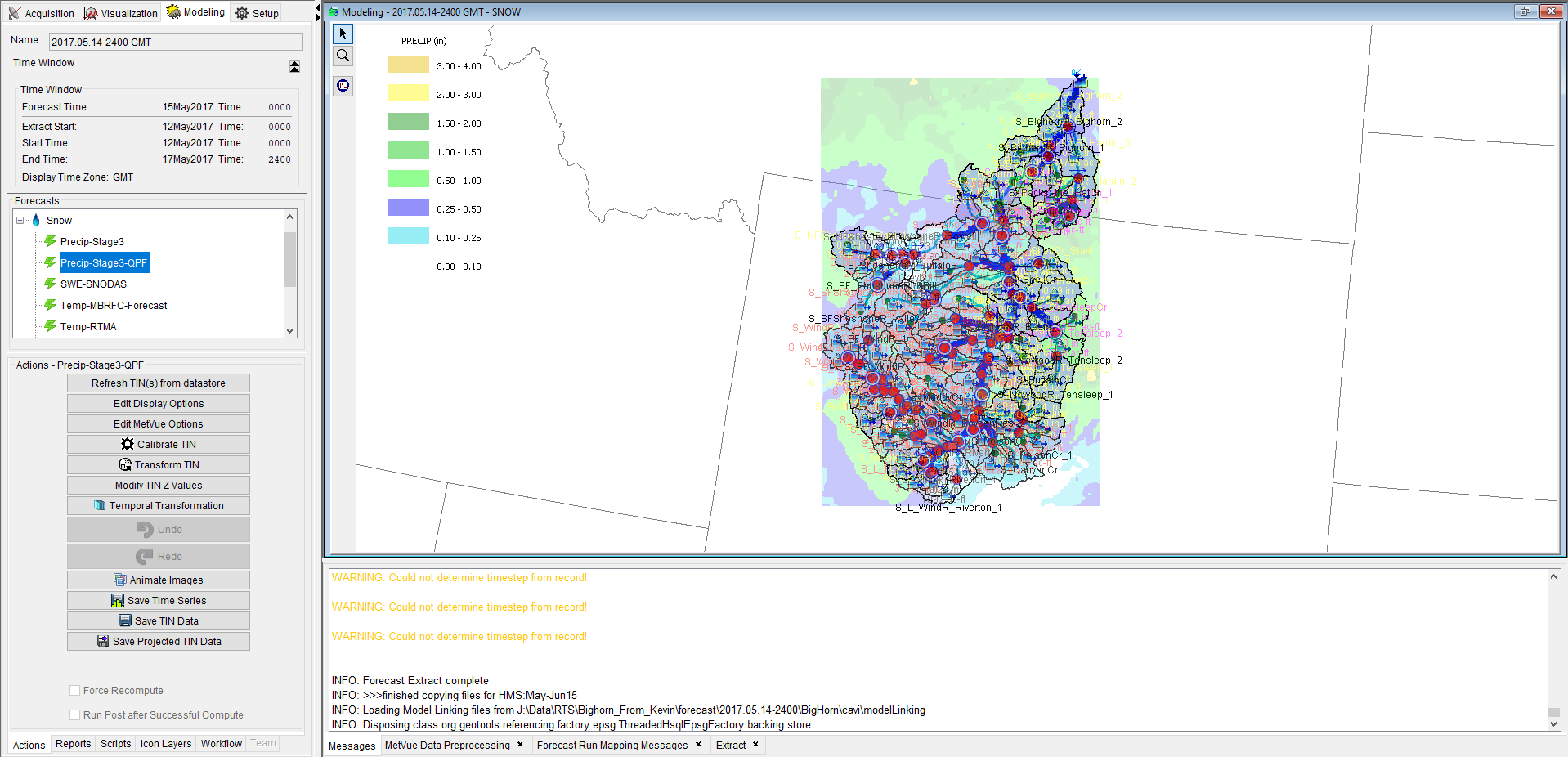
If a Map Panel node is selected, the Actions panel below the forecast tree is populated with the following action buttons:
- Refresh TIN Data - reloads data into the Map Panel
- Edit Display Options - allows you to change display settings of the data
- Edit MetVue Options - launches a dialog providing access to HEC-MetVue options
- Calibrate TIN - adjust TIN values to match observed point readings
- Transform TIN - adjust TIN data spatially (rotation, translation)
- Modify TIN Z Values - adjust TIN values by a factor, increment, or set to a specific value
- Undo - undo recent changes
- Redo - redo recent changes
- Animate Images - launches the HEC-MetVue animation dialog
- Hyetograph Surface Creation - generate a series of TIN/Grids, to manipulate the temporal distribution of precipitation
- Save Projected TIN Data - project data into a new resolution and coordinate system
- Save TIN Data - additional tool to save data, either saving the data as an aggregate TIN/Grid or applying the changes to each base TIN and saving
Some of these actions are further described below.
Data Status Tracking
The Map Panel icon will change color to track the state of a TIN, as described in the table below.
Icon | TIN Status |
| Data loaded properly without a need for preprocessing |
| Data was preprocessed to apply necessary transformation and/or data filling |
| Data failed to load |
| Data has user edits |
| Data has been computed |
HEC-MetVue Display Settings
HEC-MetVue display information can be adjusted in any Map Window where HEC-MetVue information is displayed. Display adjustments can be made by clicking on the Edit Display Options button, which will bring up the Display Options Editor dialog.
The Display Options Editor allows the user to set the level of transparency for the HEC-MetVue image and set options for displaying the Legend.
- Transparency - enter a number between 0 (opaque) and 1 (completely transparent)
- Show Legend - the dropdown menu is used to pick the location where the Legend will display (if the box is checked)
After to the display options are complete, click the Apply Changes button at the bottom of the dialog. This will redraw the MetVue options with the entered settings.
The HEC-MetVue application settings can also be edited by clicking the Edit MetVue Options button. This brings up the HEC-MetVue Application Settings dialog. All settings applied within this dialog will immediately be applied to the selected HEC-MetVue Map Panel, and will updated the display in the CAVI Map Panel if they affect TIN displays.
HEC-MetVue TIN Edit Actions
TIN data edits can be performed on a per-Map Panel basis. Edits performed are stored in memory until the data is reloaded (reverts all changes) or a compute is performed. If a compute is performed after making edits, the computed data will reflect those edits.
HEC-MetVue has edit tracking, which checks if data within a Map Panel has been edited. When run as a standalone application, HEC-MetVue will prompt the user with the option to save data prior to closing any Map Panel, Session or Project where edited data exists. When connected to the CAVI, HEC-MetVue suppresses this prompt, and therefore any edits will be discarded upon close of a forecast. This is necessary to prevent an HEC-MetVue save prompt from interrupting the CAVI workflow.
Calibrate TIN
HEC-MetVue provides a tool to calibrate spatial data based on ground observations. This was originally developed for radar calibration, but can be applied to any spatial dataset. Calibration of spatial data can be performed from within the CAVI by clicking the Calibrate TIN button. This will bring up the TIN Calibration Dialog. Due to the complexity of this tool, please refer to the HEC-MetVue User's Manual for details of TIN calibration spatial data with HEC-MetVue.
Transform TIN
HEC-MetVue allows you to translate and rotate the TIN data spatially, for the purposes of changing a storm location or its orientation with respect to a basin. Although standalone HEC-MetVue allows you to do this interactively by dragging data across the screen, these operations are only possible within the CAVI through text inputs. To make changes directly using mouse interaction, the HEC-MetVue User Interface can be launched, and edits can be performed.
To transform a TIN within the CAVI, click the Transform TIN button to open the TIN Transformation Editor dialog. The editor is separated into different sections based on whether you want to modify the Transformation Units, Spatial Translation, or Rotation.
- Distance - units can be changed by selecting an option from the dropdown menu.
- Angle - units can be changed by selecting an option from the dropdown menu.
- Cartesian Translation - the X Distance and Y Distance should be entered in the units specified above
- Polar Translation - used to translated the TIN based on an angle and distance. Angle From North (clockwise) and Distance can then be entered in the units specified above
- Rotation - used to rotate the TIN based on an angle (clockwise)
In addition, the desired Translation or Rotation can be selected by selecting the corresponding radio button. Translation and rotation must occur in separate operations in order to prevent confusion on which operation is meant to occur first. After TIN edits have been entered, click the Apply button at the bottom of the TIN Transformation Editor to perform the operation. Directly to the left of the Apply button is the Undo button, and directly to the right of the Apply button is the Redo button.
Modify TIN Z Values
HEC-MetVue also allows modification of the TIN measurement values. This can be performed by clicking the Modify TIN Z Values button which brings up the Modify TIN Measurement Values dialog. This dialog allows you to multiply the whole TIN by a constant, add a constant value to the entire TIN, or set the entire TIN to a specific value.
HEC-MetVue Application Interaction
It is also possible to open the HEC-MetVue application and perform edits. This can be performed by clicking the rain drop button (![]() ), which opens the HEC-MetVue application. Within the application, each Map Panel will reflect the state shown in the CAVI, and allow for further edits to the TIN data. As edits are performed in the HEC-MetVue application, the CAVI display is continually updated. This keeps the state of HEC-MetVue and CAVI synchronized, allowing for editing in real-time. Editing within HEC-MetVue is particularly convenient for storm translation and rotation, which can be performed interactively with mouse dragging. For more information on TIN data editing within the HEC-MetVue application, consult the HEC-MetVue User's Manual.
), which opens the HEC-MetVue application. Within the application, each Map Panel will reflect the state shown in the CAVI, and allow for further edits to the TIN data. As edits are performed in the HEC-MetVue application, the CAVI display is continually updated. This keeps the state of HEC-MetVue and CAVI synchronized, allowing for editing in real-time. Editing within HEC-MetVue is particularly convenient for storm translation and rotation, which can be performed interactively with mouse dragging. For more information on TIN data editing within the HEC-MetVue application, consult the HEC-MetVue User's Manual.
Data Save Actions
Beyond the data saving that occurs during a HEC-MetVue compute within the CAVI, three options are provided for saving data: Save Time Series, Save Projected TIN Data, and Save TIN Data.
Save Time Series
Save Time Series provides a tool to compute and save subbasin average time series. Clicking this button will bring up the Compute Time Series dialog. This dialog allows for specification of an output interval, Data Type, time zone, and output location. Output location can be DSS and/or text file. Additionally, there is an option for launching the Validation Editor, which allows for review and editing of computed time series prior to saving. Clicking OK will run the time series generation computations, and save operations.

Save Projected TIN Data
Save Projected TIN Data provides a tool to project data into a new resolution and coordinate system. Clicking this button will bring up the Project TIN(s) to a Grid dialog. This dialog allows for specification of the file type to save to. After selecting a save type, the projection information can be specified, based on the projections that the save type can support. Therefore, available settings will change based on the save type. Regardless of save type, the Target Extents will be available to edit. For save types that support multiple projections, the Projection Coordinate System can be selected. Finally, the output file information can be specified in this dialog. After clicking OK, the file will be saved.
Save TIN Data
The Save TIN Data button launches the Save TIN(s) dialog. This dialog provides an additional tool to save data, either saving the data as an aggregate TIN/Grid or applying the changes to each base TIN and saving. Since there is no projection, only the save types that support the current Map Panel projection can be selected. Following the selection of the save type, the aggregate and/or base TIN save file paths can be selected. Three additional write constraints can be selected: Write time zone, output units and time shifting. After specification of the desired save settings, clicking OK will save the specified data.
Important HEC-MetVue Application Settings
- The read and write constraints must be set from within the HEC-MetVue application as they cannot be set from within the CAVI.
- If the TIN is not going to be rotated or translated spatially, the spatial extent read constraint should be set within the appropriate read dialog.
- Trimming the spatial extents if there is no need to have data outside of the sub-basin boundaries on read can improve both the display performance and computation speed when forecasting.
- When writing to sub-basin time series with a watershed in a time zone other than GMT, the time zone write constraint should be specified within the basin average time series save dialog. This will ensure proper reading of the data from the following model in the compute sequence.
HEC-MetVue Compute Process
Standalone HEC-MetVue does not have a compute. It has many different tools for loading, manipulating and saving data. Therefore, using HEC-MetVue within the CAVI requires a special compute engine which links these operations together. The compute process is four steps: Data loading, data editing, temporal transformation, and data saving. Data loading and editing were covered in in earlier sections. Temporal transformation changes the time-step of the data to match the forecast time-step, and appropriately changes the Data Type (INST-VAL, PER-AVER, or PER-CUM). Depending on the input Data Type, and the transformation being performed, data will be interpolated, disaggregated, average or summed to get the appropriate value for each forecast time-step. Following the temporal transformation, the data will be saved to the specified output data type. In the event that basin average time series are being created, saving will involve an additional step of computing the spatially averaged time series for each modeling sub-basin.