If a river reach is included in the water quality model domain, the following data is required:
- An HEC-RAS geometry (cross-section) shapefile, which is used to define the water quality cells for the river reach and provides essential geometric information for the water quality model.
- An HEC-RAS steady flow model output file, which contains the flow output table for the river reach and is essential for computing horizontal water quality cell hydraulic parameters in the river reach water quality model.
HEC-RAS steady flow output file
The HEC-RAS steady flow files provides tables that relate the flow (calculated within ResSim) to hydraulic properties at each cross section, such as average depth, water surface area, current velocity, etc. These hydraulic properties are essential for the water quality simulation, particularly for computations like surface heat fluxes.
The ResSim water quality model only accepts the output file from a series of HEC-RAS steady flow runs. To be compatible with ResSim, the outputs must be formatted in a specific text file format. Below is an example of how to use your existing HEC-RAS model to run a set of steady flow simulations and format the output appropriately for input to ResSim.
Have RAS geometry (e.g., Russian River).

Russian River RAS geometry
2. Enter Steady flow data
Create enough "Profiles" to span range of flows expected in ResSim simulation.
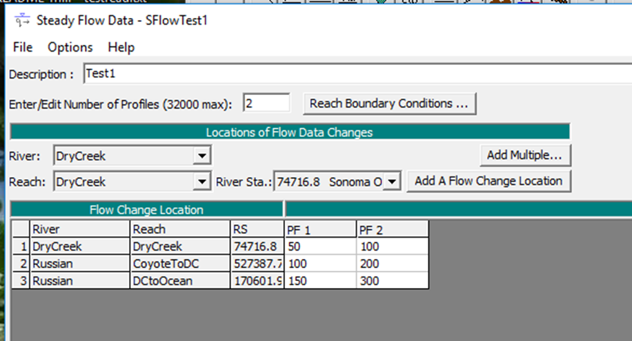
Steady Flow Data Profiles
3. Run a Steady Flow simulation. After complete, View Summary output tables by profile. This dialog comes up showing "Standard Table 1".
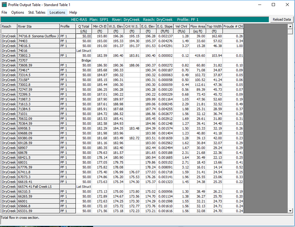
Summary output table
4. Go to Options -> Define Table… and select the following variables for the table.
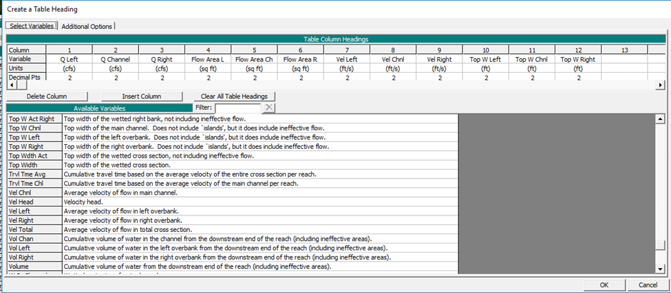
Select variables
5. Go to Options - -> Profiles…. .Make sure all are selected.

Select all Profiles
6. Go to Options - -> Reaches…. Make sure all are selected.
Options: Make sure Include Interpolated XS's and Include Profile Name in Table are selected. Make sure Include Node Names in Table is not selected.
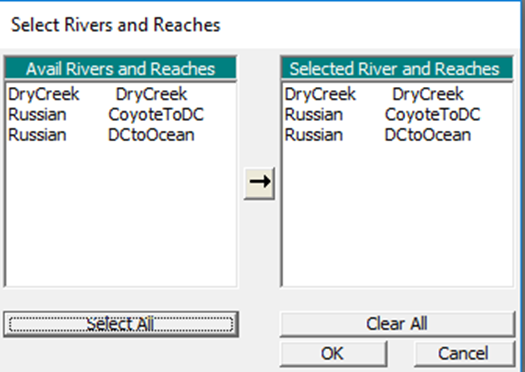
Select all Reaches
7. Go to File -> Write to Text File…. This file will be the RAS steady flow file input to ResSim.

Create Steady flow file
Note: We input a series of steady flow runs rather than an unsteady result file for a few reasons:
- A Unsteady flow result corresponds to a single, specific hydrology and couldn’t be used in any simulation where the hydrology is anything other than historical.
- The RAS team often changes the format of the Unsteady output file, so it would be difficult to support old versions as well as updates.
HES-RAS cross-section shape file
Have RAS geometry (e.g., Russian River).
Russian River RAS geometry
2. Open RAS Mapper. Go to Tools -> Options…Make sure cross-section units and coordinates are correctly defined. (ZZ)
3. Under Geometries Layer, Right click on XS -> Export Layer -> Save Features to Shapefile.

This file will be the RAS cross-section shapefile file input required for the river reach ResSim water quality model. (ZZ)