There are many map layers supported by HEC-FIA. Users can edit several display properties for each of these layers, and the different editor dialog boxes are layer-specific to polygon shapefiles, line shapefiles, and gridded data. This Appendix outlines the functions of each of the editors for the different layers in HEC-FIA.
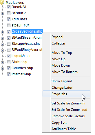
To access the map layer editors, beneath the Content Pane, select the Maps tab. The Content Pane displays all of the study elements that are represented in the map window. Select the map layer to be edited and right-click. From the shortcut menu click Properties. An editor specific to the selected map layer opens.