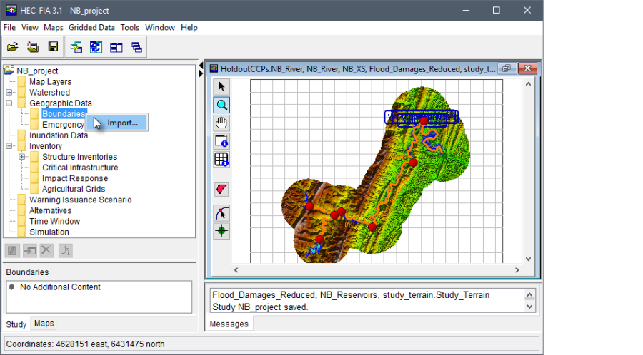
Boundaries are geographic areas (e.g., USACE Districts, states, Congressional District, counties, HEC-ResSim holdout areas, etc.) used by HEC-FIA for reporting. With large scale watersheds, users may need to create reports for many different overlapping authorities, and these boundaries help simplify the reporting function. Boundary delineations can be imported through shapefiles into HEC-FIA. To import boundaries:
From the Study Pane, which is in the Study Pane, from the Geographic Data folder, right-click on the Boundaries folder. From the shortcut menu, click Import; the Import Boundary Shape dialog box opens.
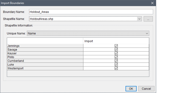
- From the Import Boundaries dialog box, in the Boundary Name text box, a name must be entered (i.e., Holdout Areas, State, Counties).
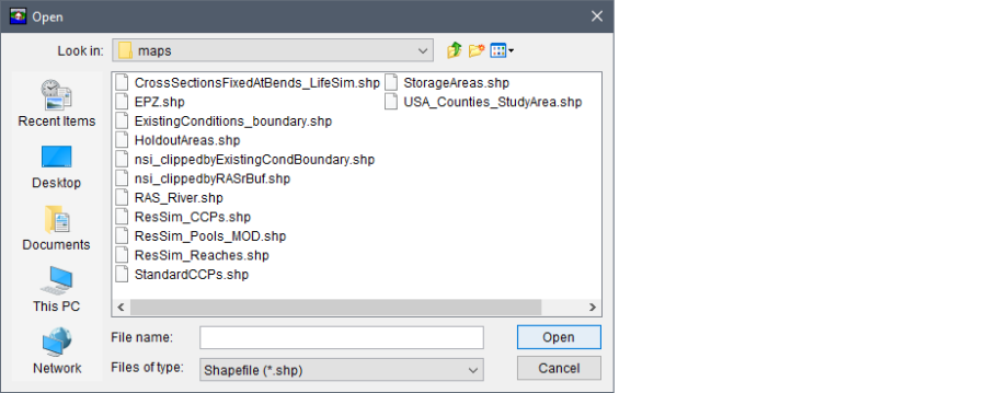
The Shapefile Path lists the available polygon shapefiles that have been added as map layers to the project. If a map layer that represents the boundaries has not been added to the HEC-FIA project, click the  button. The Open browser window opens. Browse to the location of the shapefile that represents the boundary file, select the shapefile (.shp) filename (i.e., HoldoutAreas.shp), and click *Open. The Open browser window closes, and the Import Boundaries dialog box is populated with information from the selected shapefile.
- From the Unique Name list, select from the shapefile the data field that contains the name of the boundary. Once selected, the table on the Import Boundaries dialog box lists the available boundary information.
- Click OK, the Import Boundaries dialog box closes. Information from the selected shapefile is now part of a boundary layer.