Adjust Map Layers
Once a map layer is part of an HEC-FIA project, there are limited options users can use to organize layers; display or hide layers; display the legend of the selected map layer; edit display properties of the map layer; set scale factors; copy to another location, and view the attributes table of certain map layer types.
It is recommended that the user utilize a GIS software if extensive display options (e.g., edit display properties by attributes, adding map layer labels by attribute, etc.) are needed. From the HEC-FIA main window, click the Maps tab. Now the user can see which map window is currently active and what layers make up that map window. A list of the open map windows are displayed in the Currently Open Maps Pane, and the selected map layer is the active map layer (e.g., Map Window1) in the Desktop Pane.

Figure: HEC-FIA Main Window - Maps Tab
The Content Pane for the Maps tab contains the Map Layers Tree for the active map window. The Map Layers Tree lists all map layers in the active map window with the layer listed at the top overlaying subsequent layers in lower in the list. The user can turn map layers on/off, adjust properties of the map layers, and order the map layers for viewing in the associated map window. For example, to change the color and the fill aspects of the HoldoutAreas.shp do the following:
- From the Map Layers Tree, right-click on HoldoutAreas.shp, the shapefile shortcut menu displays. This shortcut menu allows the user to expand/collapse the HoldoutAreas.shp leaf; move the shapefile to different positions in the tree (Move To Top/Move To Bottom, Move up/Move Down); show the legend of the shapefile; change the label of the shapefile; edit the properties of the shapefile; set/remove scale factors; copy the map layer to another location; and open the attribute table of the shapefile.
From the shapefile shortcut menu, click Properties, the Edit Polygon Properties dialog box opens. The HoldoutAreas.shp file is a polygon shapefile. To edit the fill of the active map layer, from the Fill tab, change the color or not have a fill. To turn off fill, click Display Fill, the check mark clears, meaning that fill is turned off.

Figure: Map Layers Tree - Map Layer Shortcut Menu Commands
To change the outline color of the subbasin layer, from the Edit Polygon Properties dialog box, click the Border tab. From the Color list, select a color ("cyan"). Click OK, the Edit Polygon Properties dialog box closes and the changes to the polygon map layer appear in the map window.
Figure: Edit Polygon Properties Dialog Box - Fill Tab
- To turn off a map layer, click the checkbox by HoldoutAreas.shp, the polygon no longer appears on the map window.
- To display the map window zoomed in, select the Zoom Tool
 .
. . Draw a box around the map layers that are displayed in the map window. From the Maps menu, click Default Map Properties, the Default Map Properties for {Project Name} dialog box opens.

Figure: Default Map Properties for [Project Name] Dialog Box
- To directly open the Default Map Layers, from the main menu click Maps > Default Map Properties, and then select the Default Map Layers Tab.
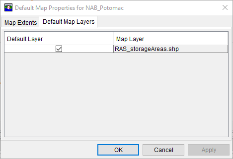
- If no shapefiles have been added to the Map Layers, then the above menu will be blank until layers have been added. Then Map Layers can be toggled on/off to be selected as Default.
- Selecting Maps > New Map Window will launch a new map window loaded with all of the default map layers.
- Click Set Map Extents to Display, click OK. The Default Map Properties for {Project Name} dialog box closes. This sets the extents for the map window so that when the HEC-FIA project is opened the next time the map window is zoomed in to the tighter area.