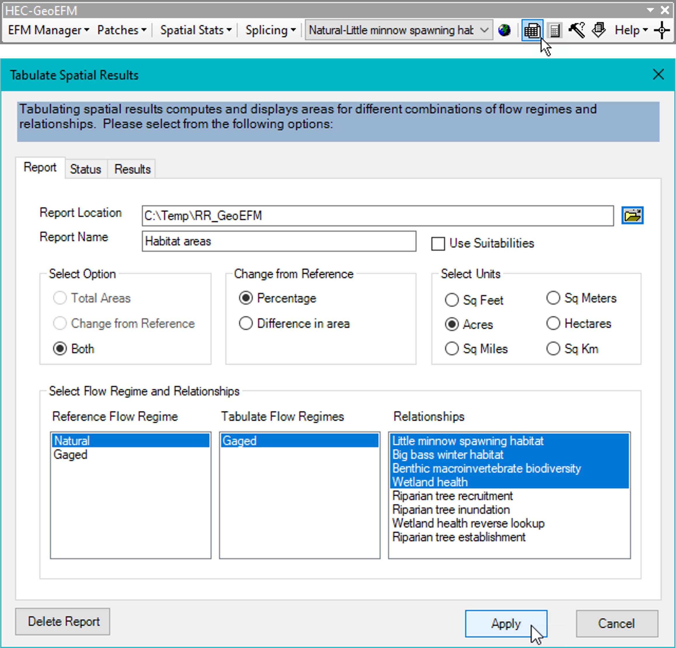
The Tabulate tool allows users to compute, report, and archive total and suitable habitat areas. Options are provided for selecting the desired flow regimes and relationships, output units, mode of comparison for multiple flow regimes, use suitabilities, and the file and path names for the report to be generated by GeoEFM (Figure 32).

Figure 32. Options and settings for the Tabulate Spatial Results interface in GeoEFM.
As in EFM, only one flow regime may be selected as the reference. Habitat areas generated by any other flow regimes highlighted for analysis will be compared to habitat areas generated by this reference in accordance with the Change from Reference setting in the Tabulate interface.
When the Ok button is clicked, GeoEFM assesses area for the result layer of each flow regime - relationship pairing selected for tabulation. A “ReportName.xml” file is generated that can be opened in web browsers and other software (Figure 33).
The Status Tab details progress as output is generated and provides warning messages if any problems are encountered. Please note that GeoEFM will not compute and report habitat areas unless all required results layers are identified and have defined spatial references. Use the ArcToolbox – Data Management Tools – Projections and Transformations – Define Projection feature to assign the appropriate projections.

Figure 33. Total habitat areas for select pairings of flow regimes and relationships.
The Use Suitabilities option (Figure 32) allows for reporting of suitable areas in addition to the total areas (Figure 34) tabulated for results layers when the option is turned off. Tallying suitable area is done by summing the product of raster cell areas and corresponding raster cell values, with value intended to be a measure of suitability ranging from 0 (wholly unsuitable) to 1 (perfectly suitable). Total areas are computed by summing raster cell areas, which means that if a cell is part of the result layer, it is habitat and tallied as such (as if it were wholly suitable).
Please note that GeoEFM provides a warning message when results layers have values outside of the normal range of suitabilities (0 to 1), but then allows users to proceed, which can lead to potentially odd results. Changes from reference, whether as a percent difference in habitat or a change in area, are tallied based on suitable area results when the use suitabilities option is on (Figure 34).

Figure 34. Suitable and total habitat areas for select pairings of flow regimes and relationships.