Download PDF
Download page Applying the Ensemble Compute Option to Downscaled Climate Model Datasets.
Applying the Ensemble Compute Option to Downscaled Climate Model Datasets
This example was not designed to provide guidance for applying downscaled climate model projections to inform an analysis. Each Federal, State, and Local agency should follow agency specific guidance for including possible future climate change information in hydrologic analysis. This tutorial highlights tools in HEC-HMS that aid modelers in making use of gridded meteorologic datasets and utilizing the new Ensemble compute option to organize many simulations.
Last Modified: 2024-10-02 13:56:03.063
This tutorial demonstrates the new Ensemble Analysis compute option in HEC-HMS applied to future climate projection datasets.
Software Version
HEC-HMS version 4.11 beta 1 was used to create this example. You can open the example project with HEC-HMS 4.11 beta 1 or a newer version.Project Files
Download the project files from this link - https://drive.hecdev.net/share/byBPkNYg
Introduction
The Ensemble Analysis compute option is a valuable tool that can be used to run multiple simulations and extract information across all ensemble members. In this example, we will explore how the Ensemble Analysis compute can be used to run multiple simulations where each one uses different meteorologic data from downscaled climate model simulations. Finally, the HEC-HMS results are processed to identify trends in the hydrologic response for the example watershed.
Downscaled climate model projections were gathered from the "Downscaled CMIP3 and CMIP5 Climate and Hydrology Projection" website https://gdo-dcp.ucllnl.org/downscaled_cmip_projections/dcpInterface.html.
"We acknowledge the World Climate Research Programme's Working Group on Coupled Modelling, which is responsible for CMIP, and we thank the climate modeling groups (listed in the Table below) for producing and making available their model output. For CMIP the U.S. Department of Energy's Program for Climate Model Diagnosis and Intercomparison provides coordinating support and led development of software infrastructure in partnership with the Global Organization for Earth System Science Portals."
The CMIP5 Climate Projection datasets were gathered for two Representative Concentration Pathways (RCP) scenarios, 4.5 and 8.5. The table below shows the Climate Models used for this example and the naming convention used in the HEC-HMS model. It is recognized that an actual application would gather results from more than five Climate Models, and the selection of climate models would include investigation about performance of the climate models for a geographic region.
| Climate Models | HEC-HMS Model Data Reference | |
|---|---|---|
| RCP 4.5 | RCP 8.5 | |
| access1-0 | CMIP5-1a | CMIP5-1b |
| access1-3 | CMIP5-2a | CMIP5-2b |
| bcc-csm1-1 | CMIP5-3a | CMIP5-3b |
| bcc-csm1-1-m | CMIP5-4a | CMIP5-4b |
| canesm2 | CMIP5-5a | CMIP5-5b |
Specifically, the LOCA downscaled CMIP5 Climate Projection datasets were downloaded: Pierce, D. W., D. R. Cayan, and B. L. Thrasher, Statistical Downscaling Using Localized Constructed Analogs (LOCA), Journal of Hydrometeorology, 15(6), 2558-2585, 2014.; and Pierce, D. W., D. R. Cayan, E. P. Maurer, J. T. Abatzoglou, and K. C. Hegewisch, 2015: Improved bias correction techniques for hydrological simulations of climate change. J. Hydrometeorology, v. 16, p. 2421-2442. DOI: http://dx.doi.org/10.1175/JHM-D-14-0236.1.
An existing HEC-HMS model was used for this example application. As shown in the analysis procedure steps below, the model was re-calibrated to a Livneh precipitation and temperature dataset prior to application of the CMIP5 Climate Projection datasets. The amount of time it took to complete an analysis step is included at the end of each section below.
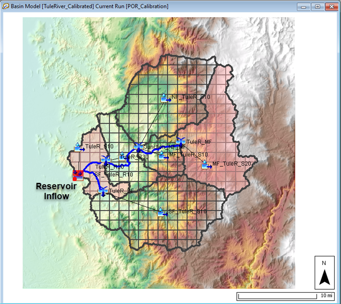
Watershed
The Tule River watershed upstream of Success Dam is used for this example. Success Dam (now commonly known as Schafer Dam) is located upstream of the town of Porterville, California. The watershed is approximately 390 square miles. Elevation ranges from 650 feet at the dam to over 8,000 feet along the watershed boundary. The figure below shows the watershed delineated into six subbasins. Two subbasins are highlighted. The MF_TuleR_S20 subbasin is a high elevation subbasin, the average elevation is 6286 feet, and the drainage area is 85.8 square miles. The TuleR_S10 subbasin is a low elevation subbasin, average elevation is 996 feet, and the drainage area is 32.9 square miles. As shown in the figure below, a 2000-meter discretization was used for all subbasin elements. Gridded precipitation, snow accumulation/melt, and loss computations were performed at each grid cell. Excess precipitation was routed using the ModClark transform method. A fraction of the infiltrated water was returned to the surface using the linear reservoir baseflow method.
Analysis Procedure
The following list identifies the steps followed in the analysis.
- Download Historical Livneh and Downscaled CMIP5 Climate Projection Datasets
- Convert Historical Livneh and Downscaled CMIP5 Climate Projection Datasets to HEC-DSS Format
- Create Gridsets and Time-Series Gages in the HEC-HMS Project
- Create Meteorologic Models in the HEC-HMS Project
- Calibrate the Basin Model to Historical Data using Daily Precipitation and Temperature Dataset
- Create Simulation Runs for CMIP5 Climate Model Projection Datasets
- Create Ensemble Analysis Simulations
- Analyze Results and Identify Trends from the Historical Period (1971 - 2005) and Future Period (2006 - 2099)
Continue to Download Historical Livneh and Downscaled CMIP5 Climate Projection Datasets.