Download PDF
Download page Download Historical Livneh and Downscaled CMIP5 Climate Projection Datasets.
Download Historical Livneh and Downscaled CMIP5 Climate Projection Datasets
This tutorial was not designed to provide guidance for applying downscaled climate model projections to inform an analysis. Each Federal, State, and Local agency should follow agency specific guidance for including possible future climate change information in hydrologic analysis. This tutorial highlights tools in HEC-HMS that aid modelers in making use of gridded meteorologic datasets and utilizing the new Ensemble compute option to organize many simulations.
The Livneh precipitation and temperature datasets were used to calibrate the HEC-HMS model for the period 1972 - 2005. As mentioned here, https://gdo-dcp.ucllnl.org/downscaled_cmip_projections/techmemo/Downscaled_Climate_Projections_Addendum_Sept2016.pdf, the Livneh dataset was used in the LOCA downscaling technique applied to the CMIP5 Climate Projection datasets. Originally, the Success Dam HEC-HMS model was calibrated to hourly precipitation, temperature, and flow measurements; however, re-calibration was performed mostly because the CMIP5 Climate Projection datasets are at daily time intervals (precipitation intensities are much lower at a daily temporal resolution).
Multiple Livneh Datasets
There are multiple Livneh Datasets available on the internet (https://psl.noaa.gov/data/gridded/data.livneh.html), and these different datasets have significantly different precipitation and temperature estimates. Make sure you gather the Livneh dataset from the Downscaled CMIP3 and CMIP5 Climate and Hydrology Projections website when utilizing the LOCA downscaled CMIP5 Climate Projection datasets.
The following steps show how the Livneh and CMIP5 Climate Projection datasets were gathered from the https://gdo-dcp.ucllnl.org/downscaled_cmip_projections/dcpInterface.html website.
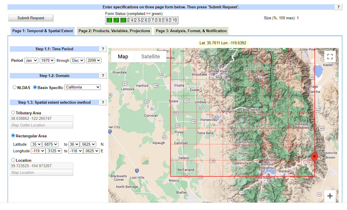
- Temporal and Spatial Extents. The period January 1970 - December 2099 was defined (you could begin the analysis in 1950). The watershed is located in California. A bounding box was defined as shown in the figure below.
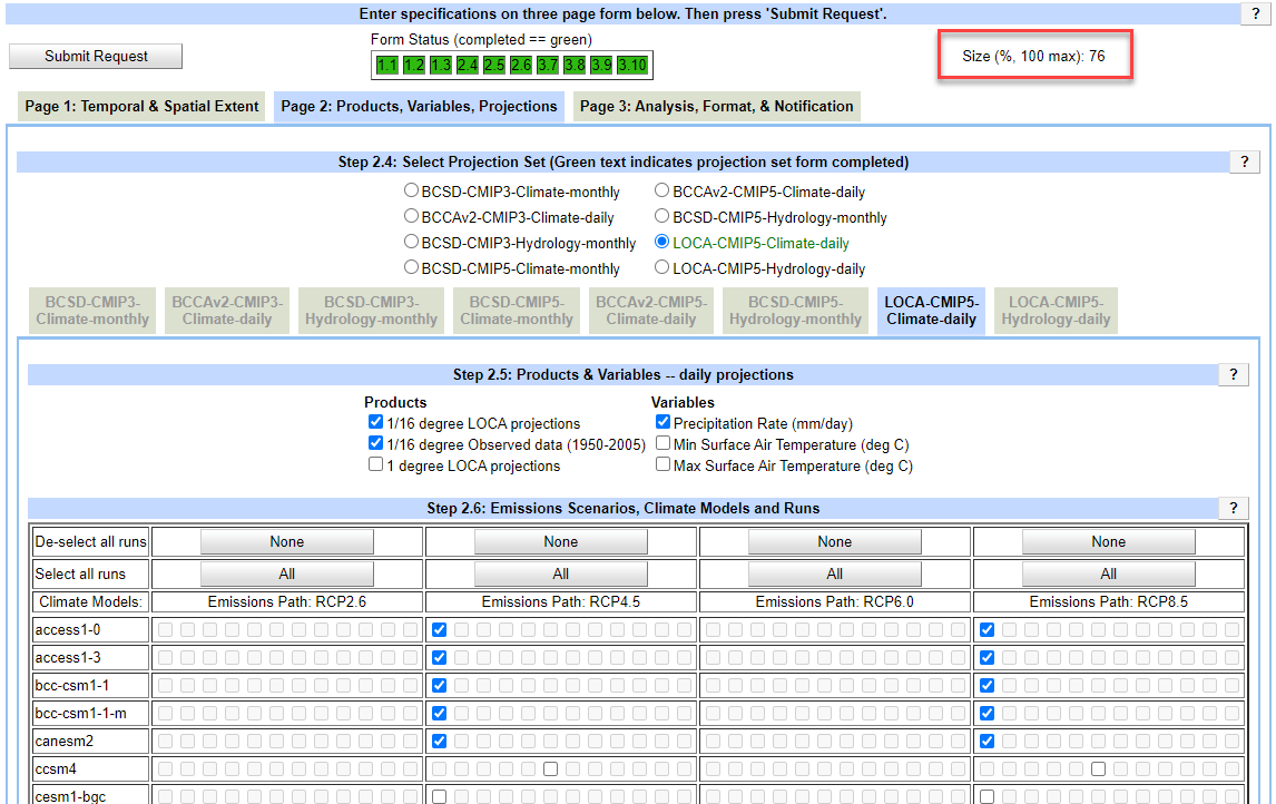
Products, Variables, Projections. Because there is a size limit to the amount of data that can be downloaded at one time, you might have to break up the download requests. As shown in the figure below, only the precipitation datasets were downloaded in the first try. The minimum and maximum temperature datasets were downloaded in separate requests. Check the box for the 1/16 degree Observed data (1950 - 2005) to request the Livneh dataset and then choose the Downscaled Climate Model and RCP datasets.

Data Download
For HEC-HMS applications, it is recommended that you only choose one data source (and one RCP scenario) per request. The HEC-HMS gridded data import wizard needs additional improvements to handle files with the same variable (precipitation) and different model alternatives. For example, only download the precipitation and temperature data for the access 1-0 dataset for request 1 and then choose the precipitation and temperature datasets for the access 1-3 dataset for request 2. When using the HEC-HMS gridded data import wizard to convert the climate model data to HEC-DSS format, you can easily organize the data into one DSS file (using a unique naming convention) or save each climate model dataset to its own DSS file (the approach used in this example).
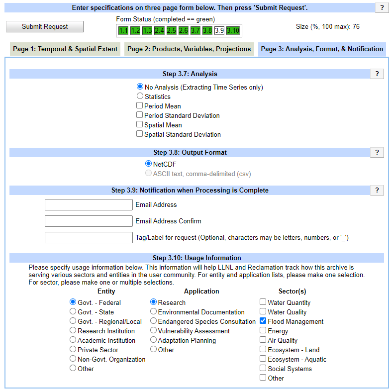
- Analysis, Format, and Notification. The No Analysis option was selected since the goal was to apply the meteorologic data to the HEC-HMS model. Choose the option to save results to NetCDF format. When entering a tag/label, use the name of the climate model.
- After some time, you will receive an email with a link to download the data. The climate data will be stored in a NetCDF format, file extension *.nc. HEC-HMS cannot directly read data in a NetCDF file. You will need to convert the gridded data format to HEC-DSS (shown in following steps).
This step took approximately 1 hour to complete (not including the wait time to be notified to download files and the process of downloading files).
Continue to Process Climate Projection Datasets for Application in an HEC-HMS Model.