Download page Introduction to Calibrating a Simple Basin Model.
Introduction to Calibrating a Simple Basin Model
Background
Calibrating a hydrologic model is the process of modifying parameters within acceptable ranges to obtain simulated results that replicate known conditions. Model calibration is a necessary component to model development in order to have some level of confidence that the simulated results adequately represent the modeled system. Since models can be used to predict future outcomes or potential changes to the watershed, the model results must show it works. In order to calibrate a model, observed data, typically collected in the field, is needed to compare with the simulated results. Observed data typically used for calibration are flow discharges and stages.
Overview
In this tutorial you will learn how to perform model calibration as an iterative process of entering and adjusting parameters and evaluating goodness-of-fit between the computed and observed hydrograph. In the tutorial Estimating Clark Unit Hydrograph Parameters, you got a taste of what model calibration looks like by increasing and decreasing your unit hydrograph parameters. In other tutorials, you learned about different loss and baseflow methods and how to initialize those parameters. We will incorporate lessons and techniques learned from those tutorials to calibrate our basin model. The process of calibration will be iterative, and include manually changing model parameters and checking how those adjustments impact the model's ability to match observed data (flow hydrograph). There are other methods of calibration such as using optimization tools, however, those will not be covered in this tutorial.
Goal
In this tutorial you will
Enter initial model parameters in HEC-HMS
Adjust model parameters and compare results
Calibrate the model to another storm event
Data
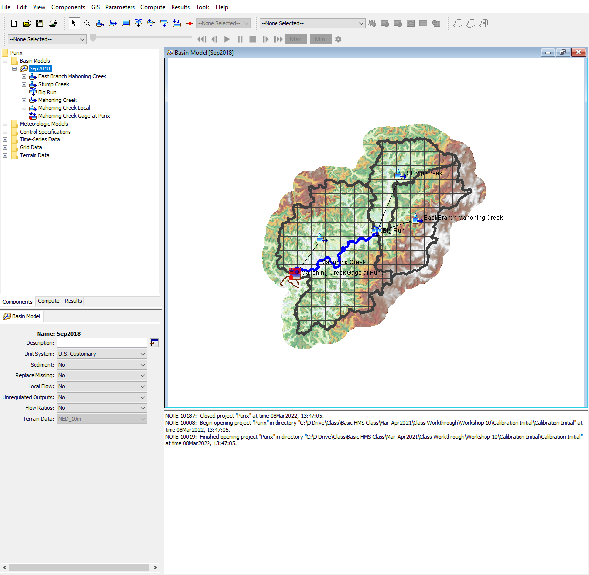
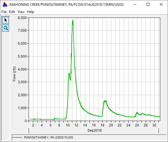
You will be using the Punxsutawney Watershed HEC-HMS model for this calibration effort. The meteorological model contains gridded rainfall from MRMS for 2018 and has already been configured for you. The observed hydrograph has also been downloaded from the USGS and ready to be compared to the computed results.