Background
This workshop is based on a previous study performed by HEC. The objective of the study was to evaluate the adequacy of the Coyote Valley Dam spillway and to determine the likely downstream inundation area and flood depths in the case of a failure of the Dam. The hydrologic analysis started by developing a calibrated precipitation-runoff model of the project area using HEC-HMS. The modelling domain and initial parametrization were developed using GIS data sets. Measured precipitation and peak flow data for the February 1986, January 1995, January 1997, and January 2006 events were used to calibrate the HEC-HMS model to ensure its proper use for modeling the PMF and frequency-based storm events.
With a calibrated precipitation-runoff model, the Probable Maximum Flood (PMF), as well as the 50, 100, 200, and 500-year frequency based storm events were simulated on the basin. With these flows, subsequent hydraulic analyses determined the downstream inundation caused by both with and without failure analysis of the Dam for the Probable Maximum Flood (PMF), as well as the 50, 100, 200, and 500-year frequency based storm events. A sunny day failure was included to evaluate non-rainfall induced failures. Inundation maps for each scenario were created.
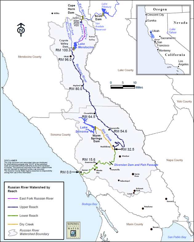
A map of the Russian River watershed is shown in the figure below.
Objectives
In this workshop, you will calibrate the Russian River model for three historical events. You will validate your model with an additional historic event.
The following major tasks will serve as an outline for the workshop:
- Calibrate the Model Using Three Calibration Events
- Create a Validation Parameter Set
- Validate the Model
Continue to Calibrate the Model Using Three Calibration Events