Download PDF
Download page Snowmelt PDT Workshop.
Snowmelt PDT Workshop
A 3-day workshop at CEIWR-HEC in Davis, California for ~10 engineers from District offices across the Corps to update existing snowmelt models using the latest technology, build new skills in modeling river flows from snow melt, and provide recommendations to HEC on future software needs and improvements. This activity will benefit the nation through utilizing cutting-edge snowmelt modeling to better represent snow contributions for water supply and flooding, fortifying a community of practice, and fostering collaboration among USACE staff.
You will need HEC-HMS version 4.11 or newer to open the workshop files. You can download the software from https://www.hec.usace.army.mil/software/hec-hms/downloads.aspx.
The following table provides links to all lectures and workshop pages located in the HEC-HMS Tutorials and Guides space. All workshop files can be downloaded from the workshops pages as well. Finally, all PowerPoint files are included below and can be downloaded for reference.
Lectures and Workshops | Links | PowerPoint Files |
|---|---|---|
Lecture 1: Snow Hydrology and Data Brief history of snowmelt/accumulation modeling. Explanation of the physical processes at work during snow fall and pack accumulation. Discussion of the role of ripening and pack melt. Introduction to the types of atmospheric data required for snow modeling. Discussion of methodologies used to collect information about the snowpack. Sources of data and appropriate processing procedures. | ||
Lecture 2: Snowmelt Modeling Methodologies Introduction to the temperature index, hybrid, and energy budget snow modeling methods along with guidance on parameter estimation. Discussion of parameter calibration techniques, optimization, and uncertainty. | ||
Workshop 1: Point Snowmelt Calibration Review atmospheric data and prepare a Meteorologic model for use with all available snow modeling methods in HEC-HMS. Become familiar with the available snow modeling methods using a point watershed. Calibrate using data from a SNOTEL. | Calibrating Point Snowmelt: Swamp Angel Study Plot, Colorado | |
Workshop 2: Gridded Snowmelt Calibration Become familiar with the available snow modeling methods using a gridded watershed. Calibrate using SNODAS data. | Calibrating Gridded Snowmelt: Upper Truckee River, California |
In advance of the workshop, attendees should:
- Upgrade your HMS Temperature Index model to at least the official release v4.11 or v4.12-beta.4: https://www.hec.usace.army.mil/software/hec-hms/downloads.aspx
- Have Temperature-Index snow simulations or forecast alternatives running for at least one or two interesting recent snow events / water years.
- Add a Terrain to your project, select it within your basin model(s), georeference your basin model(s), and update to a Structured discretization.
- While at HEC, we will explore different grid cell sizes, 2KM, 5KM, and 10KM, and note differences in run time and results.
- For instructions on changing your discretization from File-Specified to Structured, see this tutorial and guide: Changing the Basin Model Discretization from File-Specified to Structured.
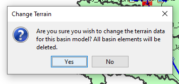
- If you are encountering a warning dialog stating that all basin elements will be deleted, use the following instructions to solve the problem:

- Click No within the Change Terrain Data Warning Dialog.
- Close the HEC-HMS project.
- Navigate to the HEC-HMS project directory.
- Make a copy of the “<name>.basin” file.
- Open the “<name>.basin” file in Notepad++ or another text editor.
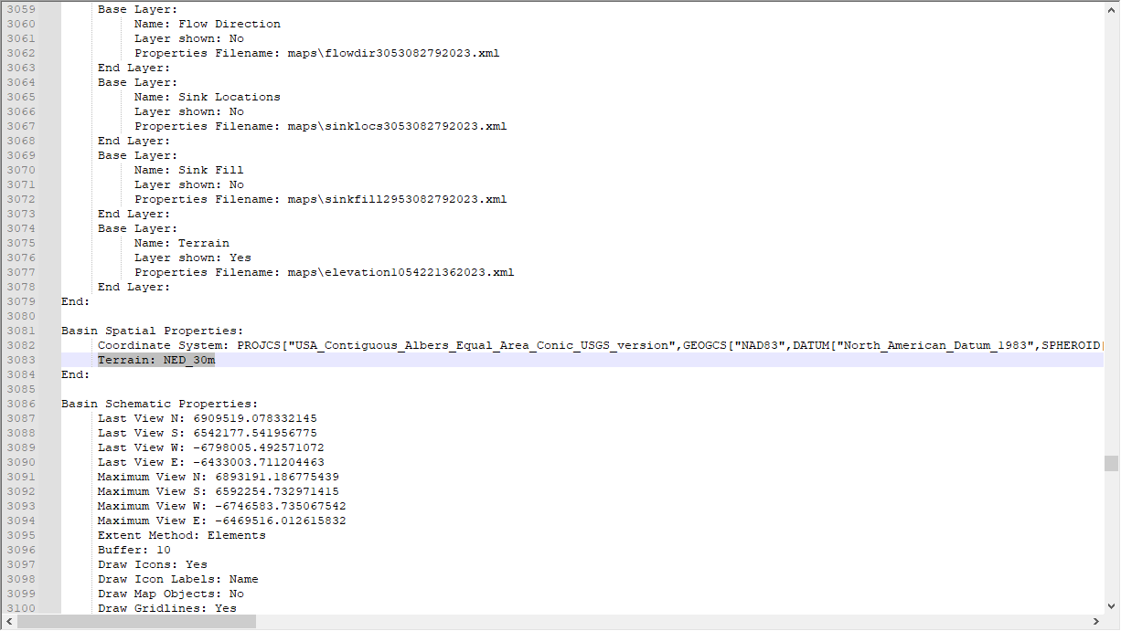
- Delete the “Terrain: <name>” line within the “Basin Spatial Properties” section:

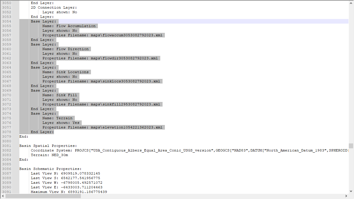
- Delete any lines mentioning flow accumulation, flow direction, sink locations, sink fill, and/or terrain within the “Basin Layer Properties” section:

- Save and close the “<name>.basin” file.
- Reopen the HEC-HMS project.
- If you haven’t already imported the terrain to the HEC-HMS project, import it now.
- Open the basin model of interest.
- Select the terrain.
This should remap the terrain to the basin model of interest.
- Contact HEC with any questions.
- Compute terrain slope, aspect, and solar shading from terrain dataset.
- This could take a couple of hours depending on the terrain files size.
- It is recommended that you resample the terrain to a grid cell size so that the overall file size is less than 200MB.