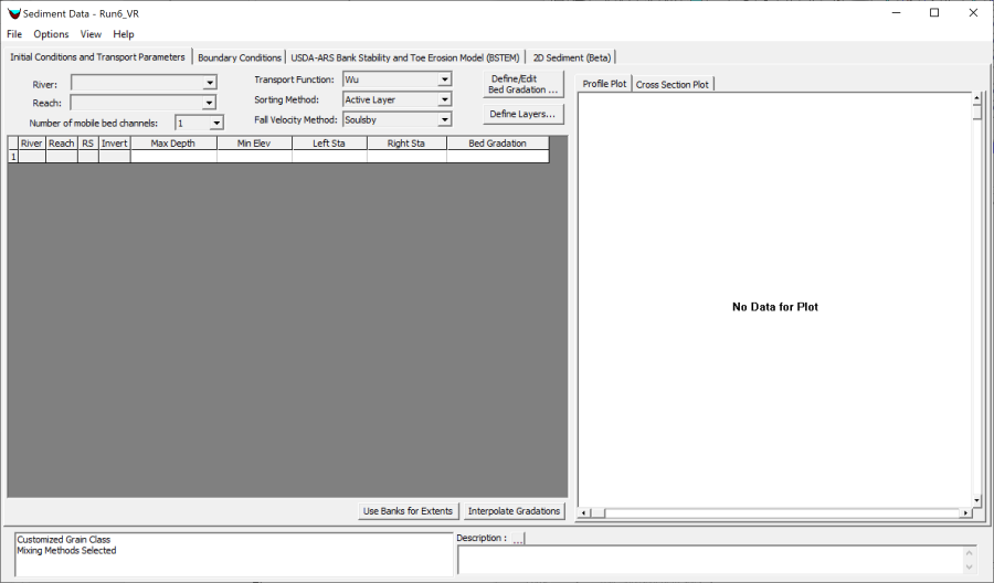
2D sediment transport models in HEC-RAS require four files: an unsteady flow file, a geometry file, a sediment file, and a plan file to tie them together. Sediment data should be specified after the geometry. Some mandatory sediment parameters are specified spatially and thus require knowledge of the geometry. If the geometry changes, the sediment data may need updates before it can run. Sediment results are very sensitive to hydraulic results (e.g. roughness parameters and ineffective flow areas). An HEC-RAS sediment model will not be robust or reliable if it is not built on a well constructed hydraulic geometry (USACE, 1993, Thomas and Cheng, 2008). Before adding sediment data, test the hydraulic model over the expected range of flows using the HEC-RAS Unsteady Flow Analysis option, calibrating the bottom roughness and if necessary, the turbulence coefficients. It is recommended to identify hydraulics model problems before adding the bed change complexity. Only add sediment data after crafting a careful, robust, hydraulic model. This document focuses on the 2D sediment data. However, many of the 2D sediment parameters and data inputs are the same as 1D. To enter sediment data, select Sediment Data from the Edit menu or press the sediment data icon. The sediment data editor will appear as depicted in Figure 22. The sediment data editor has four tabs: Initial Conditions and Transport Parameters, Sediment Boundary Conditions, the USDA-ARS Bank Stability and Toe Erosion Model (BSTEM), and 2D Sediment (Beta). The first two and last tabs are mandatory for 2D simulations. The third (BSTEM) is only for bank process computations and is not required for a sediment transport model. Figure 2 2. Sediment Data editor.