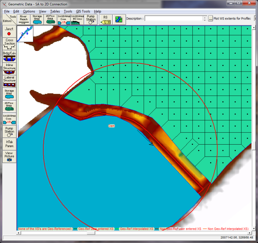
The latest version of HEC-RAS (5.0 or later) now has the ability to perform two-dimensional flow routing. For a dam break study, the user can model the downstream area entirely with 1D elements (Cross sections and storage areas); as a combination of 1D and 2D elements (cross sections, storage areas, and 2D flow areas); or the entire downstream area can be modeled as a 2D flow area.
2D flow areas can be directly connected to storage areas by using a hydraulic structure called a Storage Area/ 2D Flow Area Hydraulic Connector ("SA/2D Area Conn"). See the example below in the figure below.

In the example shown in the figure above, the storage area is upstream of the 2D flow area, so the positive flow direction is from the storage area to the 2D flow area. So when defining the hydraulic structure that connects the two areas, the storage area will be considered the headwater side, and the 2D flow area will be considered the tailwater side. In the example shown in the figure above, a storage area is being used to represent a reservoir pool. The hydraulic connection between the storage area and the 2D flow area is used to model the dam. The 2D flow area is being used to model the hydraulics of the flow downstream of the dam. Additionally, the user could model the reservoir pool with a 1D river reach, or a 2D flow area.
Using the approach shown in the figure above, is a very quick way to get a dam break model up and running. However, modeling the downstream area with a 2D flow area, does not necessarily make this a detailed model. Downstream areas will often have bridges, culverts, roads that are barriers to flow, levees protecting urban areas, etc… These types of areas require detailed modeling to get accurate answers, whether you are modeling them as 2D flow areas or 1D river reaches. Developing a detailed model for the downstream area requires detailed terrain, hydraulic structure information, and the time to model those areas correctly. If a 2D flow area is used, it still requires lots of work to make the computational mesh respect all of the barriers to flow (bridges, culverts, roads, levees, etc…). Developing a detailed computational mesh that respects all of the flow barriers, and includes all of the hydraulic structures is the most time consuming part of developing a model, but it is necessary to get good results downstream. If you do not take the time to do this, and you just throw in a 2D flow area with a nominal grid size, do not assume you have "accurate" results just because you are doing 2D modeling.