River Station Markers are used to override the the computation of the river station along the River layer. By default, the river station is computed as the length from the downstream most point on the the river line. If you wish to try and tie in cross sections to historic river stations, use the River Station Markers to set the river station at know locations. River stations will be computed based on the interpolation between River Station Markers. Any cross sections not bounded by a river station marker will result in the river station being interpolated based on the river station marker and the endpoint of the river reach line (zero or line length).
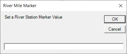
To add a River Station Mark, click on the River line and provide the "mileage" to use for that river location.