Watershed Systems Approach
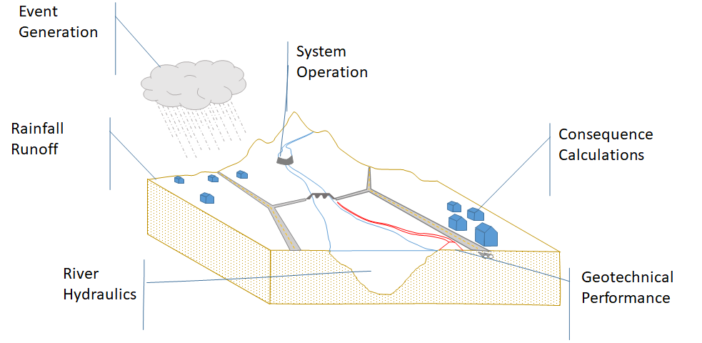
The water resources characteristics of a watershed, both natural and manmade, can be represented by a set of vertically-connected modeling systems. For example, hydrologic event generation creates rainfall or runoff events that are routed through a system of reservoirs. Outflows from these reservoirs are evaluated via river hydraulics, which in turn generate consequences data when paired with any relevant geotechnical performance information. HEC-WAT attempts to provide the user with the capability of modeling this complex interaction of systems through a plugin architecture that connects multiple modeling software tools.

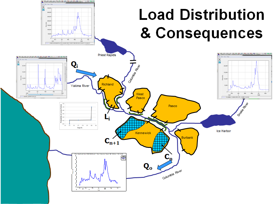
Additionally, HEC-WAT allows you to evaluate the entire watershed as a horizontally-connected system by supporting representation of its geospatial characteristics. This is a new capability within the USACE suite of software. While intuitively we know that changes in one area of the watershed may generate impacts in other areas of the watershed, previous USACE water resources software tools did not fully capture system-wide effects. An example of how HEC-WAT can now be used to evaluate these system-wide effects is shown here, based on the lower Columbia River watershed.
Hydrographs are available throughout the watershed, illustrated with inflow graphs at Yakima River, Priest Rapids and Snake River. These hydrographs are routed downstream as appropriate, and HEC-WAT checks the modeled Columbia River water surface elevations (WSELs) against the sampled levee fragility curve failure elevations at specified locations. If a modeled WSEL exceeds the sampled failure elevation on the fragility curve, the levee fails as dictated by the modeling and a portion of the river flow is diverted into the interior area where consequences are then estimated. These interior areas are shown in gold: Richland, West Pasco, Pasco, Burbank and Kennewick.
The main river flow hydrograph is adjusted to reflect the diversion of flow into the interior when a levee breaches. The result is that the overtopping of or a failure of the levee at the upstream end of the system will result in a reduction in peak flow and total flow volume as the flood event continues downstream, thus reducing stress on the downstream infrastructure. This is but one example of how an action upstream can influence conditions downstream. This system-wide evaluation process occurs seamlessly within HEC-WAT and demonstrates the value of a systems approach.
