Elevation Options Dialog
For the other map layer formats – USGS DEM, ASCII NetTin, and ArcGIS® DEM; they all have the same editor, the Elevation Options dialog.
To edit an ASCII NetTin file:
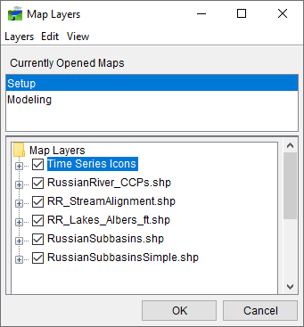
- From the Layer Tree (Map Layers dialog), right-click on an ASCII NetTin file. From the shortcut menu, click Properties, or double-click on the ASCII NetTin name.
- The Elevation Options dialog will open (Figure 1).

- Across the top of the dialog, is displayed the name of the ASCII NetTin file.
- Click the Properties tab of the Elevation Options dialog (Figure 1).
- From the dropdown list, there are available color contour schemes – Aspect Shading, Grayscale, Linear, Precipitation, Red-Green-Blue, and Terrain (default).
- The Draw Edges check box is specifically for ASCII NetTin files. If selected, the edges of the triangles the make up an ASCII NetTin file will be drawn.
- You can set the contour tic interval, by entering a value in the Tic Interval cell. The program sets the maximum and minimum limits of the contours automatically. You can set your own maximum and minimum limits. Clear System Specified Min/Max Values, the Maximum and Minimum cells (Figure 1) are now available for you to enter values.
- You can control the brightness (amount of white), saturation (amount of black), and transparency (level of opacity or alpha) for the colors. You can adjust the values by using the Brightness, Saturation, and Transparency slider bars or cells.
- By default the Aspect Shading option is on, aspect shading is where you make the map layer appear in relief by placing an imaginary light source above the map and shading the contours. You can adjust the angle of the light source by using the Angle slider bar or the cell. If you do not want aspect shading, clear Aspect Shading.
- Clipping provides you a way to highlight an area based on your color choices and values. For maximum clipping, you would fill the contour with the clip color from the maximum value of the map to the value entered for Maximum Clipping. An example of where you might use maximum clipping would be smog levels, cloud cover, or snow level at a particular elevation. By default, maximum clipping is turned off, to select click Maximum Clipping. Then either enter a maximum clipping value by using the slider bar or enter a value in the cell. You can also set the Maximum Clipping color. Click Color, the Color Chooser will open (see Using the Color Chooser for more on the color chooser). From the color palette, select a color, click OK. The Color Chooser will close and the selected color will now appear on the Color button and at the top of the Scale (Figure 1).
- Minimum clipping will fill the contour with the clip color from the minimum value of the map to the value entered for Minimum Clipping. An example of where you might use minimum clipping would be to see where a water level would be if it flooded to a particular elevation. By default, minimum clipping is turned off, to select click Minimum Clipping. Then either enter a minimum clipping value by using the slider bar or enter a value in the cell. You can also set the Minimum Clipping color. Click Color, the Color Chooser will open (see Using the Color Chooser for more on the color chooser). From the color palette, select a color, click OK. The Color Chooser will close and the selected color will now appear on the Color button and at the bottom of the Scale (Figure 1).
To set scaling for an ASCII NetTin file:
- Click the Scale tab of the Elevation Options dialog (Figure 2).

- Both zoom-in and zoom-out scale factors can be set. By default the ASCII NetTin layer is set for Always show layer. To set visualization scales click Only show layer in the following scale range.
- To set the scale so that the ASCII NetTin layer becomes visible as you zoom-in, you can set the scale to the current scale by clicking Set to Current. If you wish to enter a value, from the Only visible below 1: cell enter the scale factor.
- To set the scale so that the ASCII NetTin layer becomes visible as you zoom-out, you can set the scale to the current scale by clicking Set to Current. If you wish to enter a value, from the Only visible above 1: cell enter the scale factor.
- Click OK, the Elevation Options dialog will close (Figure 2), and the visualization scale is set for the ASCII NetTin layer.
- Click OK, and the Map Layers dialog closes.