Last Modified: 2024-10-28 10:43:36.258
Modeling Baseflow with HEC-HMS
Overview
In this tutorial group you will become familiar with different baseflow methods in HEC-HMS, separate examples for using the constant monthly, linear reservoir, and recession baseflow methods are included. There are questions at the end of each tutorial.
Background
In this tutorial group, you will be working with the Mahoning Creek watershed. The model was originally created using terrain data downloaded from the USGS National Map Viewer. Soils and land use information were used to estimate initial model parameters, including loss and Clark unit hydrograph parameters.
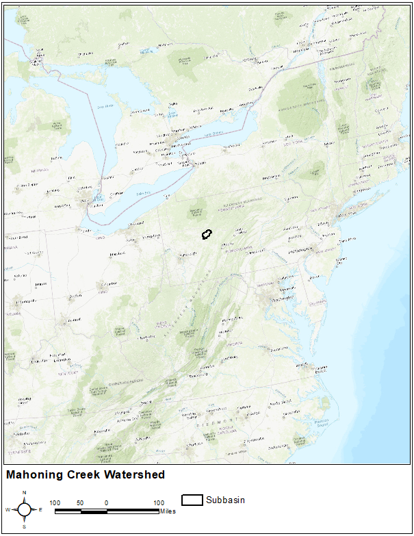
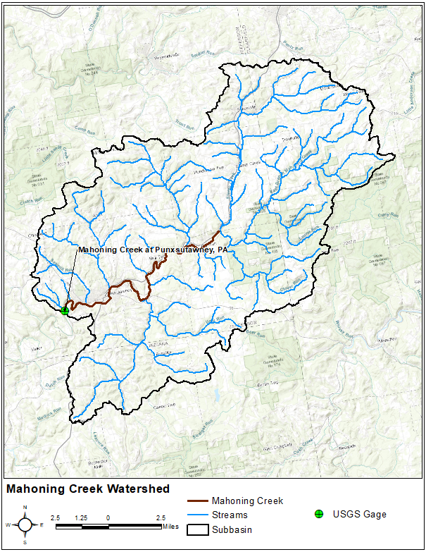
The Mahoning Creek watershed at Punxsutawney, PA is part of the Allegheny River Basin located in western Pennsylvania. The primary conveyance system of this 158 sq. mi. watershed includes the following streams: Stump Creek, East Branch Mahoning Creek, and Mahoning Creek. The confluence of Stump Creek and East Branch Mahoning Creek is located east of the enclave of Big Run. Mahoning Creek is downstream of the confluence. The watershed will be modeled as one subbasin.
Data
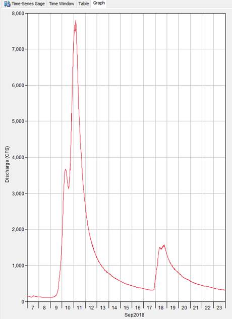
The simulation time-window for this tutorial group is September 7, 2018 through the end of September 23, 2018. Multi-RADAR/Multi-Sensor (MRMS) gridded precipitation is used as the boundary condition for the model. The MRMS gridded dataset has a spatial resolution of 4 square kilometers and a time step of 1-hour. The monthly average evapotranspiration method is used to compute canopy evapotranspiration to remove soil moisture. 15-minute observed streamflow data was gathered from the USGS for the Mahoning Creek at Punxsutawney gage. The streamflow data was shifted 5 hours to be on Coordinated Universal Time (UTC), also Greenwich Mean Time (GMT). By default, MRMS data is saved on UTC. The following figure shows the observed streamflow data for the Mahoning Creek at Punxsutawney gage for the simulation time period.
Model Configuration
The HEC-HMS project for this tutorial group has three Basin Models. Each Basin Model is named based on the baseflow method used by the Mahoning Creek subbasin element. The only difference between the 3 Basin Models is the baseflow method.
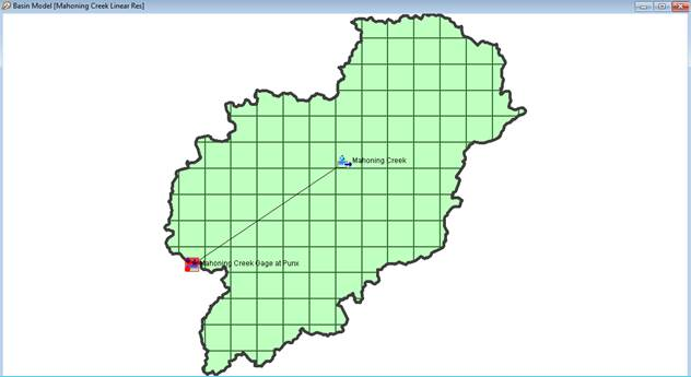
The following figure shows the Basin Model configuration. There is one subbasin element connected to a sink element. Flow from the Mahoning Creek at Punxsutawney gage was linked to both the subbasin and the sink elements. The subbasin element was configured to use the 2000-meter SHG structured discretization method, the simple canopy method, the Deficit and Constant loss method, and the Clark unit hydrograph method.
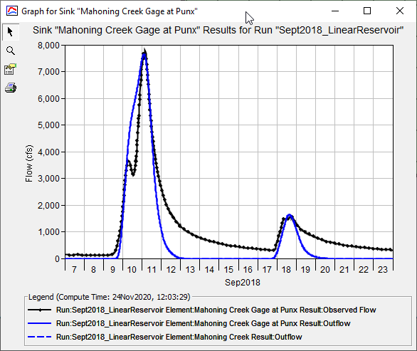
Simulation runs have already been configured that link the three Basin Models with the Meteorologic Model and Control Specifications. Initially, results at the Mahoning Creek Gage at Punxsutawney sink element will look like the following figure. Notice how the computed flow is missing an interflow and baseflow portion of the runoff hydrograph. The computed flow only includes direct runoff. The remaining tutorials in this group will show you how to turn on the different baseflow methods, how to parameterize the baseflow model, and how to calibrate the baseflow model.
Continue to Applying the Constant Monthly Baseflow Method